


Texas
Coastal Geology
Richard
L. Watson, Ph.D.
P.O. Box
1040 Port Aransas, TX 78373
361-749-4152 send email
If
you would like to make a donation to help support the expense of
providing these photos of the Texas Coast, please click on the Paypal
button below.
Reports
by Richard L. Watson, Ph.D. and others.

Some of these documents are
very large pdf files so be patient.
Protect
the Natural Dune Seawall and Prevent Hurricane Destruction at Port
Aransas, Texas
Modern
Depositional Environments and Processes, Northern and Central Padre
Island, Texas
Ralph E. Hunter, Richard L. Watson, Gary W. Hill and Kendal A. Dickinson
Nearshore Surface Currents,
Southeastern Texas Gulf Coast
Richard L. Watson and E. William Behrens
____________________________________
A
new supreme
court decision changes the application of the Open Beaches Act.
Read
the following links in addition to the papers on Coastal Law!
The
Texas
Supreme Court has revisited Severance and published its opinion on
March 30, 2012. It has reached the same conclusion that there
is
no basis in Texas law or history supporting a rolling public easement
on the dry beach between the vegetation line and the state/private
boundary of Mean High Tide for Common Law grants (after 1836 under
Texas law. This probably will result in the same
determination
for Civil Law grants (Spanish and Mexican) for the dry beach between
the vegetation line and Mean Higher High Tide. This result
pretty
much guts the open beaches act and public access to the dry beach after
erosion, sea level rise, or subsidence moves the shoreline inland.
Original Texas Supreme Court decisions on the Severance case
and
validity of a rolling easement under the Open Beaches Act.
Coastal
Law and the
Geology of a Changing Shoreline,
March 2006, updated to include section on poor beach and dune
management practices
The Civil Law Littoral
Boundary in
“Non-Tidal” Areas of the Texas Coastal Waters:
Mean Daily Higher High Water Level (MDHHWL)
An Analysis for Texas Land Surveyors
William N. Lothrop, RPLS, P.O. Box 255
Sarita, Texas 78385
(361) 294-5246
____________________________________
Why is a sand bar forming
in Packery
Channel?
Severe
Beach
Erosion at Surfside, Texas
Shoaling
Analysis, Leggett Light Channel
Origin
of Shell Beaches, Padre Island, Texas
Origin of Shell
Beaches, Padre Island, Texas (complete Master's thesis 45 mb pdf file)
The
Relationship Between Littoral Drift Rate and the Longshore Component of
Wave Energy Flux (Complete Ph.D. dissertation 70 mb pdf file)
Oso
Bay Tide and
Discharge Study,
prepared
for Archie
Walker Engineering and the City of Corpus Christi, TX
Long
and Short Term
Erosional history of Mustang and Padre Islands
with
Probably
Impact due to Oil Spill Clean-Up Procedures
Corpus
Christi Water
Exchange Pass 1972-1976
by
E.William
Behrens and Richard L. Watson (MSword)
Corpus
Christi Water
Exchange Pass 1972-1976
by E.
William
Behrens and Richard L. Watson (PDF)
POSTGLACIAL
SUBMERGENCE
SOUTH TEXAS COAST
********************************************************
Reports and papers by others
The following
two
papers are superb presentations on Texas Coastal Boundary law and its
history.
********************************************************************************************
********************************************************************************************
********************************************************************************************
The Civil Law Littoral
Boundary in
“Non-Tidal” Areas of the Texas Coastal Waters:
Mean Daily Higher High Water Level (MDHHWL)
An Analysis for Texas Land Surveyors
William N. Lothrop, RPLS, P.O. Box 255
Sarita, Texas 78385
(361) 294-5246
********************************************************************************************
********************************************************************************************
Corps
of Engineers Permit to Close Rollover Pass
Texas Supreme
Court, Nov. 5, 2010 Rolling Easements of Open Beaches Act do
not
exist!
Dissenting
Opinion, Texas Supreme
Court, Nov. 5, 2010 Rolling Easements of Open Beaches Act do
not
exist!
Estuarine
Wetland Habitat Transition Induced by Relative Sea-Level Rise on
Mustang and North Padre Islands, Texas: Phase I
by
James C. Gibeaut, Eleonor Barraza, and Boris Radosavljevic
This
paper shows sea level rise for
the next 90 years projected from past sea level rise as measured by the
Rockport and Galveston tide gauges.
It shows projected future maps of shorelines and marshes.
A Line in the Sand:
Balancing the Texas
Open Beaches Act and Coastal Development
by
Eddie
R. Fisher and Angela L Sunley,
Texas General Land Office
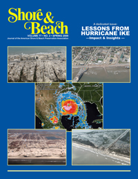
Hurricane Ike along
the upper Texas coast: An introduction
by
Nicholas
C. Kraus and Lihwa Lin
in Shore
and Beach Vol. 77,
No. 2, 3-8
National assessment
of shoreline change: Part 1
Historical
shoreline changes and
associated coastal land loss along the U.S. Gulf of Mexico
by
Robert A. Morton, Tara L. Miller and Laura J. Moore
U.S. Geological Survey Open File Report 2004-1043
Click here to see a Packery Channel
Monitoring update
presented to the City of Corpus Christi in April 2010.
The report was prepared by Diedre D.
Williams of TAMUCC (Note: this is
a pdf
file of over 3mb)
Beaches
and
Dunes and the sand cycle (GLO)
The
Texas Coastal
Hazards Atlas, Volume 2 (Brazos River to Corpus Christi Bay)
Changes
in Gulf
Shoreline Position, Mustang and North Padre Islands, Texas, by
Gibeaut,
Hepner,
Waldinger, Andrews, Gutierrez, Tremblay, Smyth and Xu
Dune Protection and Improvement Manual for the Texas Gulf Coast (GLO)
Twenty
one
years of shoreline changes on Mustang Island Gulf Beach by Tony Amos
(this file is huge (13mb), download it)
Sand
Sources and Distribution Patterns for Gulf Coast Beaches:
Focus on Upper Texas Coast Sand Budget
J. William Soderman, Ph.D.
Presented at the Coastal Texas 2020
Technical Erosion
Conference
sponsored by the Texas General Land Office
September 16, 2005
Papers and articles about
Port
Aransas and South Texas
Fabulous
Port Aransas by Miller
Harwood and W.A. Scrivener, 1949, A History of Port Aransas, Aransas
Pass, Copano, Corpus Christi and the surrounding area with emphasis on
the development of shipping and waterways. This is presented
in
two parts. Be patient, Part 1 is 8 megabytes and Part 2 is 14
megabytes.
Part 1
Part 2