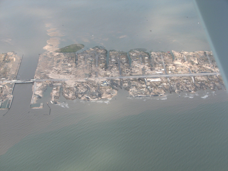
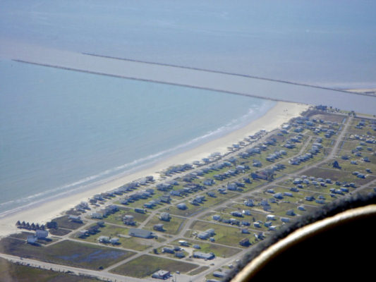
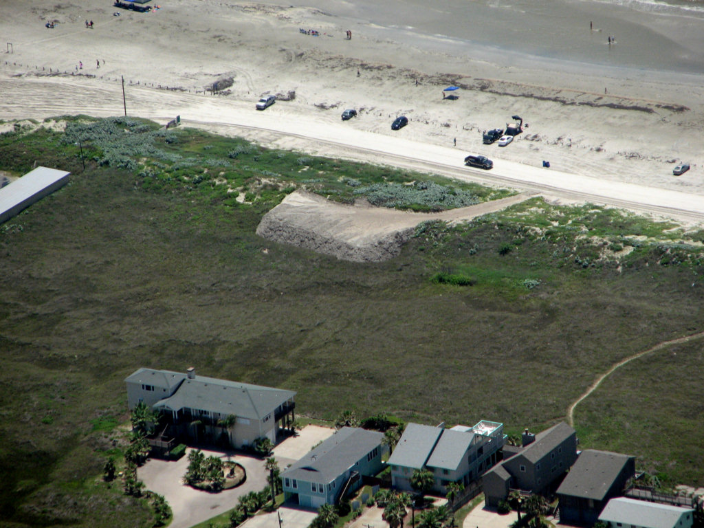
5/7/2013
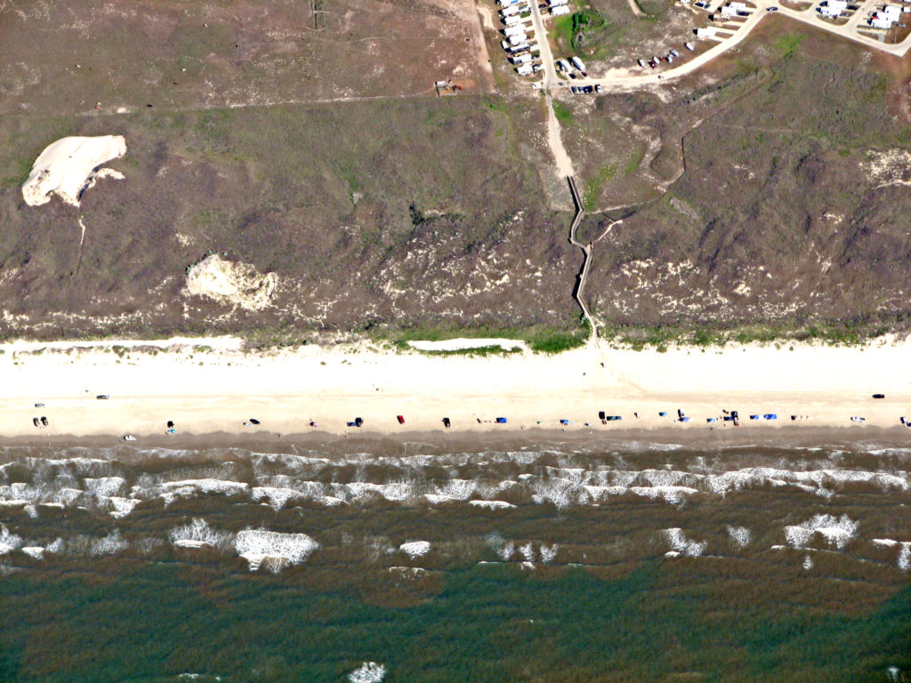
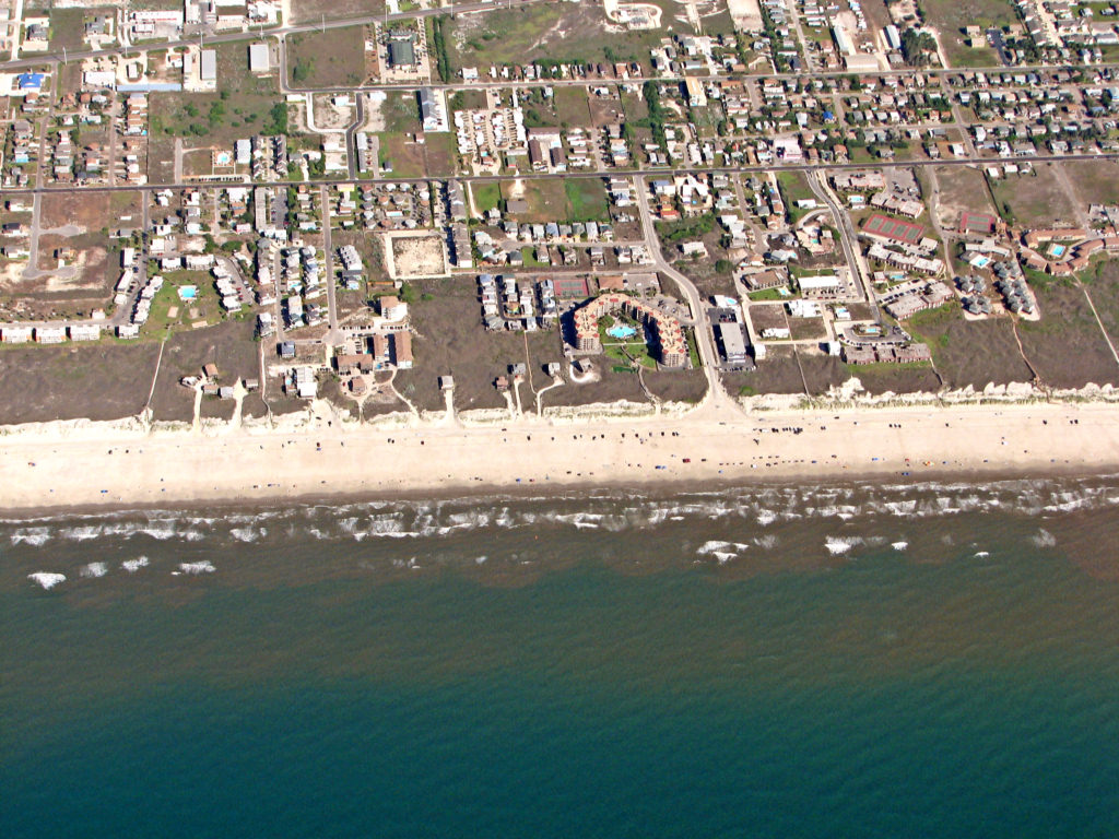
This interactive map shows the
relative susceptibility of Mustang and North Padre Islands to
geohazards, including sea-level rise, erosion, and storm washover.
Additional layers show the various geoenvironments present on the
barrier islands as well as information on parcels, upland land use, and
elevation. The map was created by the Coastal and Marine Geospatial Lab
of the Harte Research Institute for Gulf of Mexico Studies at Texas
A&M University - Corpus Christi. The Bureau of Economic Geology at
The University of Texas at Austin, in collaboration with the Harte
Research Institute for Gulf of Mexico Studies at Texas A&M
University - Corpus Christi, conducted the lidar survey and processed
the data to produce the digital elevation model.
6/5/2012
12/27/2011
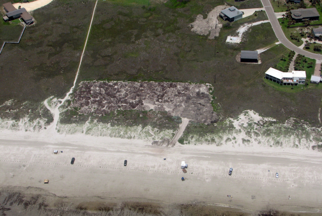
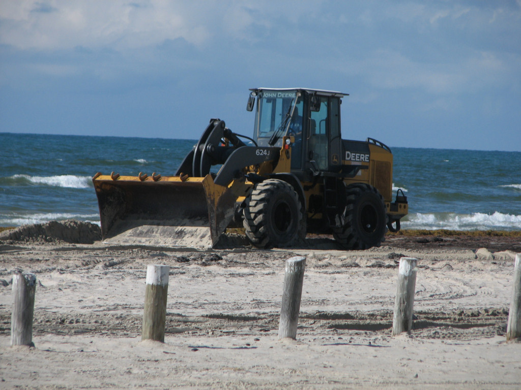
IS THE CITY
OF PORT ARANSAS REMOVING SAND ON PROPERTY OWNED BY PRIVATE LAND OWNERS
IN THE VICINITY OF CINNAMON SHORE AND MOVING IT BELOW THE HIGH TIDE
LINE ON TO THE PUBLIC BEACH?
If this property and other
properties south of Access Road 1A on Mustang Island are bounded on the
Gulf side by a littoral tidal boundary, and I believe that they are, it
may not be legal for the City to remove sand or move sand on that
property, if the sand being moved is landward of the Mean High Tide
line, even if it is seaward of the vegetation line. The Open
Beaches
Act grants access to the beach seaward of the vegetation line, but it
probably does not grant ownership of the sand deposited above the MHT
line, nor does it likely grant permission to change the profile of the
beach on the land owned by the upland owner seaward of the MHT line.
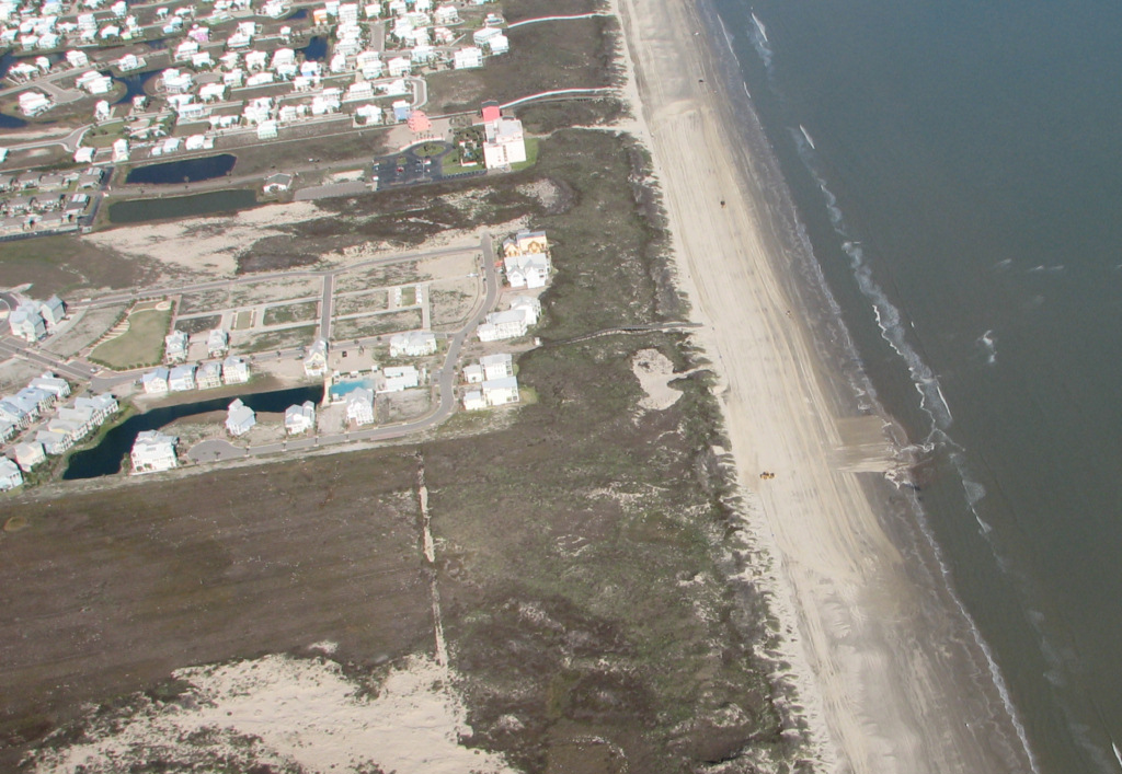
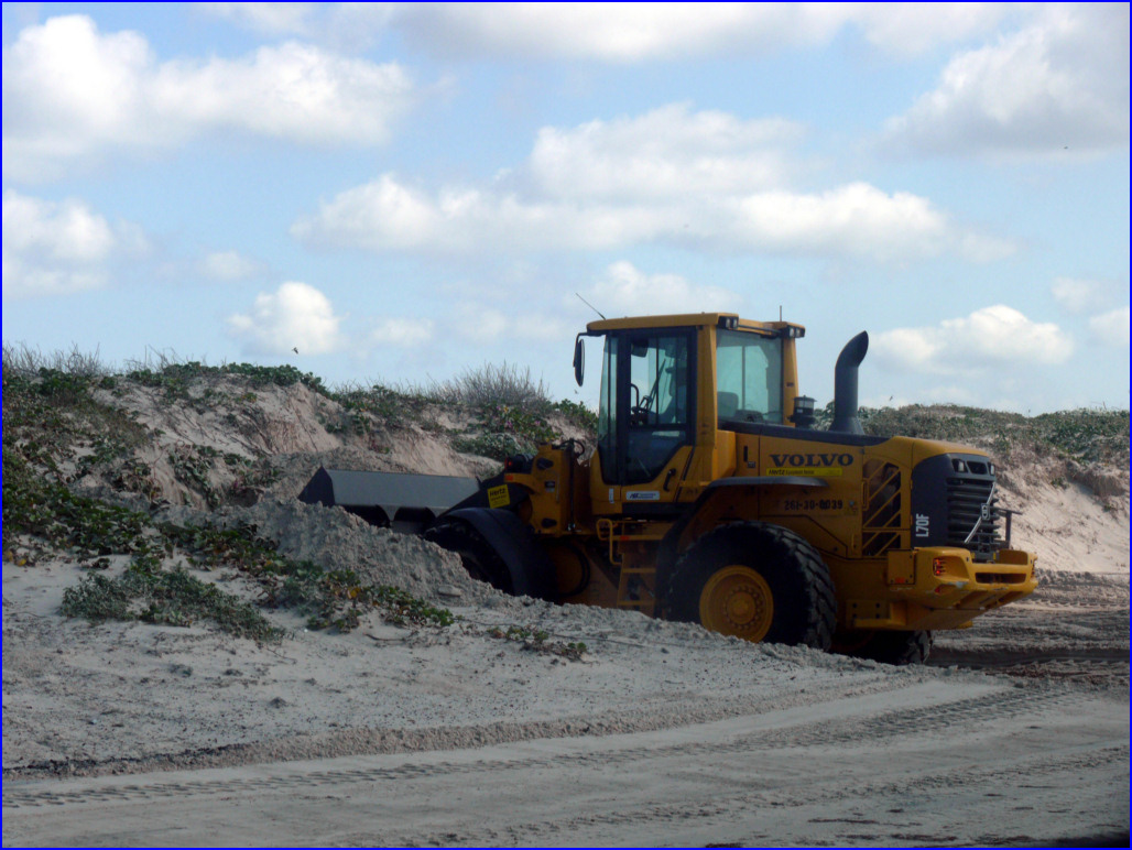
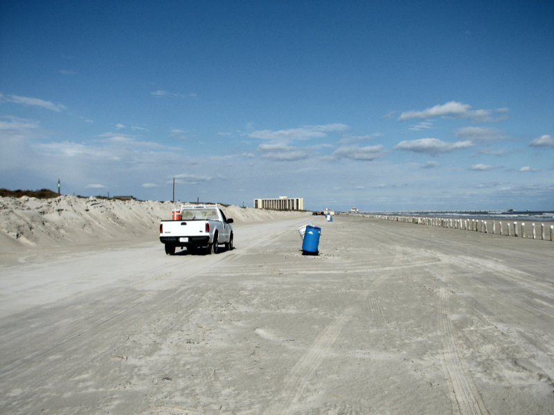
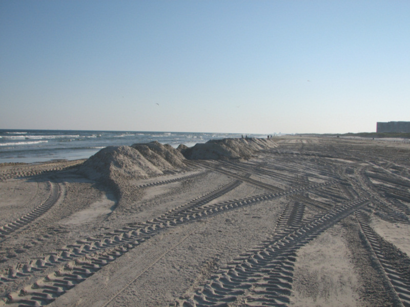
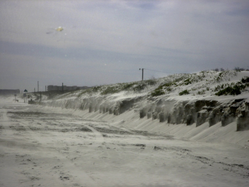
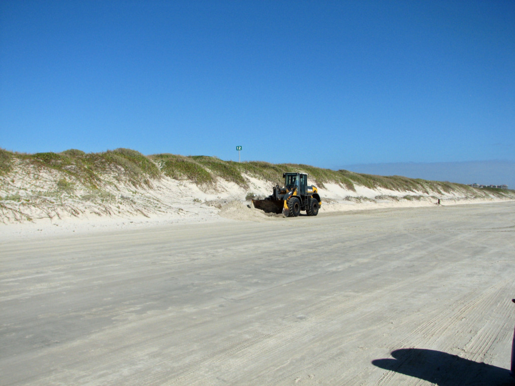
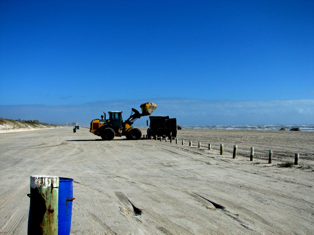
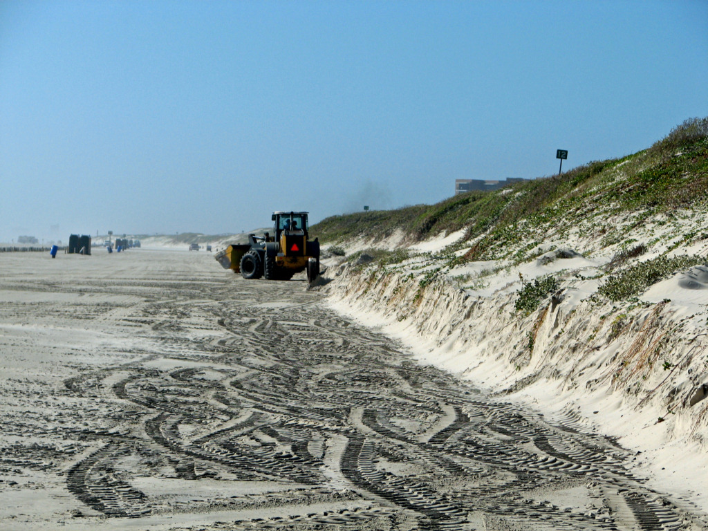
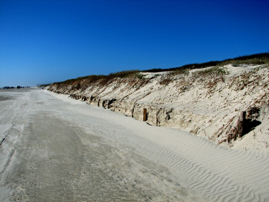
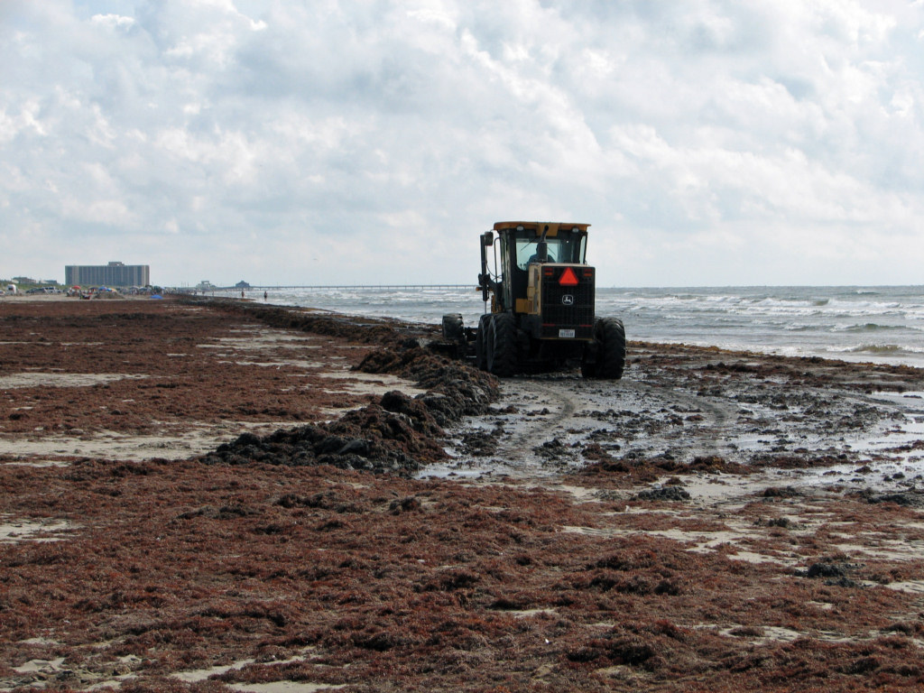
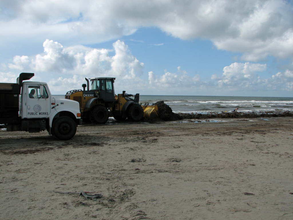
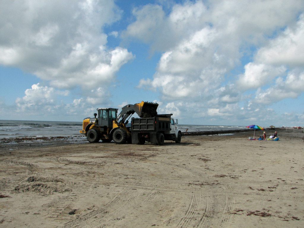
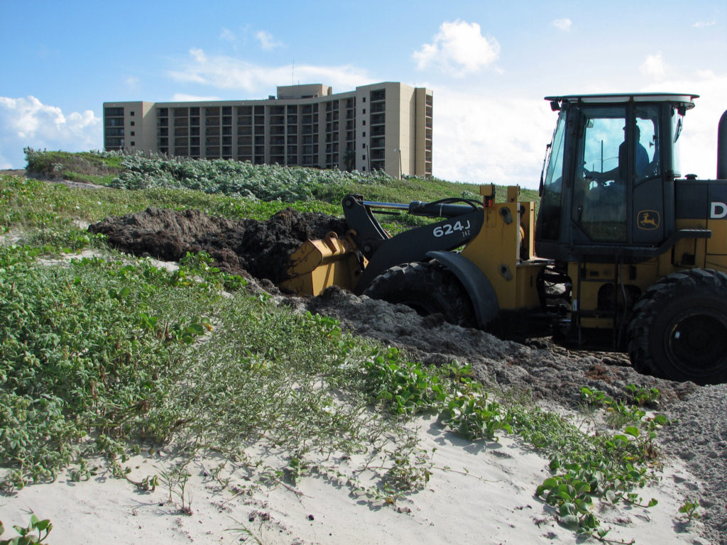
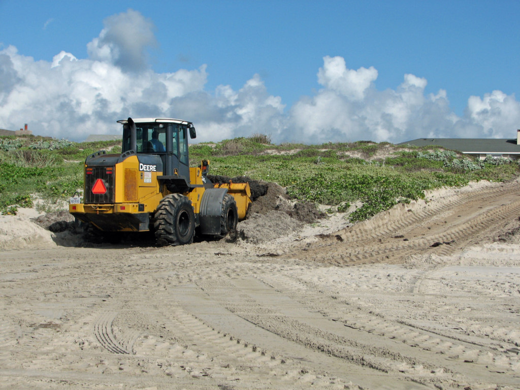
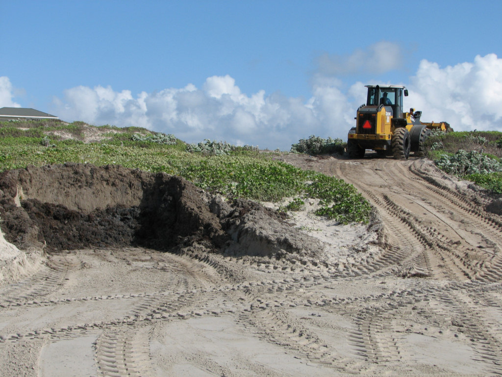
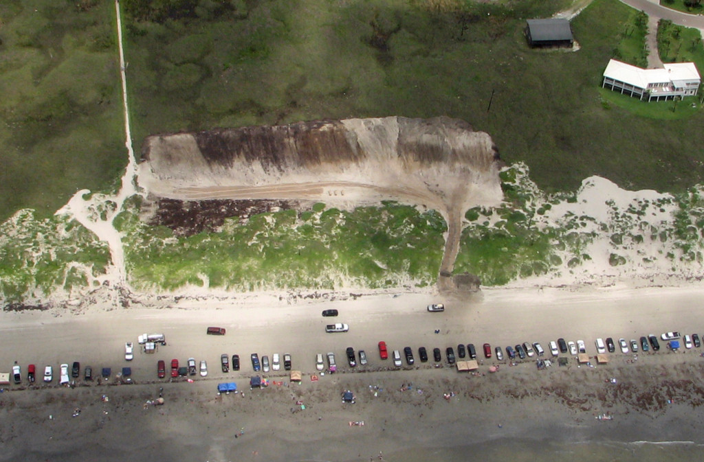
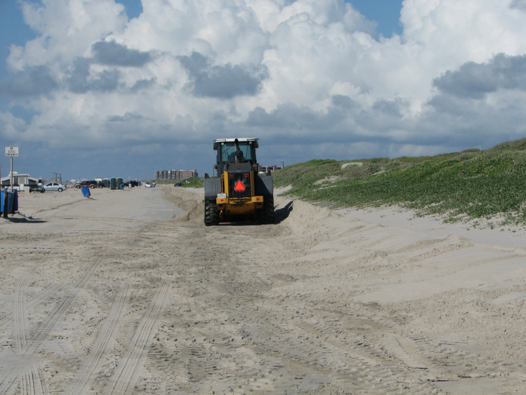
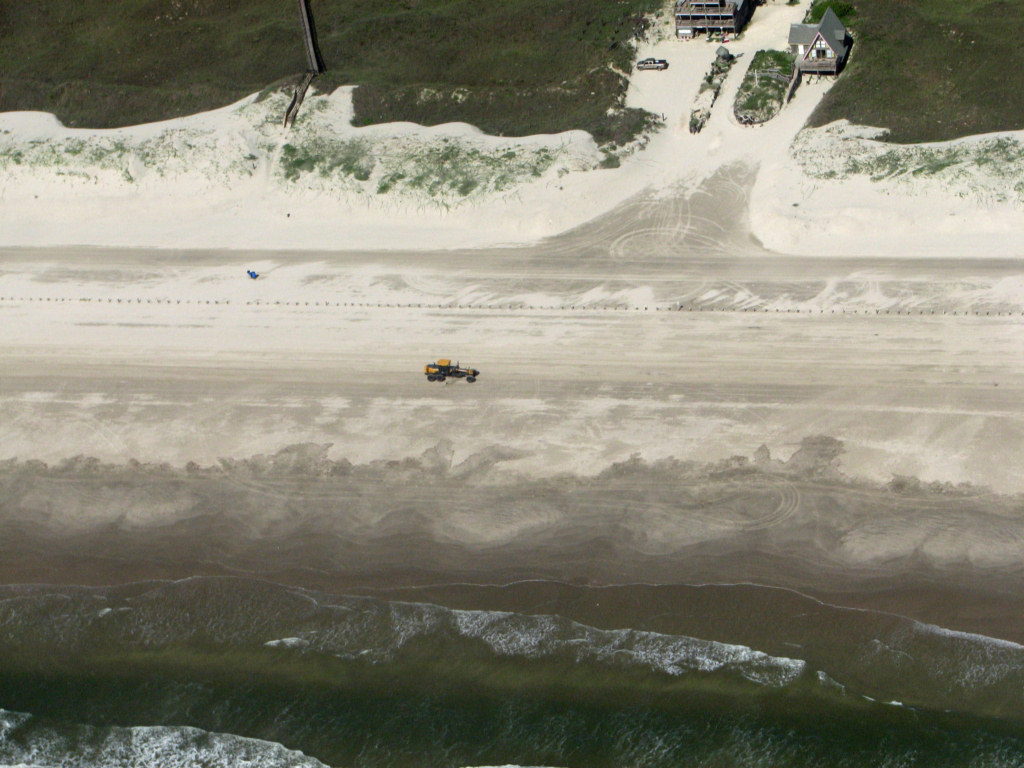
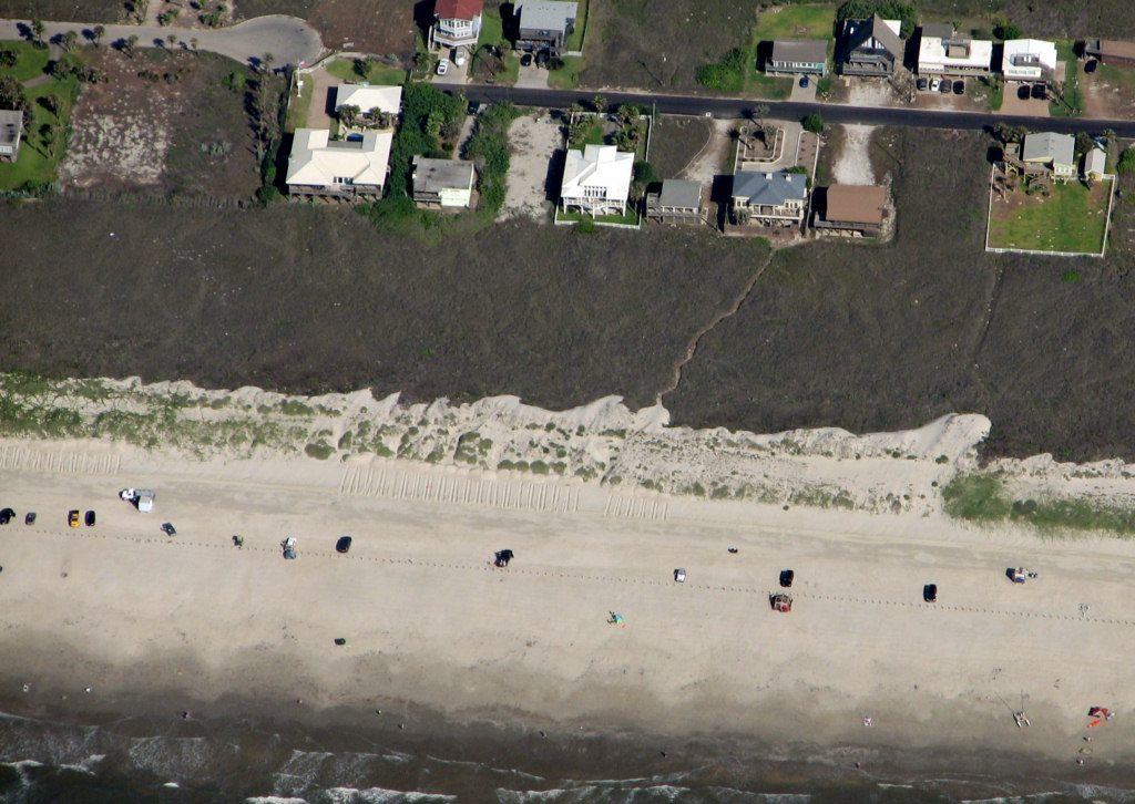
Port Aransas is scraping the beach in the
vicinity of the Cinnamon Shore development. This is in the area
of the eroding shoreline according to the erosion map prepared by the
Bureau of Economic Geology of the University of Texas. The City is
removing sand from the front of
the dunes where it has accumulated for months and dumping it in the
edge of the water. This is bad practice north of Access Road 1A
where the beach is stable to accreting and it is VERY bad practice in
the Cinnamon Shore area where the beach is eroding and the shoreline is
retreating. This area needs all of the dune strength and
stability that it can possibly have to protect the very expensive
development behind the dunes. If sand is being moved in this
area, which is probably a bad idea, it should, at least, be used to
strengthen the foredunes, not be placed in the surf where it will move
away along the shoreline.
12/27/2011 Near Cinnamon
Shore
IT IS
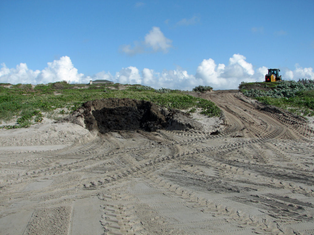
HURRICANE SEASON AND THE CITY OF PORT ARANSAS IS EXCAVATING OUR DUNE
SEAWALL, OUR ONLY PROTECTION FROM DEVASTATING OVERWASH!
June 17, 2011
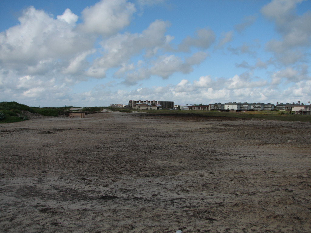
This image is a panorama of four
photographs taken standing on the the back stacking area just south of
Lantana St. Not that the stacked seaweed and sand is almost,
but not quite as high as the existing dune ridge. It has
about doubled the width of the dune system at this location. It
is placed mostly on high ground on the back of the main dune ridge.
It will not obstruct drainage from the wide flat any more than
the existing dune ridge. Drainage in a location such as this
percolates into the sand and flows out to the Gulf under the dunes and
under the beach. There are no surface drainages through the
present dune system in this area. Of course, culverts could be
placed to enhance drainage.
June 17, 2011
This photograph shows that the back stacked
sargassum and sand is 10 or 12 ft high. It will rapildy vegetate
due to the fertilizer value of the seaweed. In fact, this winter
I found a bunch of water melons on top of another recent back stack
location.

June 16, 2011
This photograph taken on 5/31/11. It
shows the "back stacking" of seaweed and sand in the disposal area just
south of Lantana St. in Port Aransas. The red line outlines about
two years of Sargassum disposal for this area. The yellow arrow
shows the very minor damage due to the front end loader driving up over
the dune to carry the material behind the dune ridge. The damage
created is insignificant relative to the great strengthening of our
natural dune seawall by placing this material behind the main dune
ridge. If we have sea level rise, or if we have shoreline
erosion, the front of the dune ridge will be eroded. Building the
dune system inland behind the main dune ridge with our beach
maintenance sand and seaweed disposal will result in making our
hurricane protection much stronger. This is a very beneficial
practice and far superior to excavating the front of the existing dunes
for temporary storage of Sargassum and sand. The permanent
addition to the dune system below grows our protection. Temporary
placement in an area excavated in the front of the dunes does not grow
our protection, but rather weakens the existing protection. Back
stacking is a good answer to both maintaining our tourist beach and
improving our hurricane protection. This disposal area is on
TXGLO land. This would be highly desirable on other GLO land
behind the dunes and on private land further south along the island
where beach erosion is a serious problem. This method builds new
dunes which will be there when beach erosion and shoreline retreat
takes the present foredunes.
May 31, 2011
This photograph shows the backstacking area
just south of Avenue G in Port Aransas. Note that the Sargassum
and sand mix has about tripled the volume of the dune system in this
area. The tiny TEMPORARY access road for the front end loader is
insignificant damage relative to the massive increase in dune volume
provided by the back stacking. This is a very good procedure.
This is also on GLO land.
June 3, 2011
Uh Oh, Tony Amos is not
pleased with the City's destruction of the dunes.
Tony
comments; "These are the dunes near Marker 35 that I have been
following for years. They have been growing and stabilizing with
vegetation since Hurricane Rita. The logic is not obvious.
They scoop out the dunes, vegetation and all and dump it in the
sea to make room for unconsolidated weed/sand (and I might add, trash)
mixtures they create by scraping the beach elsewhere and trucking it to
this location." Let's look at Tony's photos.
First we scoop out the dunes! (Photo
by Tony Amos)
Now we drive to the edge of
the water. (Photo by Tony Amos)
 Then we dump the dune sand,
dune vegetation and morning glories into the sea! (Photo by Tony
Amos)
Then we dump the dune sand,
dune vegetation and morning glories into the sea! (Photo by Tony
Amos)
 Now we have only the dead
remains of beautiful beach morning glories! (Photo by Tony Amos)
Now we have only the dead
remains of beautiful beach morning glories! (Photo by Tony Amos)
May 31, 2011
The
City of Port Aransas is has a new scheme to dispose of Sargassum sea
weed in a method that is very damaging to the foredune ridge, which is
our only seawall protecting us from dangerous hurricane overwash.
Some of the homes protected by this dune ridge are valued at over
one million dollars. Their hurricane protection has been weakened
by excavating the well vegetated dune ridge in front of them.
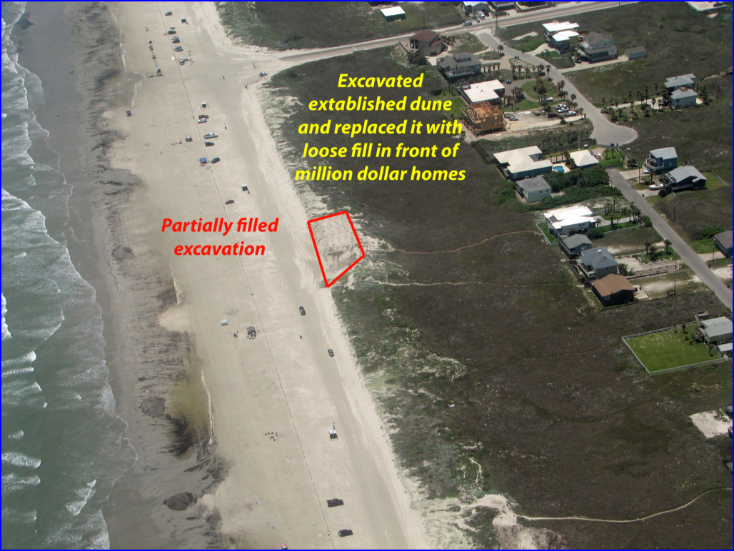
May 31, 2011
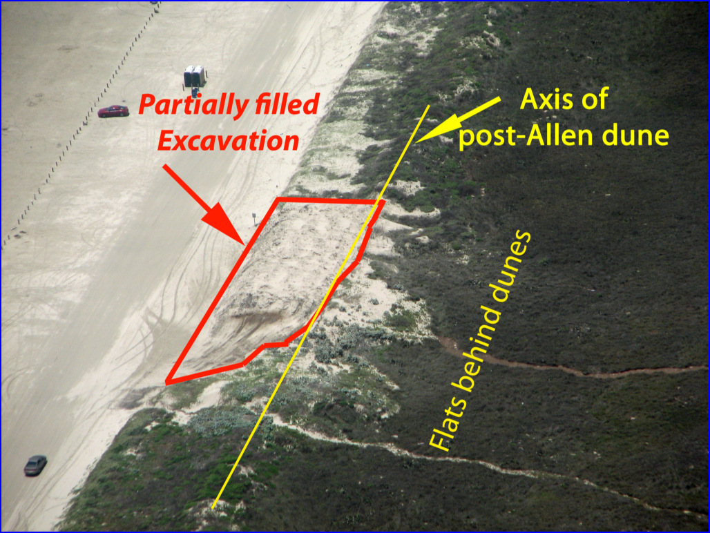
This excavation has cut
nearly completely through the main dune ridge. It has been
partially back filled with new loose sand and Sargassum weed.
May 25, 2011
Until very recently, any manmade or natural accumulation of sand
with or without vegetation located on the beach or within 1000 ft.
landward of the vegetation line was legally a dune and could not be
disturbed without a dune permit and only if the disturbance was
considered minimal or was remediated. In the late 90s, in this
vicinity, a tourist on a beach buggy had the temerity to run his
vehicle so that it straddled a clump of vegetation on the very low face
of the foredune ridge, but did no real harm. He was fined over
$1000.
The City and the Texas General Land Office came up with an new and very
dangerous designation for the dunes on the front of our foredune ridge.
It any of those dunes have been man-made by the City stacking
sand there, it is now called a maintenance dune and has no protection.
The City is now excavating the front of our very important dune
seawall and filling the excavated portion with Sargassum weed which has
just washed in to the beach. The problem with this is that it very
greatly weakens the dune which has been building naturally and with
some help from the City placing sand in it since it was almost
completely destroyed by Hurricane Allen 31 years ago. IT TOOK 31
YEARS WITH NO MAJOR STORMS FOR US TO REACH THE EXCELLENT LEVEL OF
PROTECTION THAT THE DUNE SEAWALL IS NOW PROVIDING.

May 25, 2011
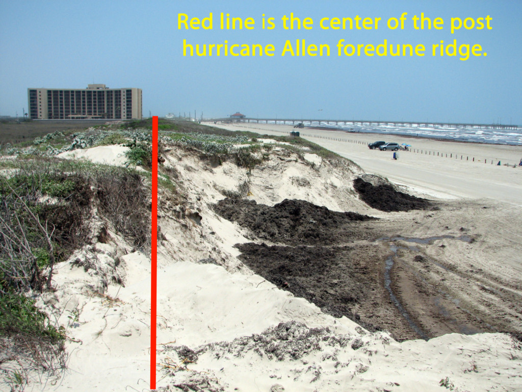
The excavation is so large that it
is difficult to get into a photograph. This panorama shows the
location of one of these excavations of the dune seawall between
Lantana St. and Avenue G. The big condo is the Dunes Condominium.
Some of the homes that you see to the left that will be the first
to be destroyed if the dune seawall fails are valued at over
$1,000,000. The land between the dune ridge and those homes is
owned by the State and managed by the Texas General Land Office.
The red line shows the center line of the post hurricane Allen
foredune ridge. The excavation has cut this very important
protective ridge more than 1/2 way through. It has been
stabilized by vegetation for several decades and has continued to grow
upward. The cut is being filled by loose sand and seaweed.
The new material will be eroded by a hurricane much faster than
the well vegetated stabilized old dune that has been cut. It is
vital that the foredune system be as strong as possible to buy time
during a hurricane so that it is not breached. Cutting into this
dune system and replacing it with fresh loose material is giving up a
large amount of that protection. If a private individual or
company did this destruction to our dune seawall, they would be in
serious trouble. The sand that was excavated was placed on the
low beach. That low beach will provide zero protection against
destructive hurricane overwash as the beach will be below water level
early in the storm. The storm waves, in this location, will now be able
to rapidly cut through unconsolidated and unvegetated sand and breach
the foredune ridge. It takes decades to build these ridges
naturally, or naturally with augmentation, but they can melt away in
hours. We need as many of those hours as possible. Just a
few hundred yards to the north of this location, the City has been
disposing of Sargassum and sand behind this dune ridge. This is
far preferable as it does not damage the existing dune seawall, but
builds it wider and stronger. That is a win win.
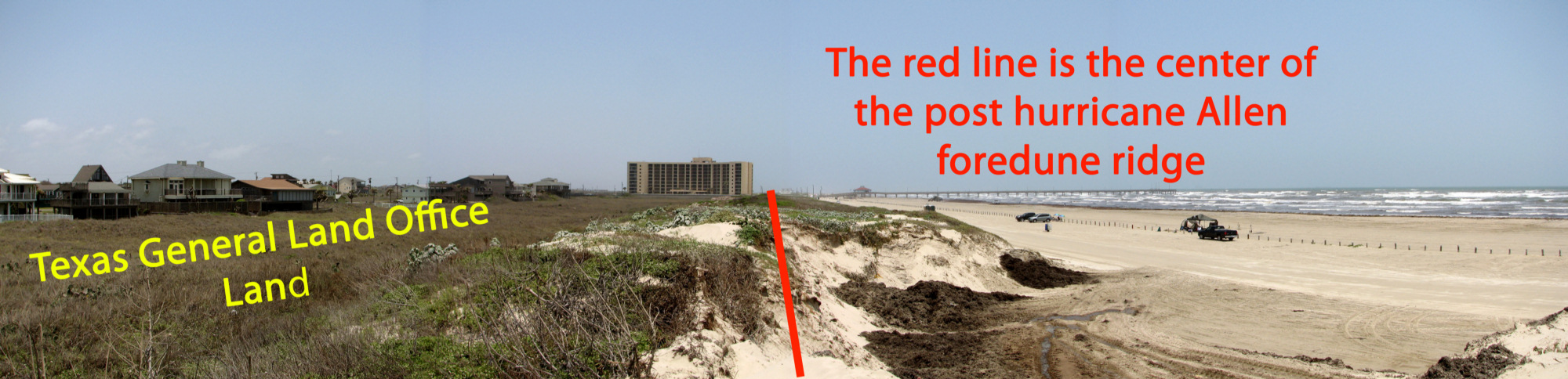
May 25, 2011
This photo was taken standing inland of the
center of the old post Allen dune ridge. The cut looks to be
about 12 to 15 feet deep. You can see that the cut has been
partially filled with fresh black weed and sand and there is an older
fill behind that. The main foredune ridge drops off to the
vegetated flat and the GLO land almost immediately to the right of the
red line. There is almost none of the old strong dune left after
the excavation at this location. In plane English, this is NUTS.
May 25, 2011
This is the same situation looking to the
north. The red line is again on about the center line of the post
hurricane Allen foredune ridge.
May 25, 2011
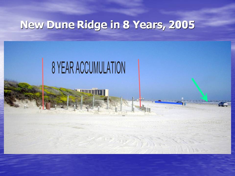
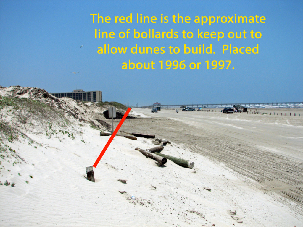
In
1996 or 1997, the City Council wisely placed a row of bollards (posts)
twenty or thirty feet seaward of the base of the post hurricane Allen
dune ridge. This was just flat beach at that time. The
purpose was to keep cars from between the face of the old dune ridge so
that sand could accumulate their naturally and build us a stronger and
wider dune seawall. Sometime the City would add sand in that
protected zone during beach cleaning operations. Largely on its
own, by natural wind blown sand, a substantial foredune was built and
became vegetated. In the present operation the City has removed
the bollards and, at this location, excavated the entire dune that
built since 1996 and over half of the pre-existing post hurricane Allen
foredune ridge.
This
is how much natural vegetated dunes that those bollards built in about
8 years. That very well vegetated slope on the high dune is the
face of the post hurricane Allen foredune, our seawall in 2005.
This was before the City began placing sand between the new
bollards and the old foredune ridge. To cut into this protection
makes no sense. During the past several years the city used the
valley between the new seaward dune ridge and the old post Allen ridge
as a disposal area for sand and Sargassum weed. This built the
very substantial dune seawall that we have at the present time.
It
is a huge mistake to excavate disposal areas in our dune seawall and
weaken it at any time and especially during hurricane season. It
takes decades to build a strong vegetated dune ridge.
New Texas Supreme Court Decision
affects beach front property owners and public access.
The Supreme Court of Texas on Nov. 5, 2010 just decided
that the "rolling easement" guaranteeing public access to the dry beach
below the vegetation is not legal. There is no such thing in law
as a "rolling easement," easements are fixed. This will have
serious implications for both beach front property owners and the right
of public access to "dry beach" above MHT or MHHT. The easement
will probably still apply for slow and imperceptible movement of the
vegetation line, but not for rapid and instantaneous movement
(avulsion) due to a hurricane or other storm. You can see the
entire court decision at the following link. Two justices were in
dissent.
You
can view the dissenting opinion here.
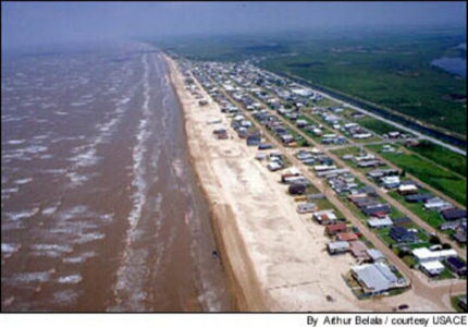
Most of the beach
erosion of the Texas coast has been caused by man-made changes to the
shoreline and rivers.
The following link is a narrated PowerPoint presentation explaining the
causes of beach erosion on the Texas Coast. It is a large file.
When
a state of the Federal government builds a water storage reservoir for
water supply or flood control, the government must buy the land that
will be flooded. Most of the erosion of the Gulf beaches has been
due to man-made changes in the shoreline, primarily long jetties at
inlets. In addition the thousands of large and small up-stream
reservoirs and impoundments have greatly reduced the amount of sand
brought to the coast by rivers. When these changes were made, the
present resulting shoreline erosion was not anticipated.
However, since the erosion was caused by the State and
Federal construction on our shoreline and rivers and since the
harbors for shipping and the reservoirs for water supply benefit all
texans, then the state should compensate the private property
owners along the shoreline for their loss and purchase the land where
the beach is now located. This is exactly equivalent to
purchasing the land that will be flooded by a reservoir created
by the government.
A Line in the Sand: Balancing the Texas
Open Beaches Act and Coastal Development
by
Eddie R. Fisher and Angela L Sunley,
Texas General Land Office
High
resolution digital
copies of many of
these photographs are available for sale. You may purchase a digital
photo in the highest resolution that I have for $25.00 for personal use
or for use in your presentations. The charge will be $150 for use
in
publications or for commercial reproduction. Contact me to
purchase
photos. These photographs
are
copyrighted and are the property of Richard L. Watson. They
may
not be copied or used without permission. You may however
link to
this website from your website or by email.
December 15, 2010
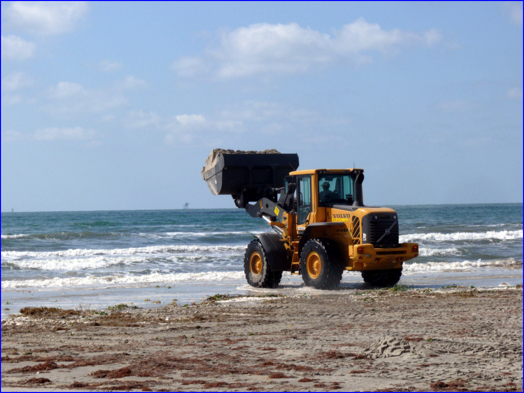
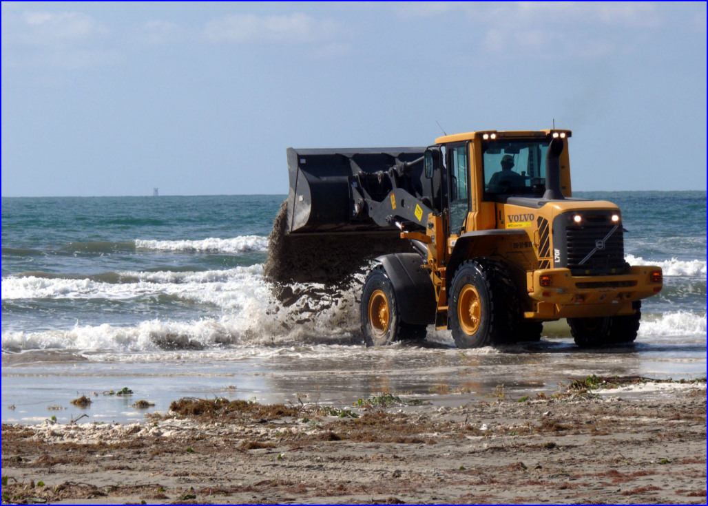
For the past several months, the City of
Port Aransas has been moving THOUSANDS of dump trucks of sand from the
toe of the dunes down to the lower beach and the water's edge.
The City now has the permits in place to do this legally.
In addition there has been a major shake-up of the coastal
section of the Texas General Land Office, with three of four
coastal geologists terminated. This practice of moving vast
quantities of sand from the front of the dune ridge is very short
sighted. The foredune ridge is our natural dune seawall and
provides excellent protection by direct wave attack and prevents direct
overwash. However, a major storm can take out hundreds of feet of
dune width. In short, you can't have too much sand in the dune
system when it comes to protection from hurricane overwash. Look
at the photos below to see the damage. If you are new to this web
page, you might want to read further below for more information about
this problem. Also visit the Hurricane Information page (see
button at the top of this page) to see how badly damaged the Bolivar
Peninsula was by Hurricane Ike due to the fact that they had little in
the way of fore dunes to serve as a seawall. Contact your council
members and tell them to stop this practice. Sand removed from
the driving road on the beach was on its way into the dune system.
When it is removed from the road, it should be PERMANENTLY placed
in the dune system and not removed to the lower beach. Our
natural dune seawall protects over a BILLION dollars of real estate.
December 15, 2010
December 15, 2010
December 15, 2010

December 15, 2010
December 15, 2010
Note the hanging vegetation
and roots that have been undercut by the front end loader. These
plants stabilize the dunes and slow erosion during hurricanes and
lesser storms. Leaving this un-vegetated vertical wall leaves it
very vulnerable to storm attack.
December 15, 2010
December 15, 2010
December 15, 2010
7/18/2010
This photo shows the new
seaweed and sand disposal area behind the dunes at the County Park,
just north of Beach Street.
7/7/2010
The City of Port Aransas is removing
sargassum along with included sand and transporting it into areas
behind the main dune ridge. The procedure is to use a grader to
scrape the seaweed, with as little sand as possible into long rows.
These rows are then picked up by a front end loader and
transported by truck to the disposal area. Since disposal is in
the dune field, this will ultimately make our dune seawall stronger and
provide better hurricane protection. In addition, the seaweed is
probably the primary nutrient for dune grasses, so these areas should
vegetate in fairly quickly as they have in the past. The entire
sequence of operations is shown in the following photographs.
7/7/2010
7/7/2010
7/7/2010

7/7/2010
The Sargassum and sand is being temporarily
dumped in a small cut out in the face of the dunes, to be immediately
picked up by the loader and dumped in the disposal area behind the main
dune ridge. I assume that this small temporary cut out will be
filled with sargassum and sand, so that it can re-vegetate and leave no
weakness in the main dune ridge. If we are going to remove
material from the beach, this process of building the dune ridge on the
back side will provide us with better storm protection and the beach
materials are being moved in the natural direction from the water into
the dunes. This disposal area is a short distance south of
Lantana St.
7/7/2010
7/7/2010
7/7/2010
7/7/2010
This is a new disposal area.
Scroll down through the photos taken 7/3/2010 to see a much
larger disposal area that has been in use for several years.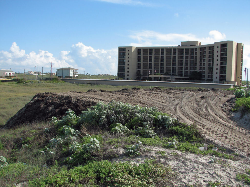 This is the new disposal
area in the above photo. The aerial photo was taken on 7/18/2010.
This is the new disposal
area in the above photo. The aerial photo was taken on 7/18/2010.
7/3/2010
This
shows a much larger and longer use Sargassum disposal area a short
distance south of Avenue G. The following photos show this area
on the
ground.
7/7/2010

7/7/2010
7/7/2010
This sand/seaweed mix is
loaded with nutrients and should vegetate quickly.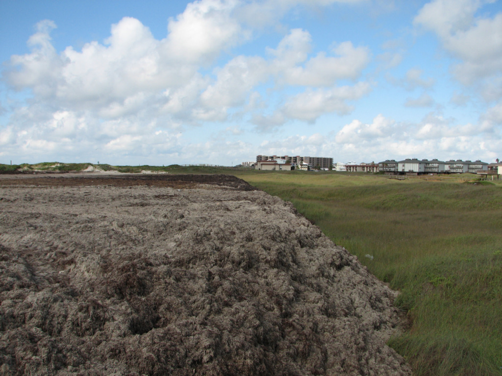
6/22/2010
The City of Port Aransas now has a USACE
permit to move sand to the lower beach. This is most unfortunate,
as it means moving sand which was blown onto the roadway and which
would have naturally blown into the dunes to make our very important
dune seawall much stronger and better able to resist overwash by a
severe hurricane. These photos were taken between Lantana and
Avenue G. First a grader was used to pile road sand up at the tow
of the dunes. Now a great many dump truck loads of that sand are
being carried to the lower beach and spread out with a second loader.
Two loaders and two dump trucks in constant motion are moving a
tremendous amount of sand in the WRONG DIRECTION. It would be
much better if this sand was placed in the dune system. If you
don't remember how the Bolivar Peninsula was recently nearly totally
destroyed by Hurricane Ike, scroll down on this page of go to the
hurricane page. These dunes are our ONLY protection from severe
overwash during a large hurricane. It takes decades for them to
rebuild between storms, so any sand that was headed in their directions
should NEVER be taken back in the seaward direction. Communities
on the upper Texas coast just spent as much as $35 per cubic yard for
sand to rebuild their dunes. Each dump truck of sand carried AWAY
from the dunes is worth about $200 at those prices.
6/22/2010
6/22/2010
Here you can see the loader about
to take another bite of dune sand. What a shame.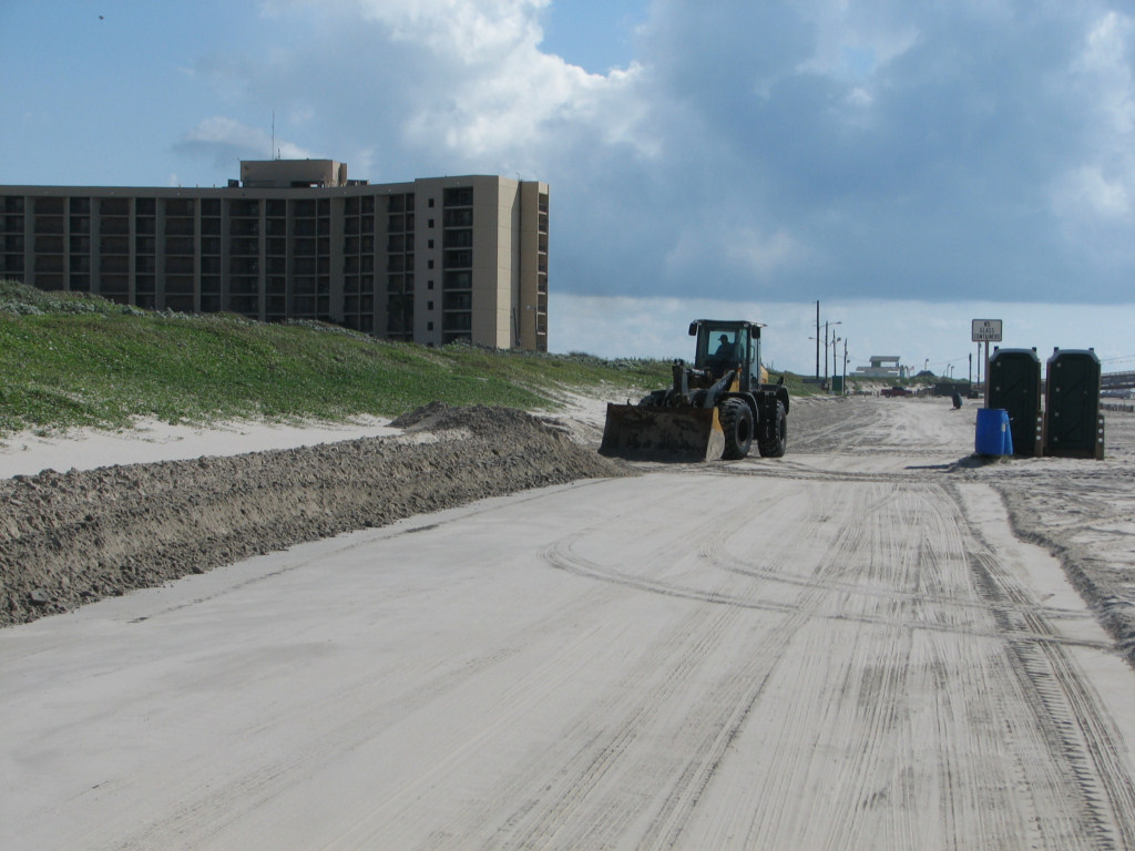
6/22/2010
The loader dumps the sand in
the dump truck waiting for it while the other truck dumps on the lower
beach.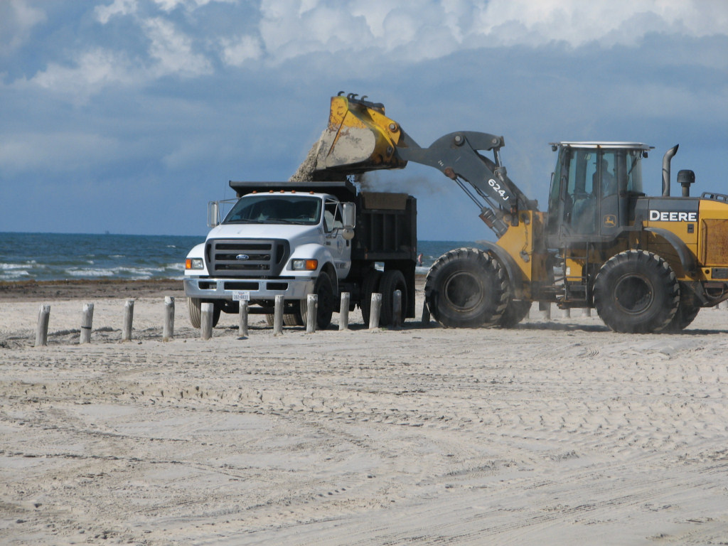
6/22/2010
The dump truck dumps its
load of sand on the lower beach. It will be immediately leveled
out by the second loader.
6/22/2010
The loader levels the sand
dropped by the dump trucks.
6/20/2010
The
following link is the Corps of Engineer Permit to move sand to
the lower beach. The actual permit begins on page 591. It
is preceeded by all of the documents leading to obtaining that permit,
including objections by this author and others. In defense of the
Corps of Engineers, they MUST grant a permit if all of its regulations
are met. The Corps has no power regarding protecting the dunes
and their growth as they are located above the annual highest normal
tide and they do inot involve wetlands. It is most unfortunate
that the General Land Office is allowing this sand transport to occur.
5/11/2010
The City of Port Aransas is removing sand
from the beach road and "back stacking" it behind the foredune ridge.
This builds the dune ridge stronger and provides additional
hurricane overwash protection. This is far far better than moving
sand from the road way to the lower beach. Back stacking is
taking sand that was headed in its natural direction toward the dunes
and placing it where it will do the most good. Even better, the
sand is mixed with Sargassum weed from the beach, the natural
fertilizer for dune vegatation. Bravo.
5/11/2010
See the above photo for
explanation.
10/6/2009
A road grader is being used
to blade the beach at Port Aransas. This photo is just south of
Access Rd. 1A and the Aransas Princess.
10/6/2009
A road grader is being used to blade the
beach at Port Aransas. I don't see the necessity to do this as
they are grading the pedestrian beach. Disturbing the sand or
distributing it down to the wet beach will stop this sand from moving
toward the dunes which is its natural direction of transport.
This is important because those dunes are our seawall for
hurricane protection. Of course, this grading will also destroy
any natural grasses growing on the beach before they can grow to a
significant clump and begin to aggegate coppice dunes.
8/8/2009
The following series of
photographs were taken of the Port Aransas dunes and beach management
on 8/8/2009. These photos show placement of sand behind the
dunes (back stacking) and in front of the dunes. The photos
are
organized from south to north.

 Note the sand pushed up to
the base of the vegetation 8/8/2009
Note the sand pushed up to
the base of the vegetation 8/8/2009
6/9/2009
On
June 4-5, 2009 The Texas General Land Office held the Texas Coastal
Conference 2009 in Galveston, Texas. Dr. Watson gave an
invited
presentation titled What has
hurricane Ike taught us about beach and dune management. You
can download and watch this narrated powerpoint presentation at the
following link. The file is about 20 mb, so it is best to
download it
rather than just click on it, unless you have a very fast internet
connection. Download
the presentation here.
3/29/2009

The roadway in front of
the sand
stacked against the dune is wide as is the beach. 12/10/2008
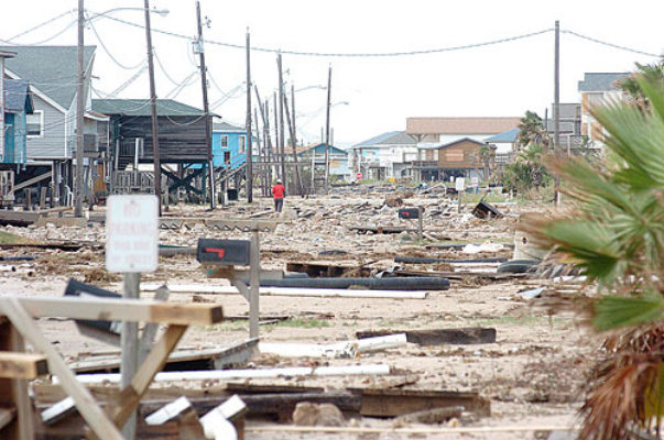
Just
as a reminder of the damage due to Hurricane Ike which overwashed
Bolivar Peninsula on September 13, 2008, look at the following two
photographs of Crystal Beach. That community lost the first
nine
or 10 rows of homes and suffered great damage further inland.
It
had no seawall and no natural dune seawall to protect it. We
should protect and grow our natural dune seawall.
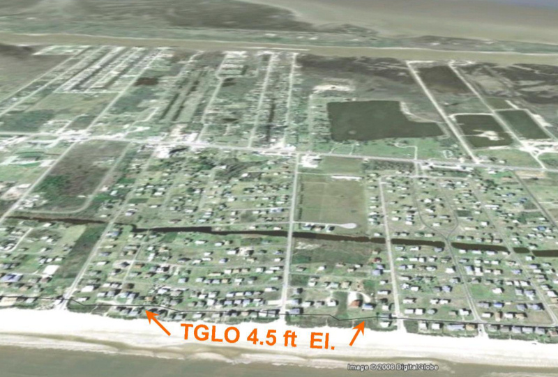
Crystal
Beach, TX from Google Earth before
Hurricane Ike. The TGLO 4.5 ft line is the estimated new vegetation
line. Structures
seaward of that line cannot be rebuilt.
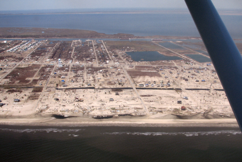
Crystal
Beach after Hurricane Ike. Many
blocks of homes have been completely destroyed. Photo by author taken
on
10/28/2008.
********************************
10/14/2008
An
official at the US Army Corps of Engineers told me that the line below
which the City of Port Aransas, or the City of Port Aransas or any
other entity may place sand is not Mean High Tide (MHT), but rather is
the line of the highest non-storm tide of the year. I have
been
informed that this is about 2.56 ft. above Mean Sea Level (MSL) by the
1988 National American Vertical Datum (NAVD88).
This means
that the line below which the City cannot place sand without a permit
is very high on the beach and is likely about at the location of the
seaward edge of the dune line. The City has been placing
sand
below this line without the required Corps permit for several years.
They are currently meeting with the Corps to find a solution
to
this problem, so that they can move sand to the lower beach with a
permit. This is unfortunate as the sand on the upper beach
and
roadway is being naturally transported toward the dunes. If
any
sand movement is made, it would be best to move the sand into the dune
system, to build our Natural Dune Seawall stronger, not weaken it by
transporting sand in the seaward direction. Nature provides
us
with this dune growth at no cost, other than the cost by the city to
pile it into a narrow ridge. This has been estimated to be
some
30,000 cubic yards of sand, or about 5000 dump trucks. Rather
than spend the money to take this gift from the sea and give it back to
the sea and the lower beach, it should be left in place and allowed to
vegetate. It is plain from the two following photographs that
the
beach is wide and that the roadway is quite wide enough for traffic in
both directions as well as parking.
********************************
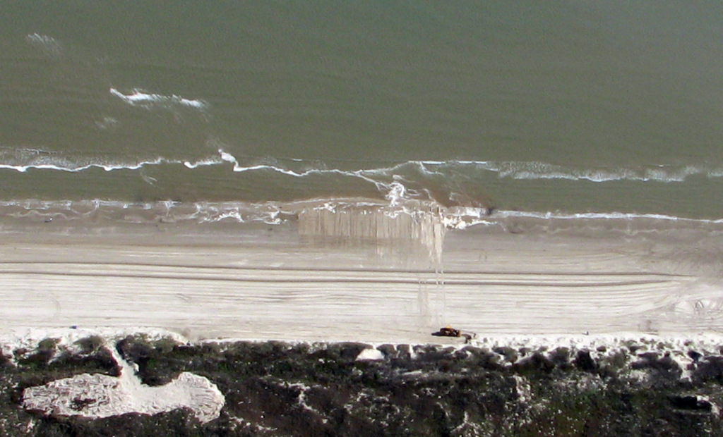
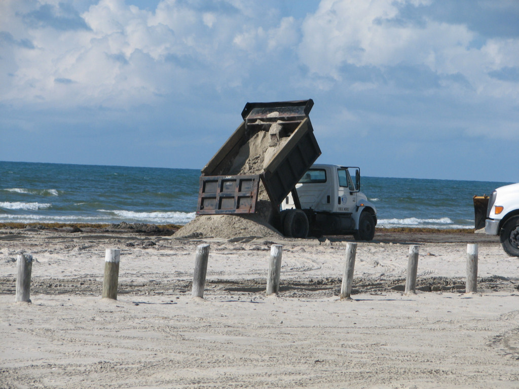
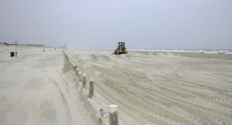
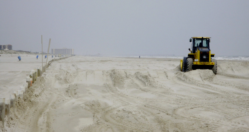
10/1/2008
Port Aransas is moving
sand below
MHT without required permit.
Port
Aransas is again
removing sand from the upper beach and depositing it at the edge of the
water. I believe that this is being done without a COE permit
which is required. I saw a survey flag where the material is
being dumped. I suspect that they are placing the material
above
where Mean High Tide (MHT) was located BEFORE the erosion by hurricane
Ike. However, that area is surely well below MHT now, and one
of
the photo shows the resulting beach widening out into the
water.
If this is below the PRESENT location of MHT, a COE permit is required
(and should not be granted).
This photo shows sand
being
excavated from in front of the dunes.
The
next two photos shows dump truck loads of sand being deposited below
present MHT at the edge of the water.
This
photo show how the beach is being widened well below MHT without a
Corps of Engineers permit. This is sand that should be
building
our natural dune seawall stronger to protect us from future hurricanes.
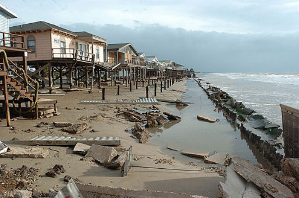
If
Hurricane Ike has not
reinforced the need to have the strongest dune system possible on
Mustang and N. Padre Islands to protect the billions of dollars of real
estate behind the dunes, I don't know what will. Surfside and
West
Galveston
Island
were severely damaged by Ike because they had no significant dune
protection or seawall. The towns of Caplen and Gilchrist on Bolivar
Peninsula
were completely
destroyed by Ike because they had no dune protection. The
following link shows photos of that destruction:
http://texascoastgeology.com/Hurricanemaps.html
The
next two photos shows what Hurricane Ike did to the Texas town of
Gilchrist on
the Bolivar Peninsula. Gilchrist had no seawall and no dunes
and
now has no town.
This
is what Gilchrist looked like in 1998 before Hurricane Ike
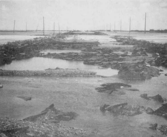
This
is what Hurricane Ike did to Gilchrist
We are
fortunate to have
a strong and wide dune system protecting most of Mustang and N. Padre
Islands. However, storms erode back the foredune ridge and it
takes decades for it to rebuild back between storms. In the
area
where Port Aransas is removing the sand, the dunes were eroded a small
amount, with the greatest erosion where there are dune cuts for
driveways and roads. In addition, some of the lower beach was
deposited on the upper road as a berm. It is this material
which
is now being dumped below MHW. A very large amount of
material
has already been removed from the upper beach and carried to the edge
of the water. Other towns in Texas
are paying up to $35 per cubic
yard ($200 per truckload) to place sand in exactly the location where
we are removing it. We are throwing money in the sea!
There
are two processes
that place sand on the upper beach which eventually grows the foredune
ridge in a seaward direction, and blows into the dune system and builds
it higher. One is the long slow deposition by wind transport
and
the other is the sudden deposition of berms by tropical storms that are
strong enough to erode the lower beach and deposit sand in front of the
dune without causing major dune erosion. BOTH of these
processes
are NATURAL and are the means by which the dune ridge is rebuilt
between MAJOR storms which can erode the dune ridges back HUNDREDS of
feet in a single storm.
We need
the strongest
dune ridges possible. They are our NATURAL DUNE SEAWALL which
protects much in the same way as a man made seawall. The
dunes
rebuild themselves at no cost to us by the above two methods of natural
sand transport across the beach to the dunes. We get a superb
natural seawall and it is FREE, if we will just let it
happen.
Galveston
behind the seawall did not experience frontal wave attack, but just
flooding from the back, which while damaging is not nearly as
bad. Bolivar
Peninsula
experienced direct frontal wave attack and entire towns are gone.
Moving
sand from the
upper beach to the lower beach is incredibly short sighted and
drastically reduces the ability of our NATURAL DUNE SEAWALL to build to
the strength where it can protect the billions of dollars of real
estate behind it in a major hurricane direct hit, or worse yet two
major storms in quick succession.
Please do what you can to
convince our
governments about the importance of our dunes as storm
protection. Look at the photos of the Bolivar
Peninsula and the other areas that
had no such
protection.
********************************
The City of Port Aransas
has applied to the
Corps of Engineers for a permit to move sand and seaweed to disposal
areas within the dunes and more importantly to move sand from the
middle and upper beach to the lower beach. Moving sand in a
seaward direction rather in its natural landward direction ultimately
starves the dunes of the sand supply which is necessary for their
growth and rebuilding between major storms. It takes decades
for
the dunes to regrow what is lost during a major storm. This permit has no
limit on the
quantity of sand that the city can move!
The
following link will take you to my letter of objection to many aspects
of this permit application.
The following links will
take you
to the Permit Application and Plans.
If you wish to request a
public hearing or
comment about these plans for beach maintenance on Port Aransas
Beaches, your response must be received by the Corps of Engineers by 31
December, 2007. The address for comments is below.
Matthew Kimmel
Regulatory Branch, CESWG-PE-RCC
U.S. Army Corps of Engineers
5151 Flynn Parkway, Suite 306
Corpus Christi, Texas 78411-4318
361-814-5847 Phone
361-814-5912 fax
********************************
July
8,
2007 City Dune Permit Proposal
The
following is a discussion about the dune permit that the City is
seeking to use the front of the foredune ridge as a permanent rotating
temporary storage for seaweed and sand. This will leave the
most
important part of the foredune ridge in a permanently weakened state
because it will never fully vegetate. City council will
consider
this proposed Dune permit on Thursday, July 19, 2007 at the regular
council meeting.
Comments on the
City
of Port
Aransas
Seaweed Maintenance
Application for Dune Permit and Beachfront Construction Certificate
By
Richard L. Watson, Ph.D.
6/28/2007
The City of Port Aransas
has
a tough problem to
solve.
How to get rid of the seaweed
on
our tourist beaches while not damaging the beach or dune system. City
council created a beach maintenance
committee to evaluate beach management practices. The
dune ridges are our ONLY protection from
damaging frontal storm surge during hurricanes.
The natural dune seawall must
be protected and allowed to grow.
All committee meetings
were
attended by
GLO representatives.
In addition the GLO
hired a geologist (Kim Mckenna) who used to work for the GLO to serve
as an
outside expert to help find non-damaging solutions to the problem. The
entire committee as well as the City
Manager and City Planner presented unanimous recommendations to be
forwarded to
the City, the GLO and McKenna.
These
recommendations made up the bulk of McKenna’s recommendations
and
the committee
unanimously voted to use her report as the final product of the
committee to be
presented to the City Council.
This
report is included as an attachment.
One of the recommendations
was that the
front of the foredune ridge be allowed to grow 20 feet further seaward
and
that, if possible, seaweed be disposed of behind the dune ridges on GLO
property between Lantana and Rd. 1A.
This will require a permit
from GLO.
This beach and dune permit
which the City
may be seeking from the GLO has several recommendations which probably
would
have been rejected by the beach maintenance committee, had they been
able to
review it.
Please
refer to the following
application for
a dune
permit.
Look at the colored figure
which
is the second page.
This permit application
calls
for
excavation of 40 feet of the most seaward part of the dune ridge to be
used as
a rotating disposal area for seaweed and sand.
After obtaining a Corps of
Engineers permit, this sand and
decomposed
seaweed could then be deposited on be beach below the high tide line or
in the
edge of the water.
Further, the permit
application calls for
deposition of sand and seaweed from eroding parts of the beach
(basically from
the Beachwalk development southward) to be deposited only within its
own
transect in the eroding section of the beach.
However, this permit application
also
states
that sand from accreting areas (Mostly between Lantana and Rd 1A can be
deposited within eroding or accreting sections of the beach! This means
that the intent, or at least the possibility, exists to remove sand
from the
accreting beach/dune system from Lantana to 1A and deposit further to
the south
in the area where the beaches are eroding.
This is robbing Peter to pay
Paul and will reduce the growth of
the
beaches and the dunes in the accreting area.
The accreting area has most of
the developed
part of Port Aransas behind it and those dune protect over one billion
dollars
worth of real estate.
If
any sand is
moved, it
should stay within ¼ mile of where it was deposited and
should,
if at all
possible be moved in the landward direction, so that it can help the
dunes to
build to give us further protection during hurricanes.
Further, the
permit
application describes the historical dune restoration (red and yellow)
in the
figure as having been built manually. I
am not sure about the dunes south of Ave G., but the new frontal dune
ridge
between Lantana was entirely built naturally.
About 10 years ago, the city
placed a row of dune protection
bollards
out 30 or 40 feet from the high dune ridge (which was partially
man-made by
stacking seaweed and sand).
These
bollards were there to keep cars and scrapers out, so that the
vegetation could
advance and build a new dune ridge. It
has built a beautiful new and natural dune ridge. It
would have built naturally in the absence
of the bollards, if cars and scrapers would have stayed out. South
from G to 1A, I believe that most of
that same new ridge also built naturally from forward growth of
vegetation and
wind-blown sand as well, but there was some seaweed placed there. In
short, this is really not just a Beach
Maintenance Storage Area as suggested by the dune permit application. It
was built naturally after a late 90s City
Council had the bollards installed. It
serves as an important part of our protection from storm surge.
Last week, the
city dumped
seaweed and sand in the low between this frontal ridge and the higher
ridge
behind it because there are few disposal areas that can now be used. This
is the first seaweed or sand dumped
there by the city north of Ave. G. This
will do no harm and will end up being a beautiful foredune ridge and
further
strengthen our storm defense.
Beach Maintenance Storage
Areas
Use
of the
front of the dune
ridge as a Beach Maintenance Storage Area is a terrible idea.
It
will be
permanently ugly as
it will not vegetate in. It will
permanently weaken the most important part of the foredune ridge
system.
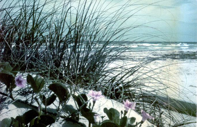
Natural foredune ridge systems have a gently
sloping front which becomes well vegetated.
The root systems of the grasses and other plants hold it
together and
retard erosion, especially during smaller storms. This
protects the main dune ridges from storm
attack. When the dune ridges are eroded,
the erode by wave attack at the base, and collapse vertically, like a
cliff. Permanently weakening the base of
the dune ridge and not allowing it to vegetate in is a great mistake
and
weakens the entire foredune system.
What
Can We
Do?
One
of the
recommendations in
Kim McKenna’s report and by the beach committee was to
dispose of
this material
behind the main dune ridge in the strip of GLO land between the beach
and
private land from Lantana to 1A. The GLO
is probably amenable to this.
This
material
will ultimately
end up as a well vegetated dune ridge giving us further lines of dunes
behind
the main dune ridge for storm protection.
If this area is entered from
Lantana, Avenue G, and private
beach access
roads (on GLO land), the damage to the foredune ridge will be minimal
and
temporary.
Conclusions
1.
Any sand removed from any part of a transect
should be kept in the same area and should NOT be transported south to
the
eroding beaches.
2.
If at all possible, sand
should only be
transported in a landward direction, toward or into the dunes. This
is its natural direction of transport. Moving
it seaward starves the dunes of sand
which would normally help build them.
3.
The front of the dunes,
whether man-made, or
natural should not be excavated to provide temporary storage areas for
seaweed
and sand as this permanently weakens the critical frontal side of the
natural
dune seawall.
4
.
Even though this City Council may have the
best of intentions and maintain our beach and dune system in a
non-destructive
fashion, thispermit opens the door for future councils to do great
damage with
the permissions that will be granted.
********************************
The City Council of the
City of Port
Aransas appointed a committee to study beach maintenance practices and
to recommend any changes and improvements. The committee was
composed of Scott Holt, Chairman, Noyes Livingston, Vice Chairman, Jim
Freeman, Murray Judson, Tony Amos, and Richard Watson as a non-voting
ex-officio member. City staff participated and were very helpful in all
meetings. City staff included, City Manager Michael Kovacs,
Planner David Parsons, Crockett Moreno of public works and Judy Lyle
from Finance. All meetings were attended by members of the Texas
General Land Office (GLO). The GLO hired Kimberly McKenna, a
coastal geologist who used to work for the GLO to study to work with
the GLO, the City, and the Committee to evaluate the committee
recommendations, to evaluate local, state and federal law pertaining to
beach maintenance, and to make recommendations to the GLO and to the
City about our future beach maintenance. The culmination of
the
work by the beach committee and City staff was a compilation of
suggestions by individual members of the committee and the staff.
It can be viewed at the second link below. Ms.
McKenna's
report is available at the first link below. It is a well
done
and comprehensive report covering all aspects of the beach maintenance
and dune protection problem.
*********************************
*********************************
*********************************
*********************************
Click
here to read a letter from Dr. Richard A. Davis (over 40 years as a
Coastal Geologist) to the Port Aransas City Council, Feb, 2006
*********************************
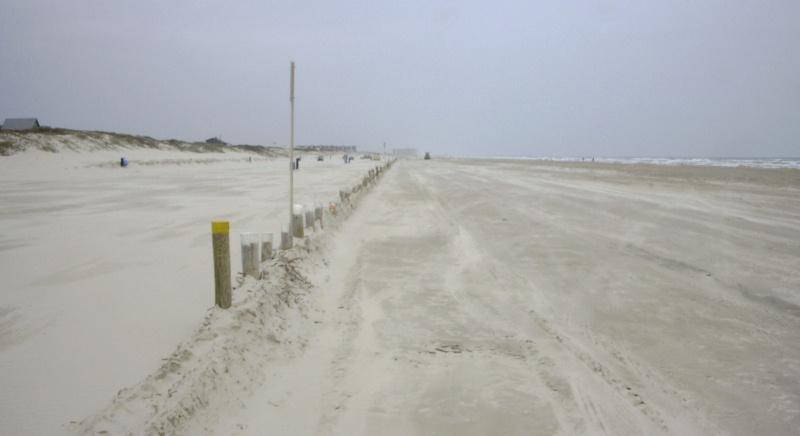
February 23, 2006
Heavy
equipment operated by the City of Port Aransas has moved hundreds of
dump trucks of dune quality sand from the beach road on the left side
of the posts. They are now removing sand from the seaward
side of
the posts and transporting it down to near the water. This
sand is
no obstacle to traffic on the beach because cars are NOT ALLOWED to
drive on the beach on the seaward side of the line of posts shown in
these photos. This sand should be allowed to continue its
natural
migration to the dunes where it will strengthen our Natural Dune
Seawall, if we will only allow that to happen.
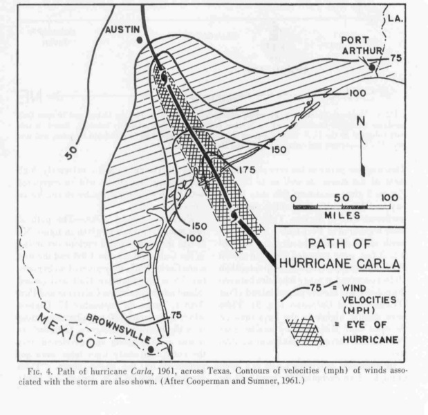
*********************************
Email
just in from a long time Port
Aransas resident who was here for Hurricane Carla.
In
1960, before hurricane Carla,
the Port Aransas dunes extended much
closer to the waters edge. The old Dunes resturant between
Lantana and
Beach was surrounded by high dunes. The entire beach was much narrower.
In that storm most of the Island was covered with water from
the
bay
and water from the gulf side scowered out the dunes leaving a much
wider
beach. Wetting down the driving area is lot better than
scraping
it
out. I think we need all the dune protection we can
get.
Thank you for
all you are trying to do to keep the city from removing sand from the
beach. Keep up the good work.
*********************************