The Supreme
Court of Texas on Nov. 5, 2010
just decided that the "rolling easement" guaranteeing public access to
the dry beach below the vegetation is not legal. There is no
such
thing in law as a "rolling easement," easements are fixed.
This
will have serious implications for both beach front property owners and
the right of public access to "dry beach" above MHT or MHHT.
The
easement will probably still apply for slow and imperceptible movement
of the vegetation line, but not for rapid and instantaneous movement
(avulsion) due to a hurricane or other storm. You can see the
entire court decision at the following link. Two justices
were in
dissent. Click
here for the opinion and more information.
On
June 4-5, 2009 The Texas General Land Office held the Texas Coastal
Conference 2009 in Galveston, Texas. Dr. Watson gave an
invited
presentation titled What has
hurricane Ike taught us about beach and dune management. You
can download and watch this narrated powerpoint presentation at the
following link. The file is about 20 mb, so it is best to
download it
rather than just click on it, unless you have a very fast internet
connection. Download
the presentation here.
Click
here to
read Dr. Watson's invited article titled "Evaluation of coastal response
to Hurricane Ike through pre-storm and post-storm aerial photography"
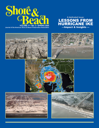
in Shore
and Beach Vol. 77,
No. 2, 49-59. This entire
issue of Shore
and Beach, the Journal
of the
American Shore and Beach Preservation Association
is dedicated to
description and analysis of the damage to the Louisiana and Texas
coasts by Hurricane Ike which came ashore on September 13, 2008.
Dr.
Watson presented a lecture titled Ike
wiped entire towns off of the map. Are we safer in Port
Aransas?
The presentation was made at the University of Texas Marine
Science
Institute in Port Aransas, TX on March 12, 2009 to a standing room only
crowd. The slide show includes before and after photos of the
upper
Texas coast destroyed by Ike, Ike's effects on Mustang and N. Padre
islands, and comparison to past hurricanes and the flooding that they
caused at Port Aransas. You can click on the link below to
watch
and
listen to this narrated presentation. However, the file is
very
large,
about 46 mb and it is probably better to download it and watch it
offline.

|
 |
If you would like to make a
donation to help support the expense of providing this
website and aerial photos, please click on the Paypal button below.
Dr. Watson presented
a talk titled Was
Hurricane Ike a wake-up call, or are we going back to sleep? on
January 15, 2008
at the Corpus Christi
museum of Science and Technology
***********************************
******************************************
*******************************
*****************************
Dr.
Watson gave a presentation titled Severe
Erosion of
Texas Beaches Caused by Engineering Modifications to the Coast and
Rivers at the Harte
Research Institute auditorium, Texas A&M University, Corpus
Christi, Texas on Friday January 19, 2007. The proposed
350 ft. setback for construction on Nueces County barrier islands was
discussed. A
PowerPoint slide
show of this talk with narration as presented at the Harte Institute
can be downloaded at the following link. The presentation is
about 70 megabytes and will take about 15 minutes to download on a fast
connection.
With
very few exceptions, the Gulf
beaches of Texas
are eroding with rates varying from a few feet per year to over 15 feet
per year. Construction of long jetties at major navigational
inlets has locked huge quantities of beach sand into permanent storage,
compartmentalizing the coast and starving down current beaches of sand,
while flood control and water supply dams on rivers that flow to the
Gulf have reduced the sand supply to Gulf beaches. Long term
shoreline retreat on most of Mustang Island and North Padre Island is 2
to 3 feet per year or more. These
and other changes have
initiated irreversible erosion of our Texas Gulf of Mexico
beaches. Even
without predicted sea level
rise this means that the shorelines will retreat 100 to 150 feet OR
MORE in the next 50 years. The 350 foot setback for new
construction proposed by Nueces County will prevent many future
problems by leaving a zone where new dunes can be artificially created
as the present dune line is eroded back. Without this, it
will
not be long before major valuable buildings will be facing destruction
unless the shoreline is armored with seawalls, a very undesirable fix.
Click here to
download my paper, Coastal
Law and the
Geology of a Changing Shoreline,
March 2006.