


TEXAS
COAST AERIAL
PHOTOGRAPHY
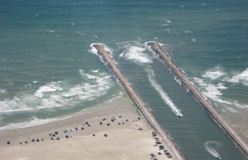
Packery Channel 10/18/2008, boat running surf
Packery Channel 10/18/2008, boat running surf.
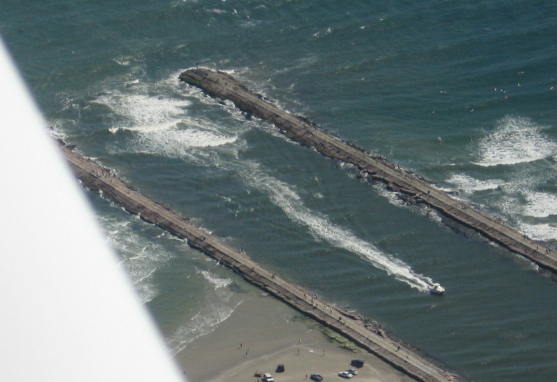
Packery Channel 10/18/2008, boat that ran surf and second one that chickened out.
Seawall 10/18/2008
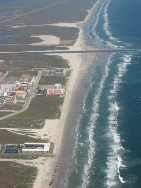
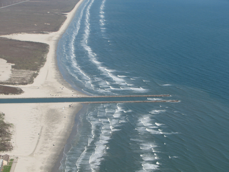
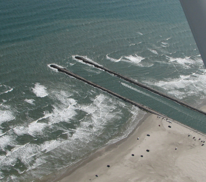
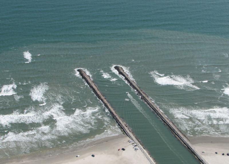
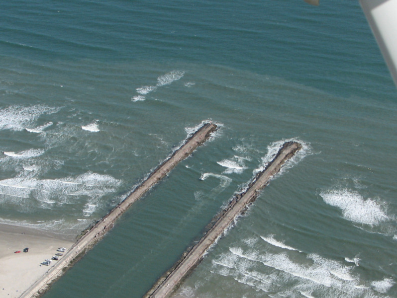
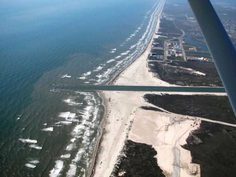
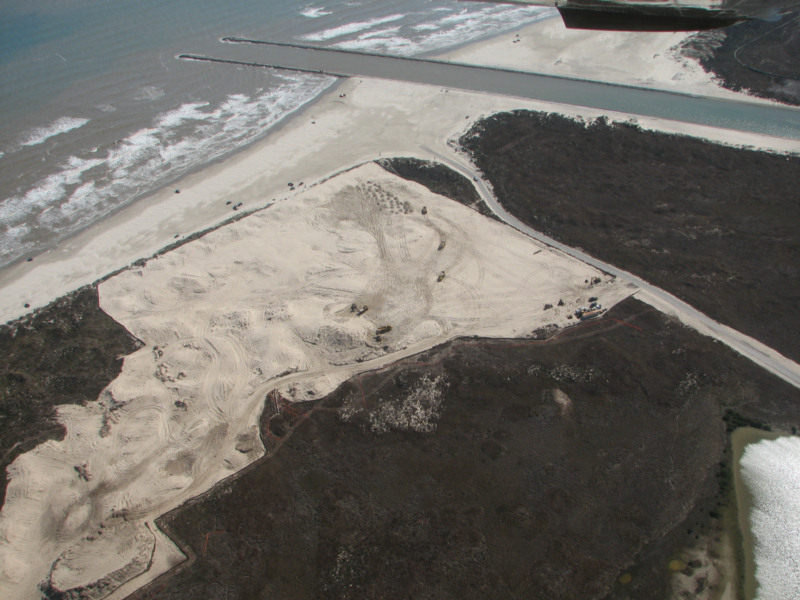
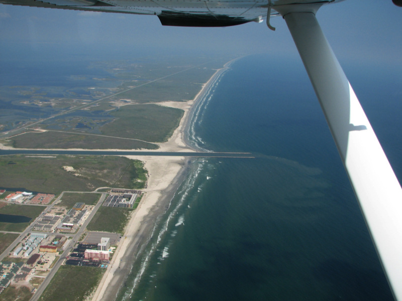
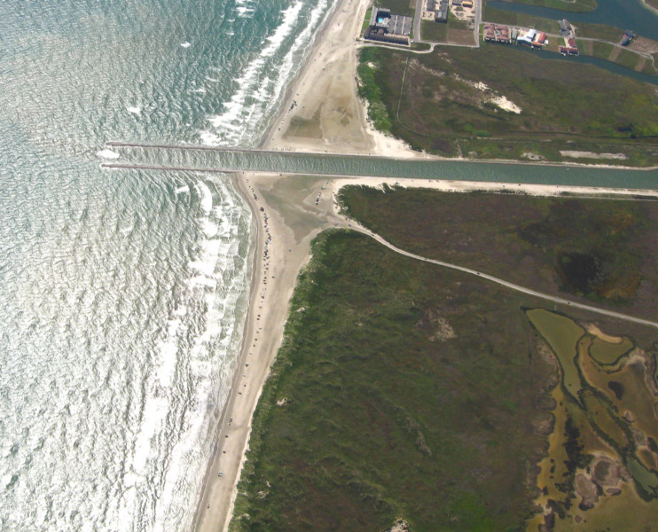
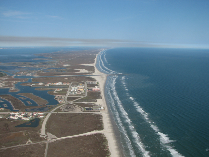
Packery Channel 4/5/2008
Packery
Channel 4/5/2008

High resolution digital copies of many of these photographs are available for sale. You may purchase a digital photo in the highest resolution that I have for $25.00 for personal use or for use in your presentations. The charge will be $150 for use in publications or for commercial reproduction. Contact me to purchase photos. These photographs are copyrighted and are the property of Richard L. Watson. They may not be copied or used without permission. You may however link to this website from your website or by email.
These photographs are copyrighted and are the property of Richard L. Watson. They may not be copied or used without permission. You may however link to this website from your website or by email.
If you would like to make a donation to help support the expense of providing these photos of the Texas Coast, please click on the Paypal button below.
Read the following report for much more information about the entire coast.
Coastal Law and the Geology of a Changing Shoreline, March 2006, updated to include section on poor beach and dune management practicesA Packery Channel and Beach Closing Blog.
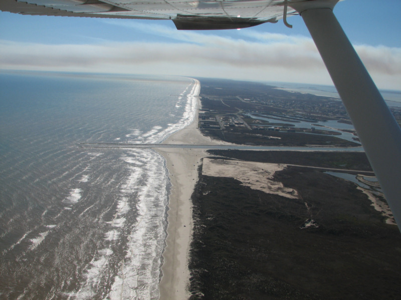
Packery Channel 12/29/2008
Packery Channel 12/29/2008
Note
that the fillet deposited by longshore drift on the north (up in photo)
side of the pass is about as far out the jetty as the fillet on the
south which is from dredged material as well as sand transported to the
north by SE wind waves.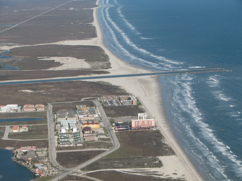
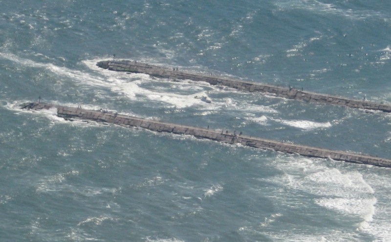
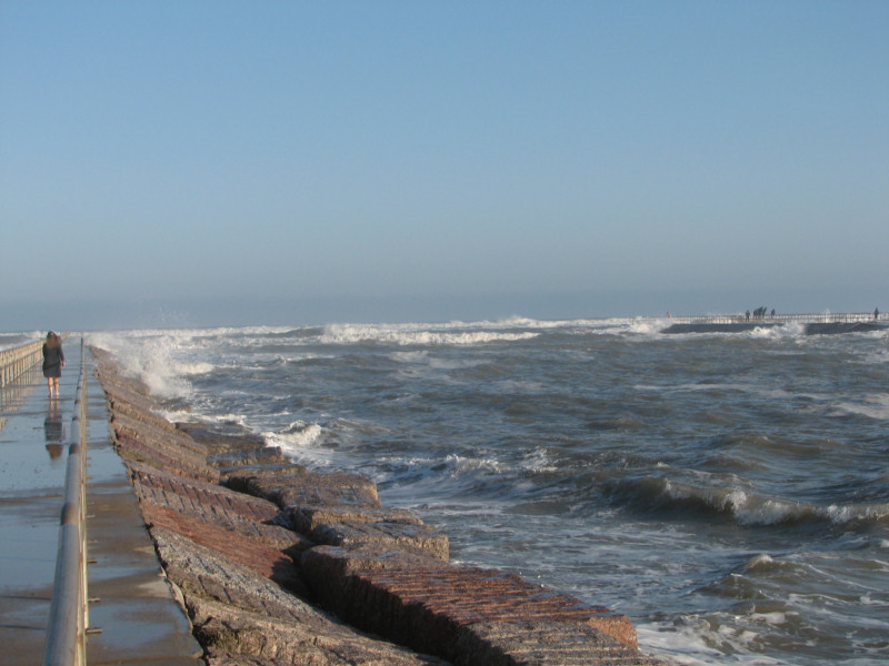
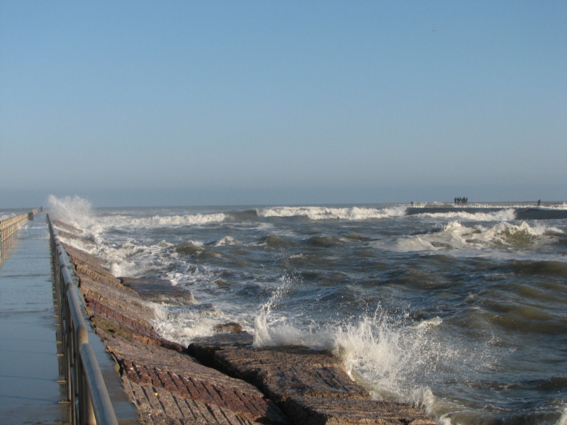
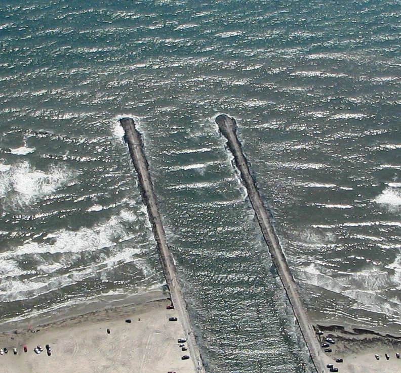
Packery Channel 12/29/2008
Note
the waves breaking on the bar in the entrance, even though it is a
fairly calm day. This bar breaks regularly now and breaks
very
heavily when the waves are larger.
Packery Channel 12/29/2008
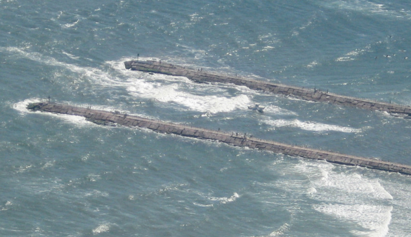
The
next four photographs are of an optimistic boater headed out.
He
then realizes that the breaking bar may be a bit more than he wants to
experience and does a very quick 180 degree turn and heads back in.
The channel looks to be much deeper and with fewer breaking
waves
on the north side of the pass right next to the jetty, but the boaters
seem to avoid that safer side, perhaps because they would have to run
fairly close to the jetty. The fish pass bar developed in the
same way on the south side of the pass entrance with a deeper, though
very narrow channel right next to the north jetty.
Packery Channel 12/29/2008
What is this just ahead?
Packery Channel 12/29/2008
Turning around, just in time!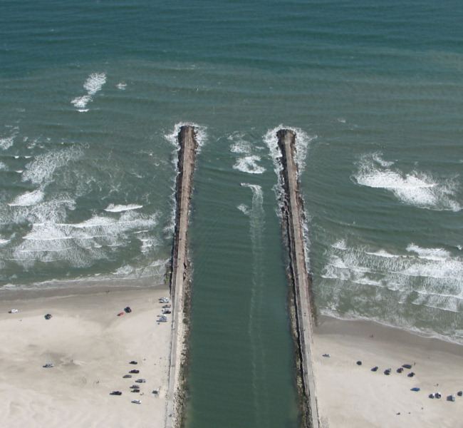
Packery Channel 12/29/2008
I'm outta here!Packery Channel 10/18/2008
Inbound boat running Packery with heavy surf in entrance.Packery Channel 10/18/2008, boat running surf
Packery Channel 10/18/2008, boat running surf.
Packery Channel 10/18/2008, boat that ran surf and second one that chickened out.
Seawall 10/18/2008
Packery Channel 4/5/2008
Tortuga Dunes DUNE DESTRUCTION 2/6/2008
I can't believe that the county and the state permitted this, though they did. What were they thinking?
Here is what Tortuga Dunes looked like a few months ago when it had Dunes.
9/21/2007
Here is what Tortuga Dunes looked like a few months ago when it had Dunes.
10/20/2007
Packery Channel 2/6/2008
Packery Channel 2/6/2008
Packery Channel 1/17/2008
Packery was interesting today. There was heavy surf left over from a norther. The pass was flooding moderately. Surf was breaking very heavily across the entire entrance and apparently on a bar beyond the entrance.
Packery 1/16/2008
Click here for a movie of Packery breaking on 1/16/2008 (8mb). Allow time for it to download and start, or download it and watch it later.
Back to Packery Channel Index