


TEXAS
COAST AERIAL
PHOTOGRAPHY

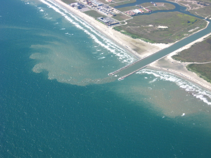
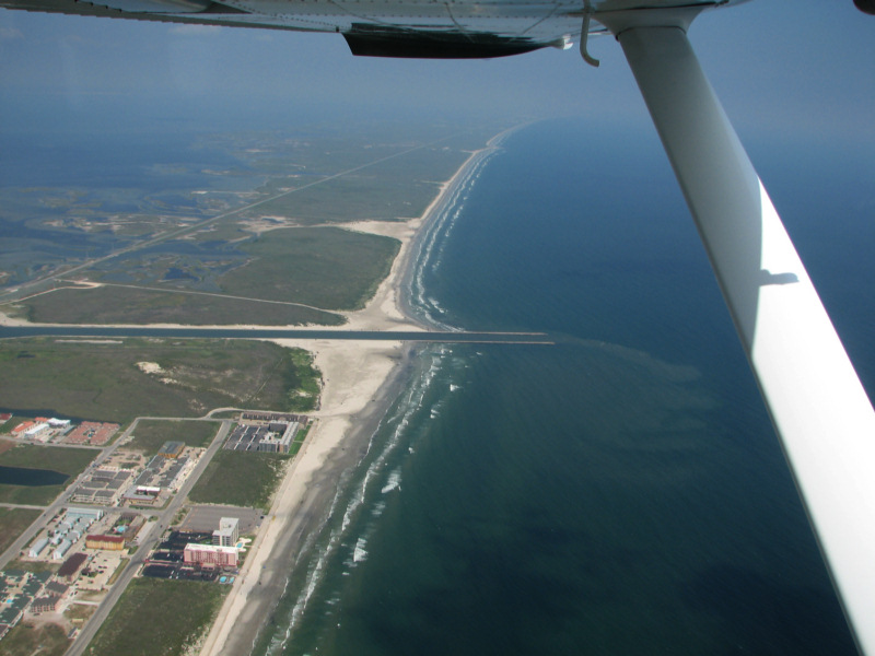
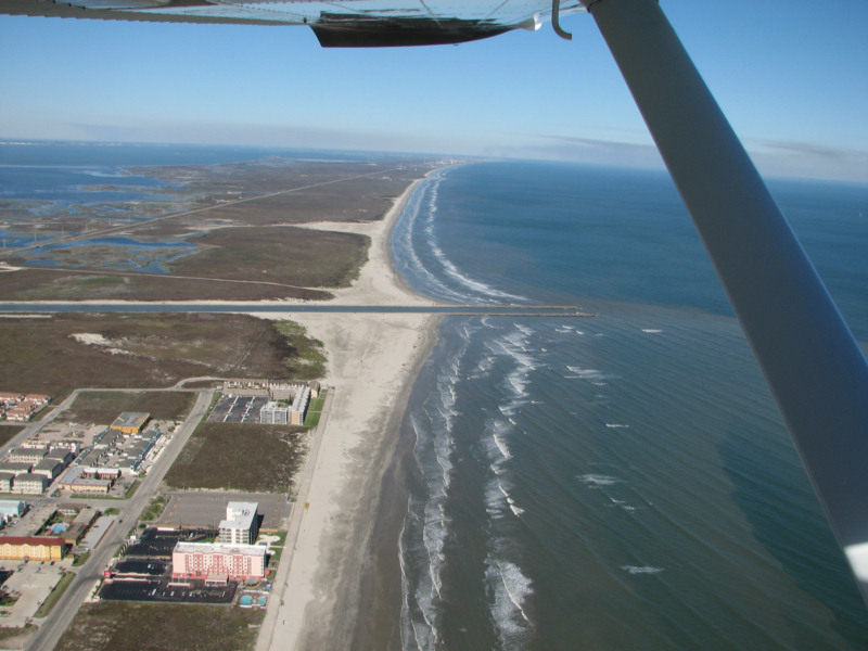
Packery Channel 1/25/2007
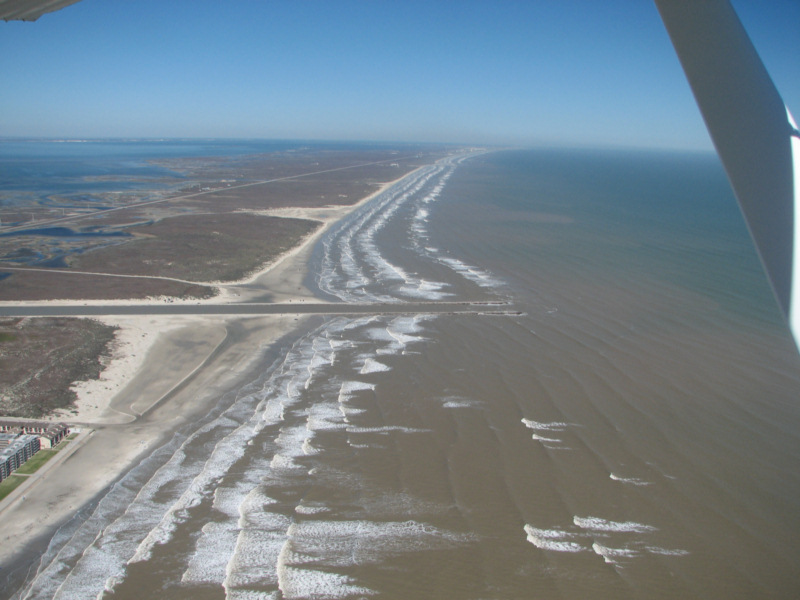
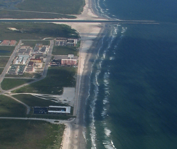
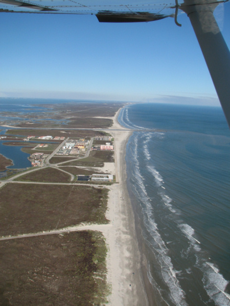
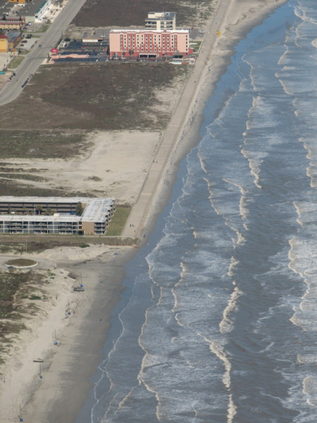
Beach gone at south end of
seawall 1/25/2007
High resolution digital copies of many of these photographs are available for sale. You may purchase a digital photo in the highest resolution that I have for $25.00 for personal use or for use in your presentations. The charge will be $150 for use in publications or for commercial reproduction. Contact me to purchase photos. These photographs are copyrighted and are the property of Richard L. Watson. They may not be copied or used without permission. You may however link to this website from your website or by email.
These photographs are copyrighted and are the property of Richard L. Watson. They may not be copied or used without permission. You may however link to this website from your website or by email.
If you would like to make a donation to help support the expense of providing these photos of the Texas Coast, please click on the Paypal button below.
Read the following report for much more information about the entire coast.
Coastal Law and the Geology of a Changing Shoreline, March 2006, updated to include section on poor beach and dune management practicesA Packery Channel and Beach Closing Blog.
The Dredge Report, a site about Packery Channel.
http://www.timeandspace.com/dredge.html
MORPHOLOGIC RESPONSE TO A NEW INLET, PACKERY CHANNEL,
CORPUS CHRISTI, TEXAS by
Deidre D. Williams, Nicholas C. Kraus, Carl M. Anderson


June 7, 2007
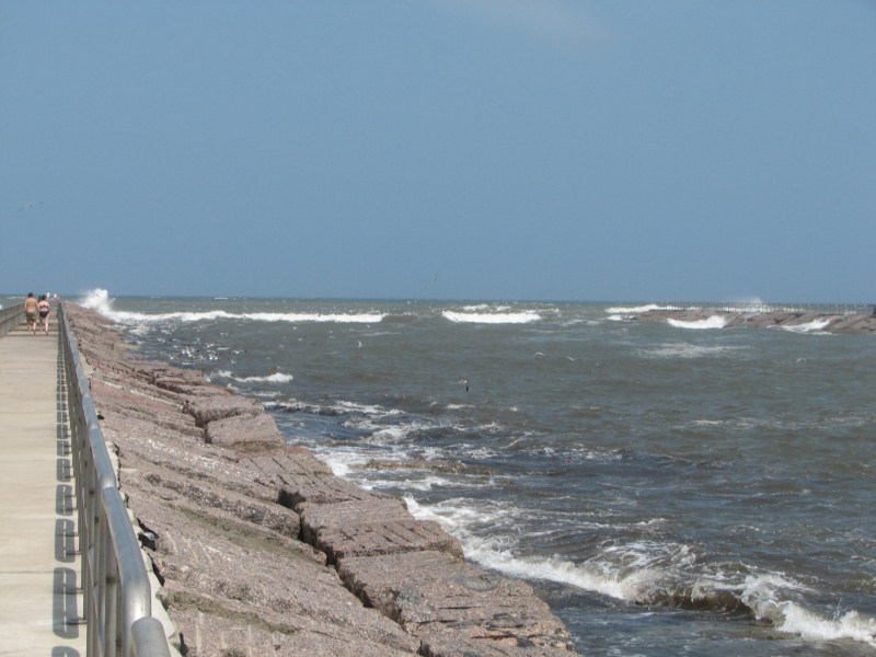
Click here to see a movie of surf breaking across the entrance of Packery Channel on June 7, 2007. The Naval Air Station was reporting SSE wind at 20 knots gusting to 30 knots.
MORPHOLOGIC RESPONSE TO A NEW INLET, PACKERY CHANNEL,
CORPUS CHRISTI, TEXAS by
Deidre D. Williams, Nicholas C. Kraus, Carl M. Anderson
Packery Channel 12/16/2007
Packery Channel 12/16/2007
Packery Channel 12/16/2007
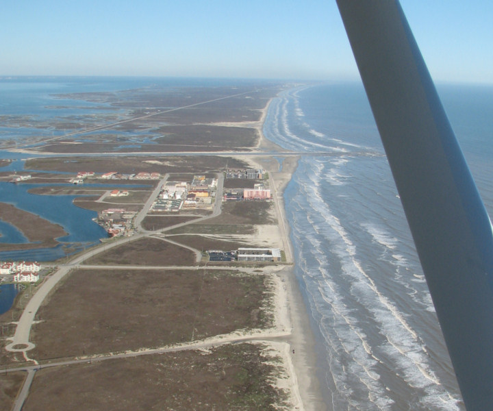
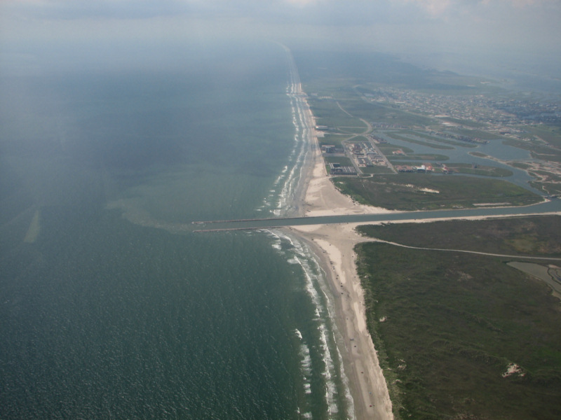
Packery and Seawall 10/20/2007
Not much beach left in front of seawall.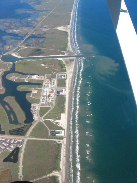
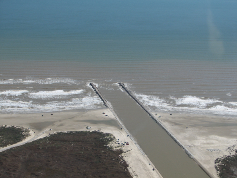
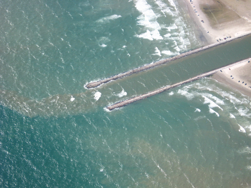
Packery Channel 10/20/2007
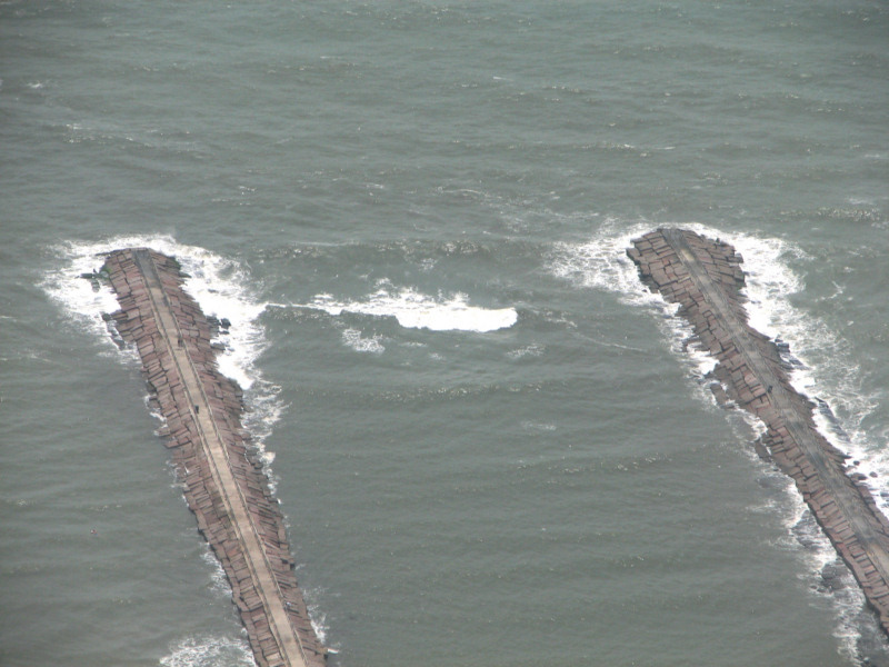
Strong ebb tide and small waves. Breaking in entrance.Packery Channel 10/20/2007
Strong ebb is tripping small waves and breaking in entrance.Packery Channel 10/20/2007
Strong ebb. little sand in front of seawall.Packery Channel 9/21/2007
Note the ebb plume. The longshore drift accumulation on the northeast jetty (lower in photo) is continuing to grow. It looks like the beach in front of the seawall is continuing to erode. It is gone at high tide at the south end of the seawall and is narrow for the south 1/3 of the seawall.
Packery Channel 9/21/2007
Seawall and Packery Channel 9/21/2007
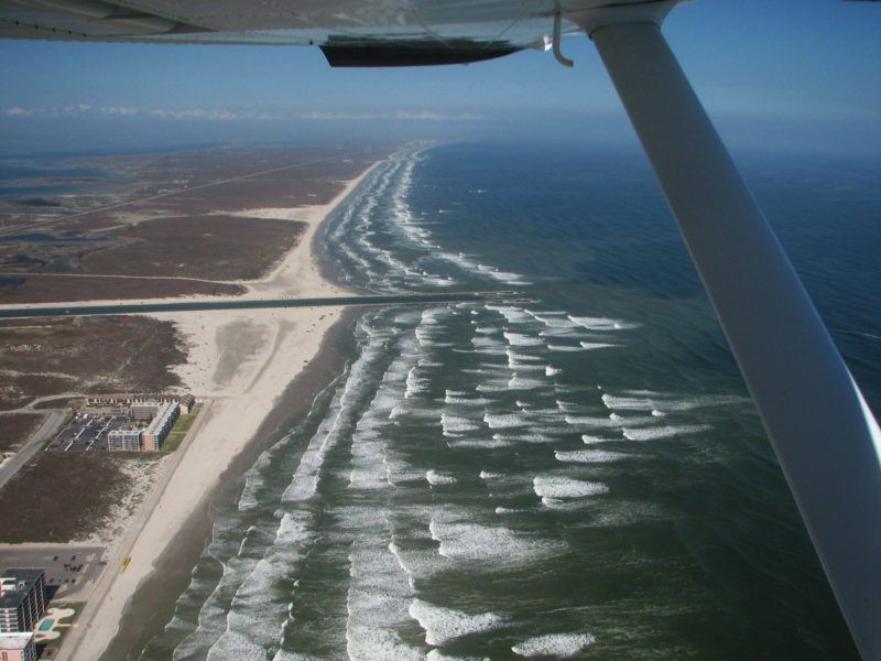
Packery Channel 6/27/2007
Packery is breaking in the
next two photos.
It was breaking intermittantly. At the time that the
photos were taken,
Naval Station Corpus Christi was reporting winds from 190 at 11 knots.
It was blowing harder the day before and earlier today
This is the second photo for 6/27/2007
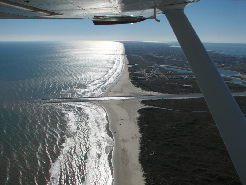
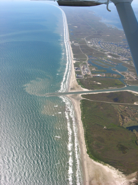
Padre Island Seawall and Beach 6/27/2007
Not much beach left.
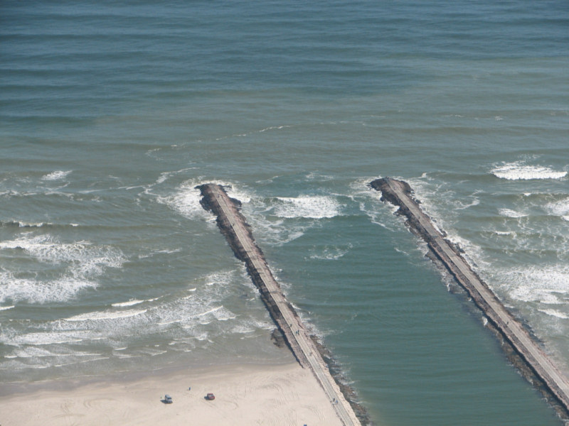
June 7, 2007
The following photo was
taken on June 7,
2007 about 3:00. The tide was flooding hard. Wind
at Naval
Station Ingleside was from 160 at 20 knots gusting to 30 knots.
The pass was breaking intermittantly at the entrance.
The
next link below the photo is a movie of the breaking waves.
Click here to see a movie of surf breaking across the entrance of Packery Channel on June 7, 2007. The Naval Air Station was reporting SSE wind at 20 knots gusting to 30 knots.
Click here to see the latest survey data and earlier surveys of Packery Channel along with descriptions of how the bathymetry within the channel has evolved.
Some interesting new survey data for Packery Channel has surfaced.
This
data was from a powerpoint presentation that was made available to me.
The front of the presentation indicates that the presentation
and
I assume the data are from Deidre Williams of TAMUCC who has been
monitoring Packery Channel, Nicholas Kraus of the US Army
Corps of
Engineers Coastal and Hydraulics Laboratory and Carl Anderson, Project
Manager for Packery Channel (Galveston District).
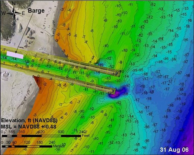
Note
that the depths in the jetty channel are 9 feet or deeper and that a
deep scour hole has formed at the end of the north jetty. It
had
been reported to me by a surfer that the depth on the bar at the
channel entrance was only waist deep. That is obviously
incorrect. It is surprising to me that the waves were
breaking at
that depth in the entrance on 2/6/2007 when the last photos were taken,
although the waves did not appear to be particularly high.
The
photos were taken at 1350 on 2/6/2007. I was unable to
download
the current data from the TAMUCC site. Maybe someone can
provide
that. The water level for the time of the 2/6/2007 photos is
presented with 2/6/2007 air photos further down the page.
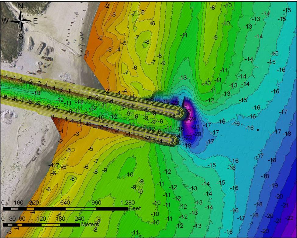
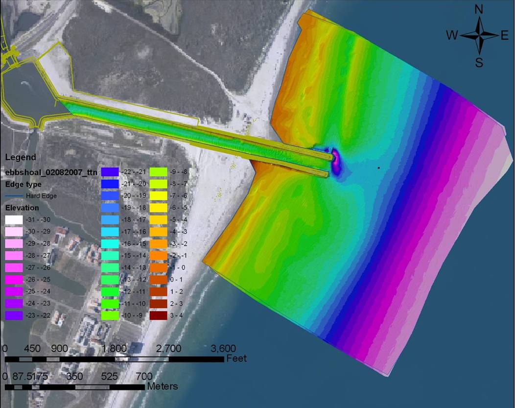
Packery Survey data with the depths shown as colors.
Note the sand waves in the channel.
Packery survey data 12/16/2006
Note that the 8 foot bar in the jetty entrance as shown in this survey was removed, possibly by strong ebb currents driven by strong northers by the time that the next survey on 2/8/2007 was taken.
Packery Channel survey 8/31/2006
Packery Channel 2/6/2007
Water Level at time of 2/6/2007 photos
Data from Division of Nearshore Research Texas A&M University Corpus ChristiDISCLAIMER: The data described below have been collected by automated equipment and are furnished "as is". DNR makes no warranties (including no warranties as to merchantability or fitness) either expressed or implied with respect to the data or their fitness for any specific application.
Packery Channel 2/6/2007
Surf's up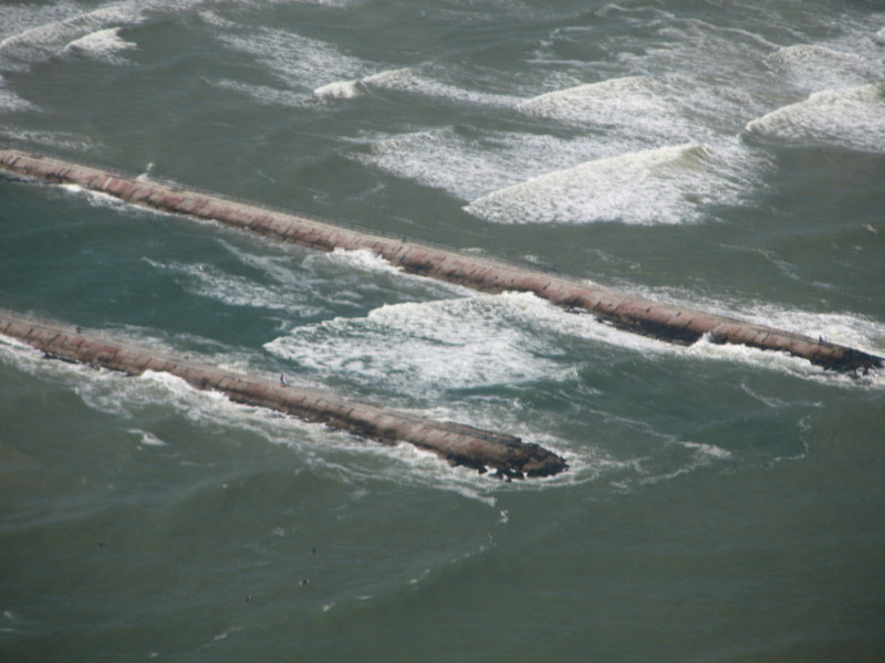
Packery Channel 2/6/2007
Packery Channel 1/25/2007
Packery 1/25/2007
Waves occassionally breaking in entrance.
Packery and eroding beach at seawall 1/25/2007
Beach gone at south end of
seawall 1/25/2007
Back to Packery Channel Index