


TEXAS
COAST AERIAL
PHOTOGRAPHY
Click
here for a video
of surf across the entrance 1.4MB 12/28/2006.
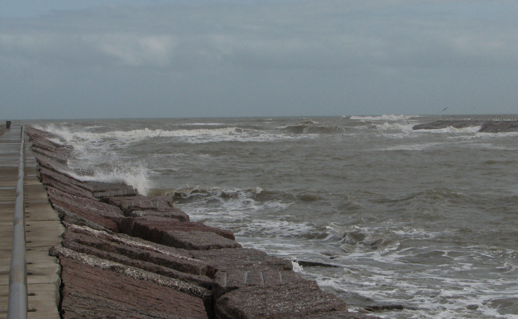
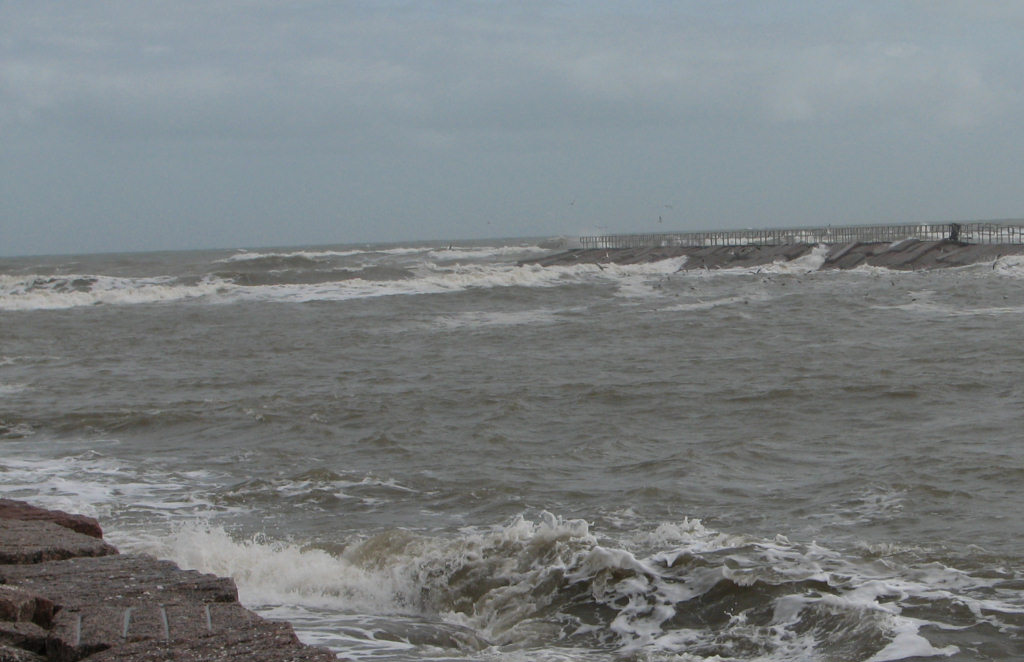
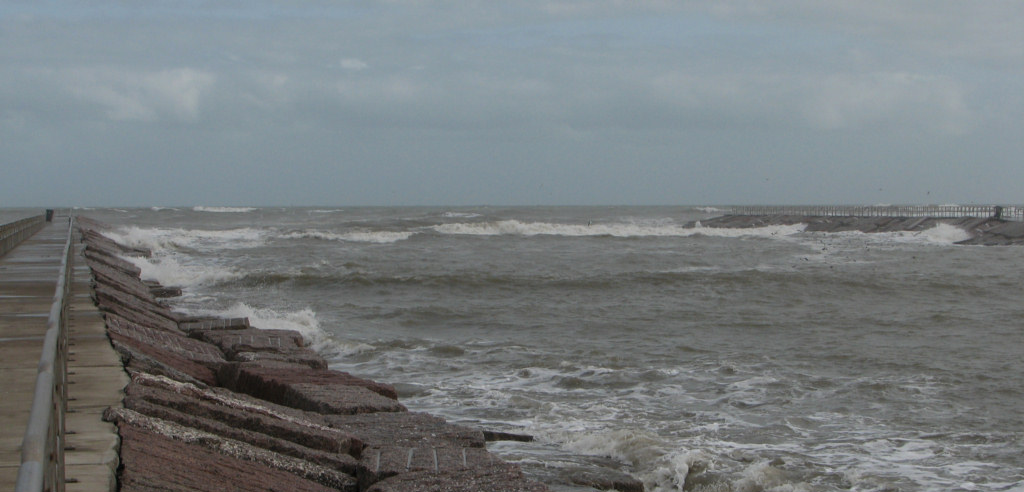
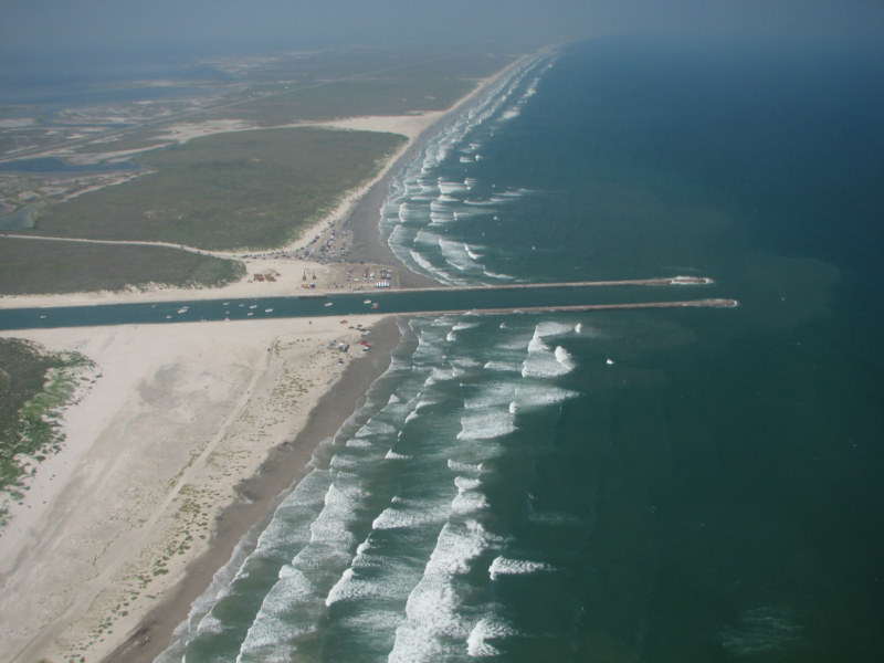
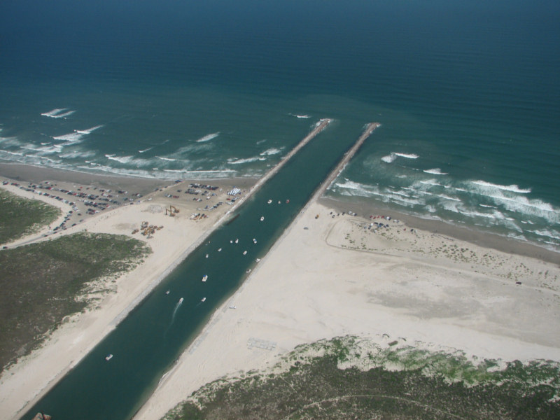
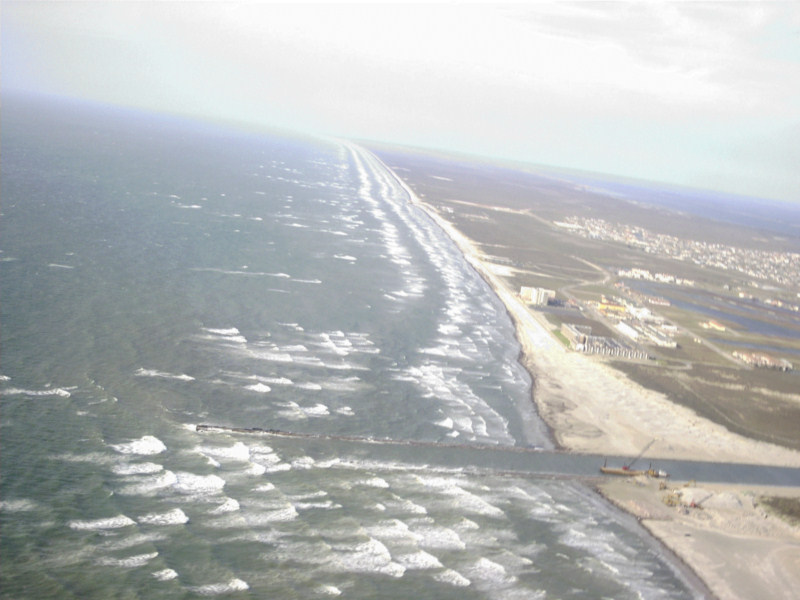
These
photos and the video were taken
at 1415 CST on 12/28/06. The wind recorded at Corpus Christi
Naval Air Station 1357 CST was from 160 degrees true at 19 knots,
gusting to 31 knots.

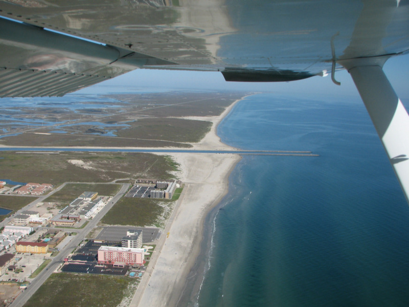

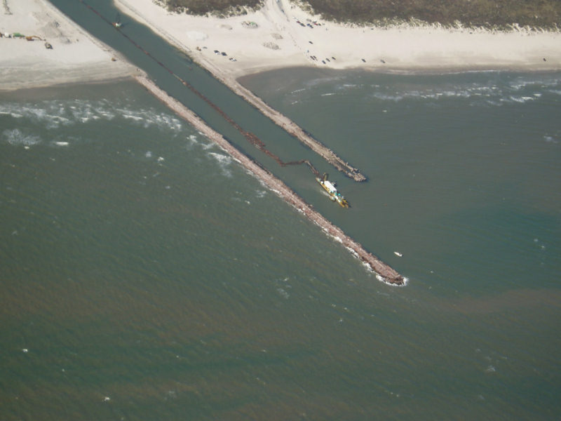
Google Earth Photo showing
CCPass and Packery
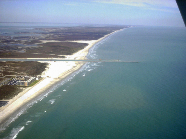
Packery 7/17/06 from 5500 ft.
Packery 6/3/2006
Packery 5/11/2006
High resolution digital copies of many of these photographs are available for sale. You may purchase a digital photo in the highest resolution that I have for $25.00 for personal use or for use in your presentations. The charge will be $150 for use in publications or for commercial reproduction. Contact me to purchase photos. These photographs are copyrighted and are the property of Richard L. Watson. They may not be copied or used without permission. You may however link to this website from your website or by email.
These photographs are copyrighted and are the property of Richard L. Watson. They may not be copied or used without permission. You may however link to this website from your website or by email.
If you would like to make a donation to help support the expense of providing these photos of the Texas Coast, please click on the Paypal button below.
Read the following report for much more information about the entire coast.
Coastal Law and the Geology of a Changing Shoreline, March 2006, updated to include section on poor beach and dune management practicesA Packery Channel and Beach Closing Blog.
The Dredge Report, a site about Packery Channel.
http://www.timeandspace.com/dredge.html
BASELINE AND CONSTRUCTION MONITORING OF
PACKERY CHANNEL, CORPUS CHRISTI, TEXAS
Deidre D. Williams, Nicholas C. Kraus, F. J. Kelly,
Andrew N. Smith, and Carl M. Anderson
BASELINE AND CONSTRUCTION MONITORING OF
PACKERY CHANNEL, CORPUS CHRISTI, TEXAS
Deidre D. Williams, Nicholas C. Kraus, F. J. Kelly,
Andrew N. Smith, and Carl M. Anderson
Click
here for a video
of surf across the entrance 1.4MB 12/28/2006.
These
photos and the video were taken
at 1415 CST on 12/28/06. The wind recorded at Corpus Christi
Naval Air Station 1357 CST was from 160 degrees true at 19 knots,
gusting to 31 knots.Surf Across the Mouth of Packery 12/28/2006
Surf Across the Mouth of Packery 12/28/2006
Surf Across the Mouth of Packery 12/28/2006
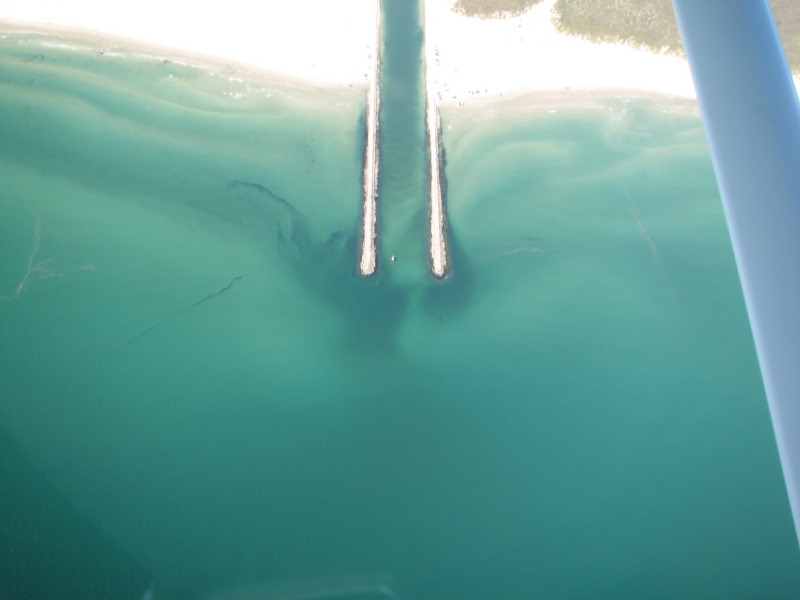
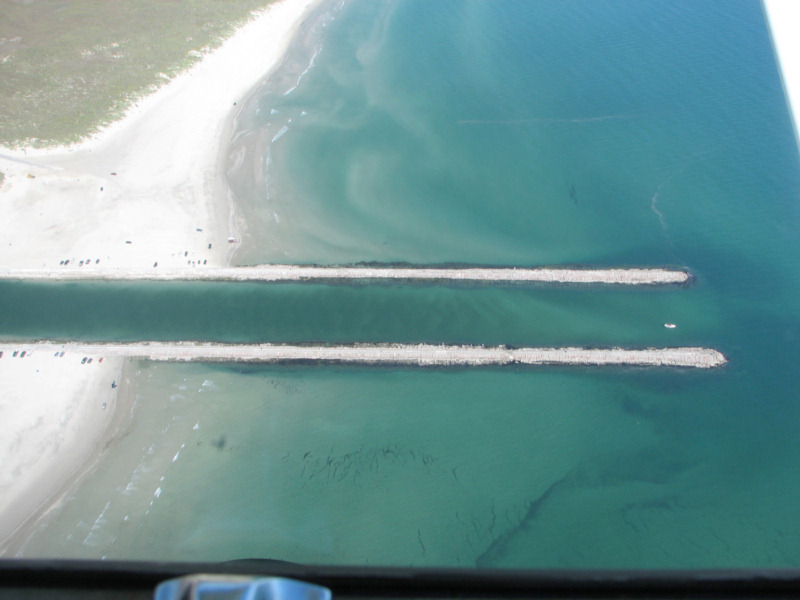
Packery Channel 12/22/2006
Today
the wind was fairly light and the surf was moderate, only breaking
regularly on the second bar. The shoal within the entrance to
Packery Channel has built up so that these light waves were regularly
breaking on the bar, as can be seen by the white patch just inside of
the entrance. The second photo shows the waves peaking, but
not
breaking on the bar.
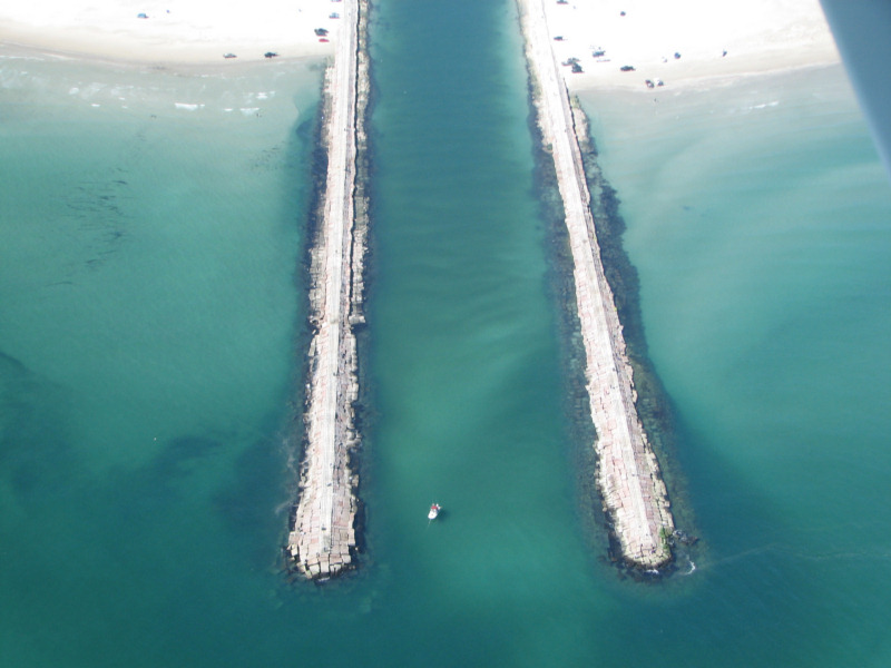
Packery Channel 12/22/2006
This photo shows some foam
on the surface
where waves were breaking within the entrance. If you look
closely, you can see the waves peaking up slightly within the entrance.
They go all the way across the entrance at the mouth and then
continue inward along the north (right) side of the channel where the
bar is the shallowest.
Packery Channel 12/22/2006
Photo by Tony Amos showing breaking surf in entrance.
Packery Channel 12/22/2006
Photo by Tony Amos showing breaking surf in entrance.
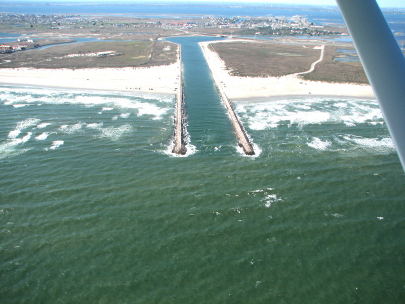
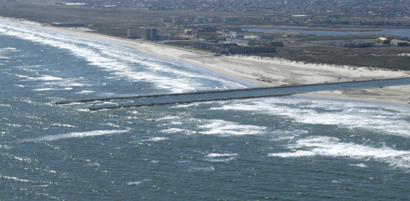
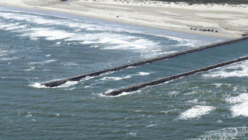
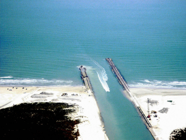
Packery Channel 11-17-2006
The
following photos dated 11-17-2006 were taken on the second day after a
40 mph norther. Note that the channel is filled with sand
waves
with the slip faces indicating that they were migrating seaward on the
enormously strong ebb tide due to the norther. There are
numerous
bars and ebb tidal shoals in and beyond the jetties. I am
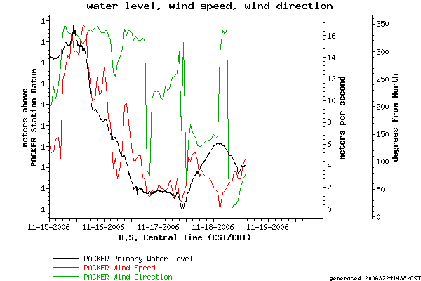
including some graphs showing tide, wind, and current data taken by the
automatic system from the Blucher Institute TCOON
network. You can plainly see the effect of the powerful north
winds on the water level and the current in the following
graphs.
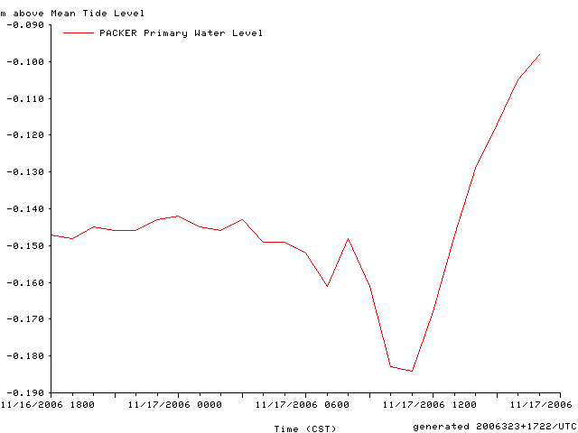
Water Level, Wind Speed, Wind Direction
Water Level at Packery on 11/17/06 the day the photos were taken
The
photos were taken at noon on the 17th. Note in the figure
below
that the extreme low tide was only one hour earlier at 1100.
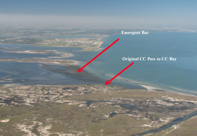
Emergent Bar between Laguna Madre and CC Bay
This
photo was taken at 1215 CST on 11/17/06. It is only one hour
after the extreme low tide shown on the tide chart above.
Note
that this is the most exposed that I have EVER seen the bar across the
N. end of Laguna Madre. Note the small channel at the near
end of
the bar, next to Mustang Island. That is about where the
original
Corpus Christi Pass entered Corpus Christi Bay. You can see
it
well in the historical navigation charts further down on this page.
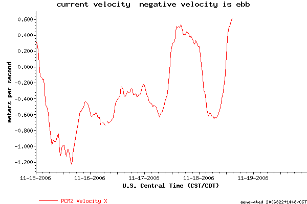
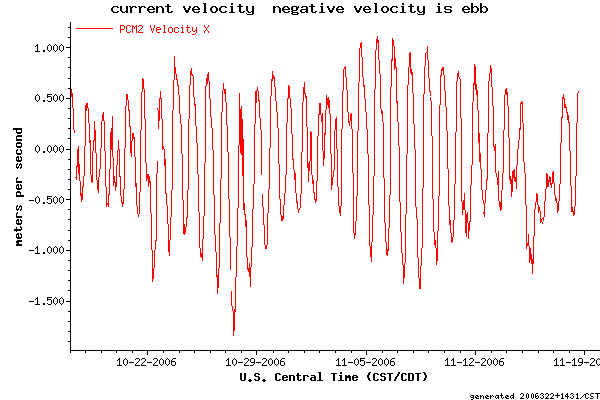
Current Velocity in Packery Channel
A Month of Current Velocities
Note
the multi day ebb current on the 17th and 18th of November.
This
is due to the strong north winds blowing the water out of
Packery
Channel. Strong winds have a greater effect on currents and
water
levels in many Texas bays than the astronomical tides.
Packery Channel 11-17-2006
Packery 11-17-2006
Packery 11-17-2006
Sand waves with slip faces indicating deposition by ebb tide from strong norther.Packery 11-17-2006
Note the huge sand body just south of the south (lower) jetty.Packery 11-17-2006
Packery 11-17-2006
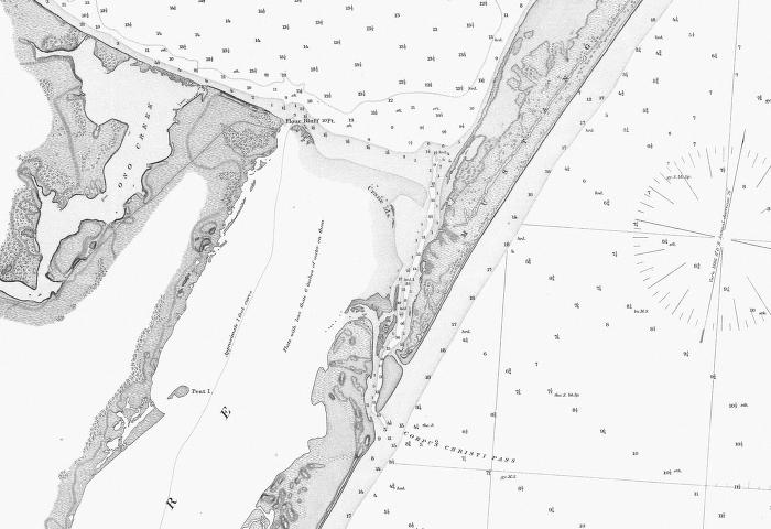
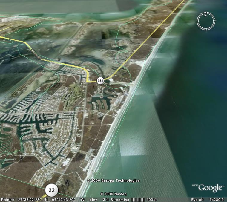
"Packery Channel" in 1887
The
manmade channel now called Packery Channel occupies an ephemeral
hurricane overwash channel. The original pass at that general
location was called Corpus Christi Pass and it ran from about the
location of Bob Hall Pier straight north to Corpus Christi Bay.
It did not in any way follow the present course of the
manmade
Packery Channel. Corpus Christi Pass closed naturally after
the
deep ship channel was dredged from Port Aransas to Corpus Christi in
the 1920s. At the time that the two maps below were printed
Corpus Christi pass was the main entrance to Corpus Christi Bay.
There was no direct shipping channel from Port Aransas to
Corpus
Christi. Ships would enter the relatively deep Aransas Pass,
located across from the light house and proceed north to an anchorage
NE of Harbor Island at Quarantine Shore. There they offloaded
to
small shallow draft "lighters" which proceeded through Corpus Christi
Bayou, a natural channel, and then Morris and Cummings Cut, a dredged
channel, to enter Corpus Christi Bay. Creation of the deep
and
direct channel from Aransas Pass at Port Aransas to Corpus Christi in
the 1920s captured virtually all of the tidal flow in and out of Corpus
Christi Bay and the natural process of longshore drift carrying
hundreds of thousands of cubic yards of sand across the entrance of
Corpus Christi Pass closed it. Lake Padre is a remnant of the
original Corpus Christi Pass. See the Aransas Pass airphoto
page
for corresponding 1887 maps of Aransas Pass, Corpus Chritis Bayou and
Morris and Cummings Cut.
"Packery Channel" in 1887
Google Earth Photo showing
CCPass and Packery

Google Earth Photo without the lines.
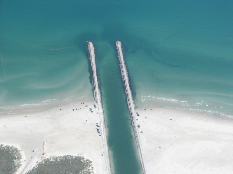
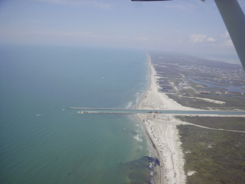
Packery Opening 10/6/2006
Packery Opening 10/6/2006
Packery Opening 10/6/2006
Packery Opening 10/6/2006
Packery 9/20/2006
Packery 8/31/2006 (from 4500 ft.)
Note
the outer bar has swept offshore further than the finished end of the
south jetty. This bar will pour sand into the channel mouth
during normal high wind conditions from the southeast. There
is a
barge and crane placing the final rocks on the end of the
jetty.
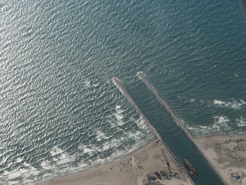
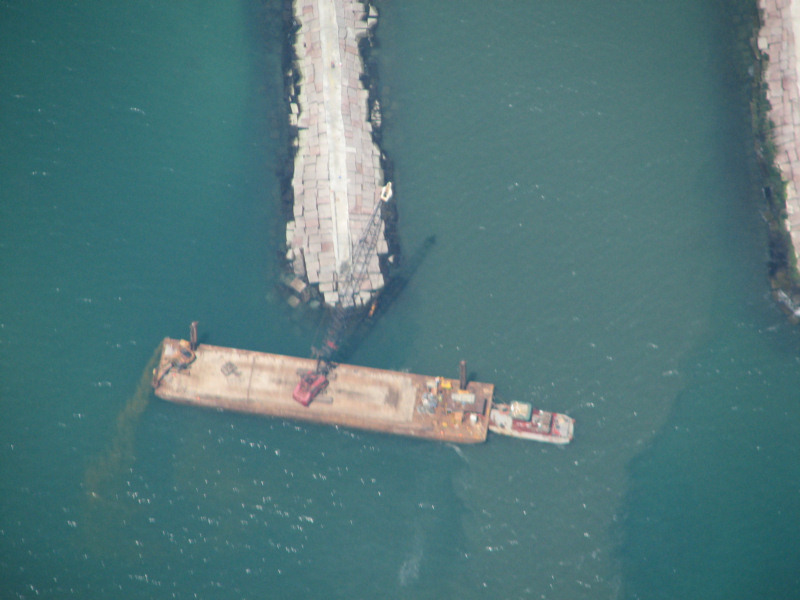
Packery 8/31/2006 (from 4500 ft.)
This is a close up of the crane placing the final rocks on the end of the south jetty.
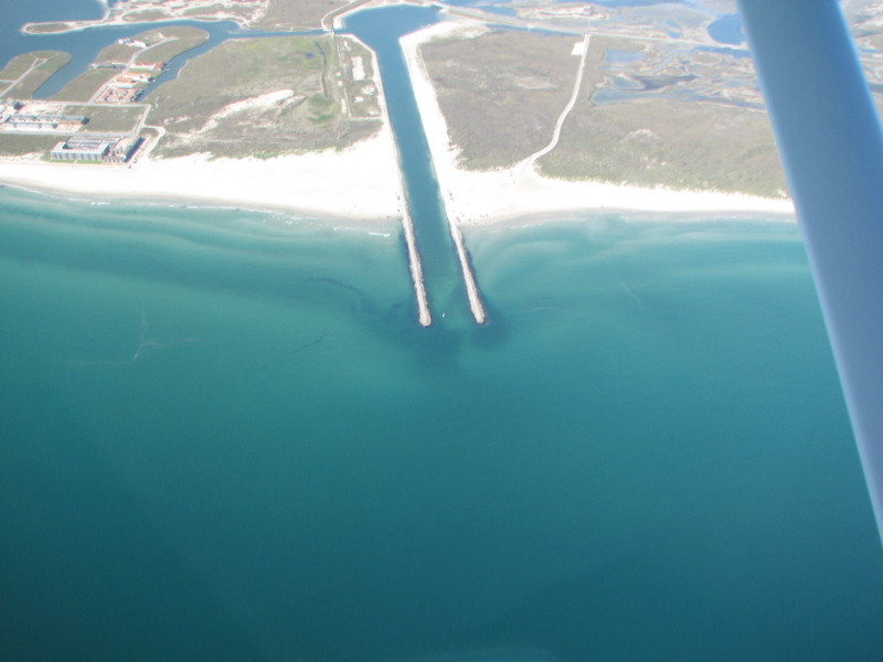
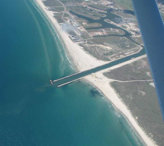
Packery 7/17/06 from 5500 ft.
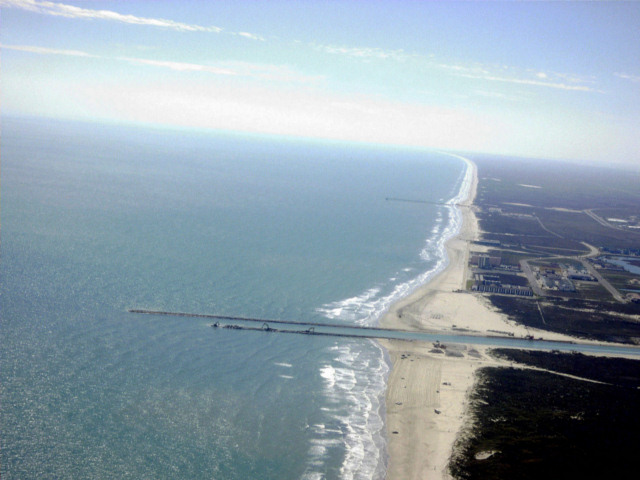
Packery 6/3/2006
Packery 6/3/2006
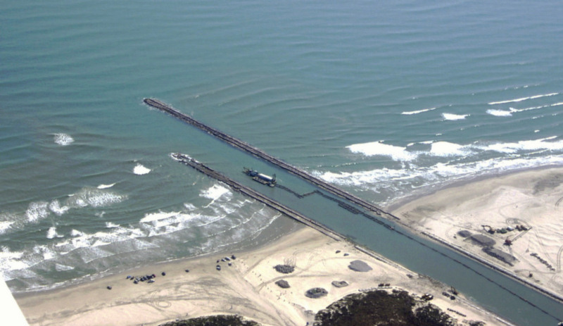
Packery 5/11/2006
The wind was from 020 at 20 knots gusting to 27 knots. Note that heavy surf is breaking well beyond the end of the south jetty which is at its finished length. It is also breaking very heavily within the channel entrance.
Packery 5/11/2006
Packery 2/8/06
The south jetty is finished and work is continuing on the north jetty.
Packery 2/8/06
Packery 2/8/06
Packery 1/11/2006
Observations on Saturday 1/7/2006
On
Saturday, January 7, 2006 I flew over Packery Channel. The
dredge
was working nearly out as the end of the north jetty.
This
surprised me, since the jetty still needs to be extended 500 feet and
sand will continue to enter the channel from the second bar which is at
the present end of the north jetty and from the third bar which is well
beyond the end of the north jetty. It seems wasteful to do
that
dredging before the jetty is at its finished length. Angel
Escobar, the director of engineering for the City of Corpus Christi
informed me that the Corps of Engineers directed that the channel be
dredged at this time and that the jetty should be at its finished
length by the end of March. At that time, they will re-dredge
to
remove any new infill. As you can see from the fourth picture below,
there is a
bar which is beyond even the finished length of the south jetty and it
will pump sand into the channel during heavy surf conditions.