


TEXAS
COAST AERIAL
PHOTOGRAPHY
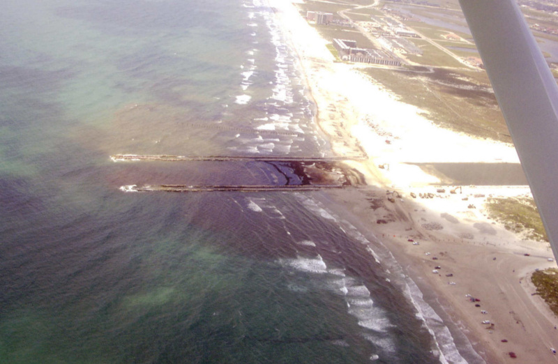
Packery 11/27/2005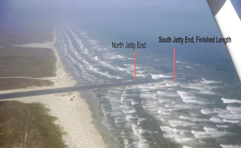
Packery 11/4/2005
Packery 11/4/2005
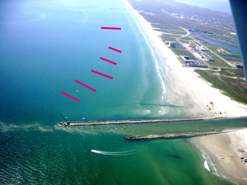
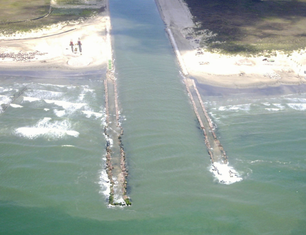
Packery 10/9/05
The second bar is at the end of the north jetty. You can faintly see a third bar sweeping almost to the end of the south jetty.
Packery 10/9/5
Note that it looks like there is an outer bar on the right side of the red lines that is sweeping nearly to the end of the south jetty.
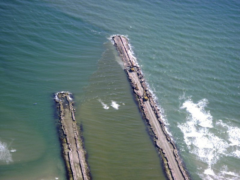
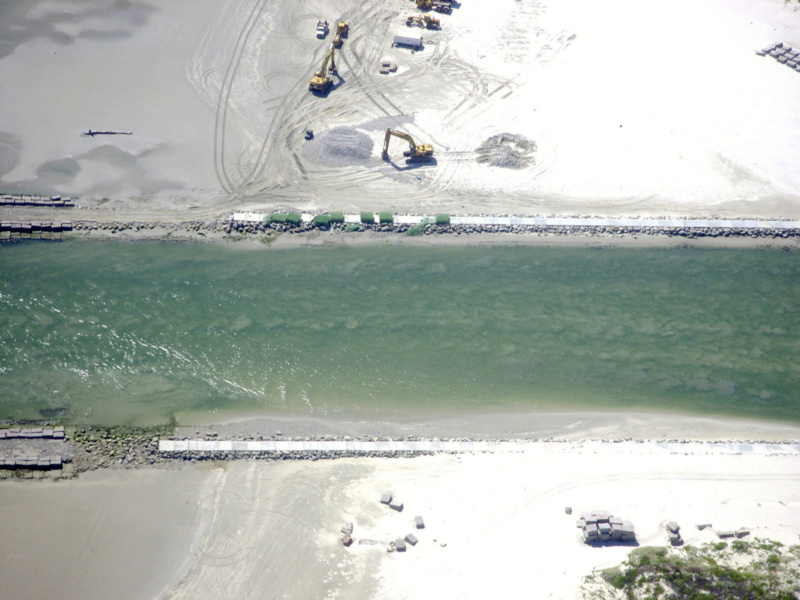
Packery 10/9/05
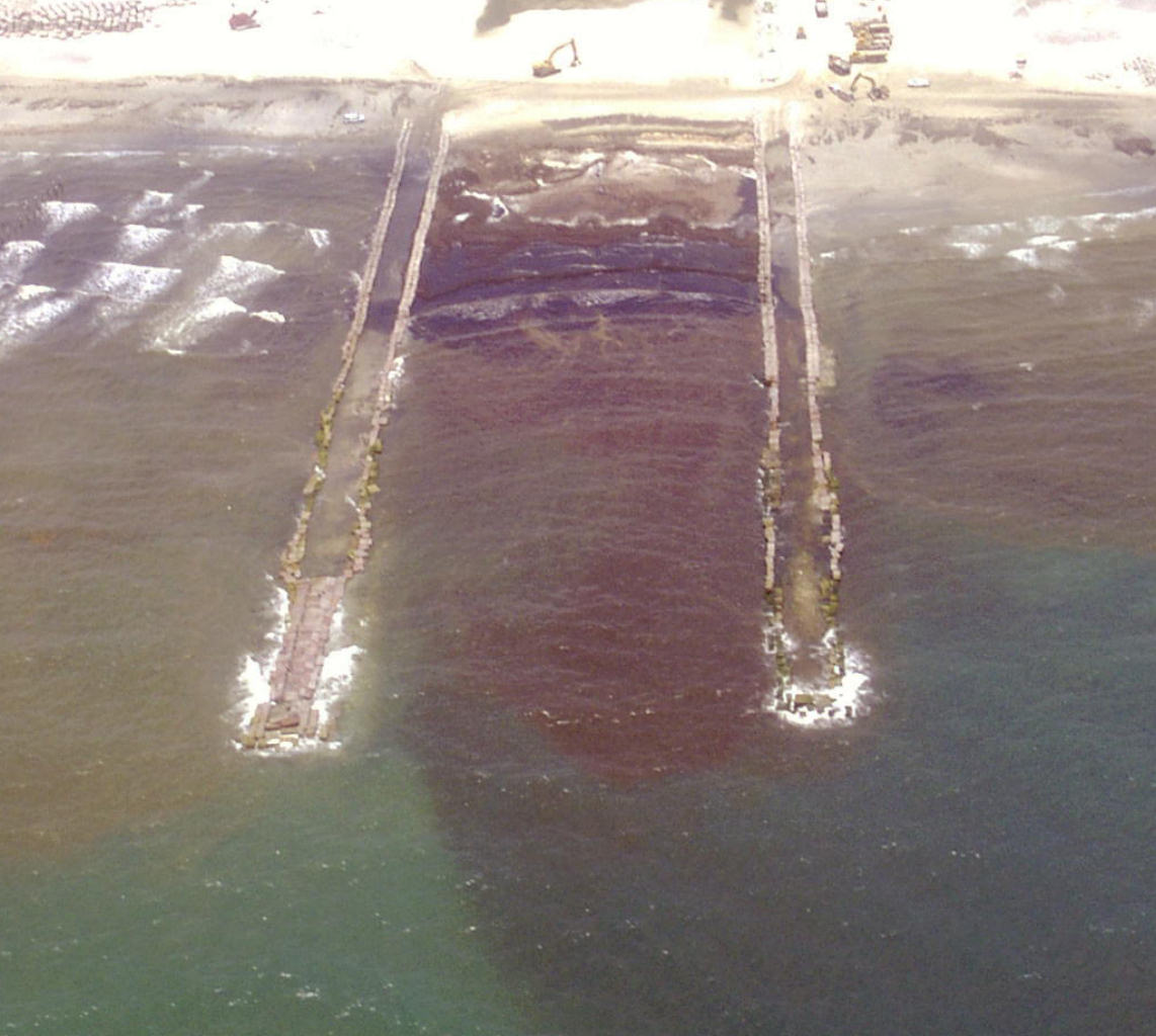
Note the sand waves filling the channel. it appears that they have their slipfaces to the right indicating that they were deposited by inflowing currents.
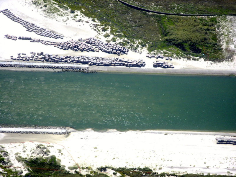
Packery 10/9/05
Sand waves filling channel. Note the slope failure of the revetment just to the right of the north (near) jetty.
Packery 8/31/05
Packery 8/31/05
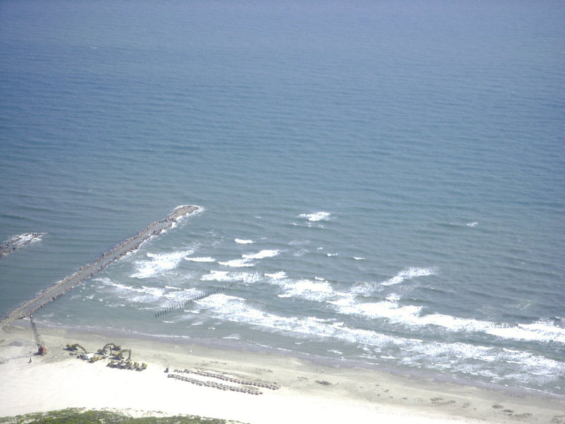
The next three photos were taken on 8/2/2005
Note that the south jetty is being extended.
Extensive shoaling was noted inside of the jetties alongside of the north jetty and the shoals looked like they were covered with sand waves. The light was not sufficient to get a photo of those shoals. A bit further south we could barely see an outer bar beyond the prominent bar which impinges on the outer south jetty, but it was too dim in the existing light and water clarity to photograph.
8/2/2005
8/2/2005
8/2/2005
Packery 7/22/05
Hurricane Emily Opened Packery 7/22/05
Be careful, there is a breaking bar inside of the entrance.
Hurricane Emily opened Packery
Channel in July, 2005
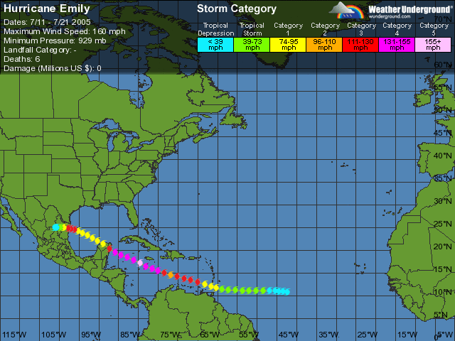
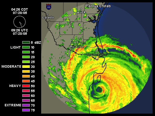
Hurricane Emily Landfall
Packery Jetties 7-22-05
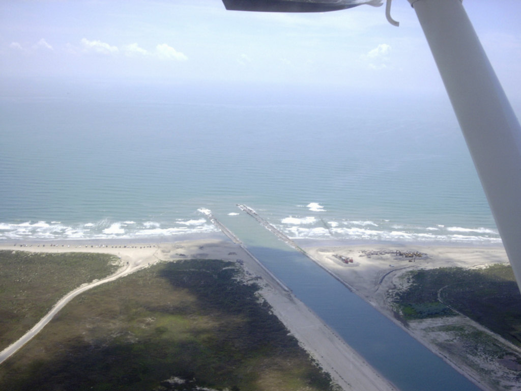
Packery Channel 6/16/05 from 6500 ft.

Packery 6/14/05
Packery Channel 6/14/05
Packery Channel 2/22/2005
Packery 2/22/2005
Packery Channel 2/22/2005
Packery Channel 1/11/2005
Packery Channel 3/30/04
High resolution digital copies of many of these photographs are available for sale. You may purchase a digital photo in the highest resolution that I have for $25.00 for personal use or for use in your presentations. The charge will be $150 for use in publications or for commercial reproduction. Contact me to purchase photos. These photographs are copyrighted and are the property of Richard L. Watson. They may not be copied or used without permission. You may however link to this website from your website or by email.
These photographs are copyrighted and are the property of Richard L. Watson. They may not be copied or used without permission. You may however link to this website from your website or by email.
If you would like to make a donation to help support the expense of providing these photos of the Texas Coast, please click on the Paypal button below.
Read the following report for much more information about the entire coast.
Coastal Law and the Geology of a Changing Shoreline, March 2006, updated to include section on poor beach and dune management practicesA Packery Channel and Beach Closing Blog.
The Dredge Report, a site about Packery Channel.
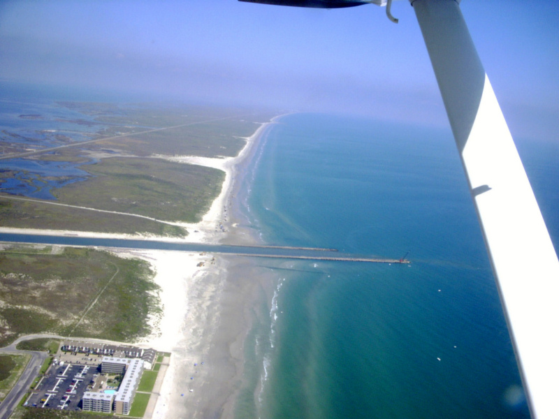
Observations on Saturday 1/7/2006
On
Saturday, January 7, 2006 I flew over Packery Channel. The
dredge
was working nearly out as the end of the north jetty.
This
surprised me, since the jetty still needs to be extended 500 feet and
sand will continue to enter the channel from the second bar which is at
the present end of the north jetty and from the third bar which is well
beyond the end of the north jetty. It seems wasteful to do
that
dredging before the jetty is at its finished length. Angel
Escobar, the director of engineering for the City of Corpus Christi
informed me that the Corps of Engineers directed that the channel be
dredged at this time and that the jetty should be at its finished
length by the end of March. At that time, they will re-dredge
to
remove any new infill. As you can see from the fourth picture below,
there is a
bar which is beyond even the finished length of the south jetty and it
will pump sand into the channel during heavy surf conditions.
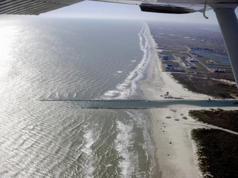
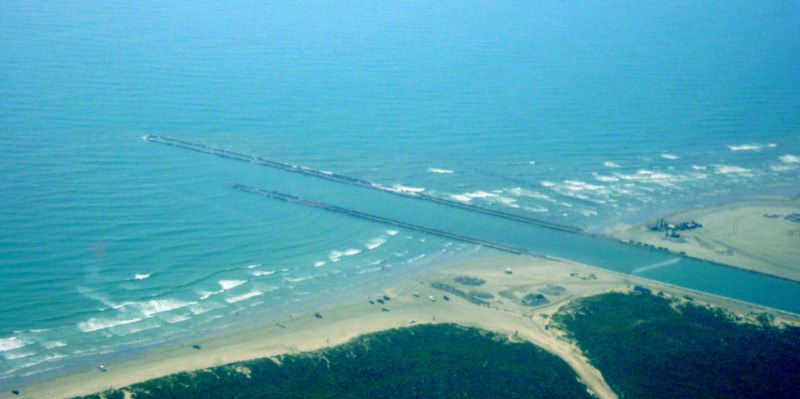
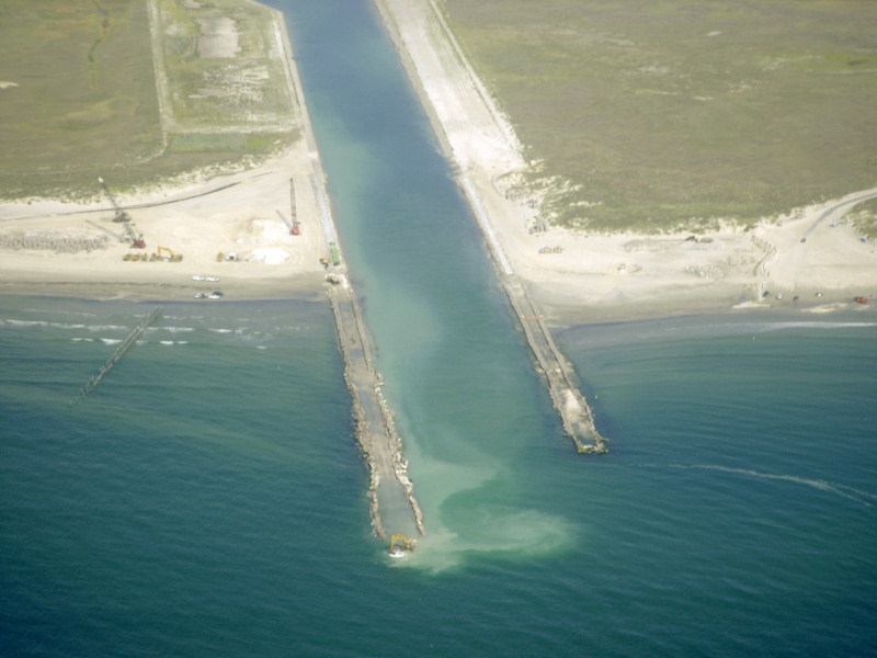
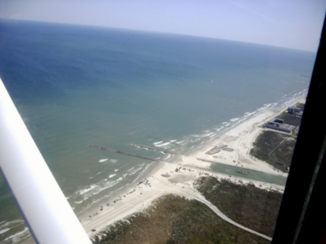
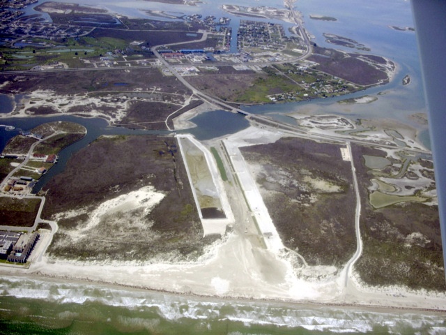
Packery 12/24/2005
Dredging has begun on the channel and spoil has been deposited in the bulge just south of the jetties and is being deposited in a second bulge just in front of the condominium farthest to the south. Surf is light and the wind was from the northwest at about 15 knots.Packery 12/24/2005
Packery 12/24/2005
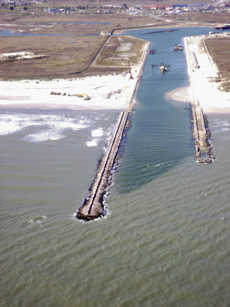
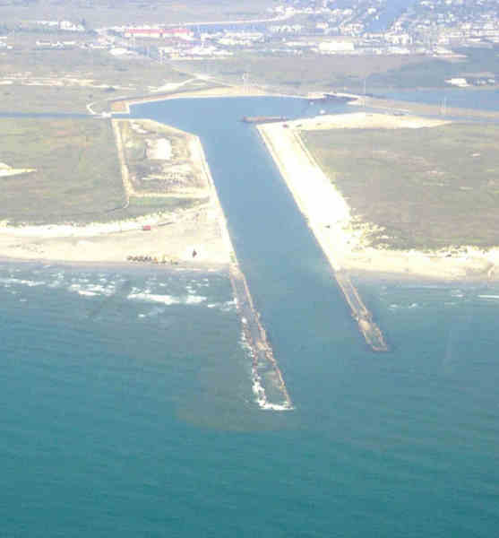
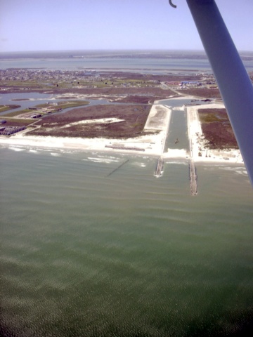
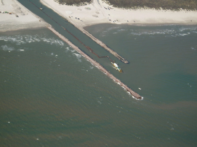
This shows the nearly completed south jetty. There is a walkway between the "high" rocks on each side of the center of the jetty. If they pour a concrete surface, that is where it will be placed.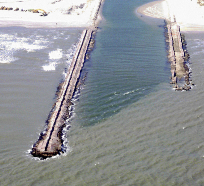
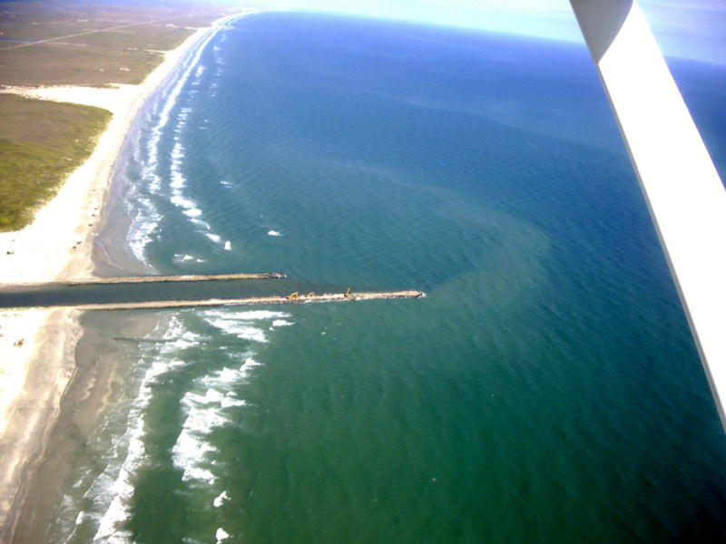
Packery 11/27/2005
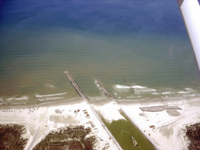
Note
that under strong southeast
wind conditions that the surf is breaking hundreds of feet offshore of
the end of the south jetty which is at its completed length.
The
outer bar is at or beyond the end of the south jetty.
Conditions
such as these will pour huge quantities of sand into a bar inside of
and outside of the entrance of the jetties. Even when the
north
jetty is completed, the jetties will be far too short to keep sand out
of the entrance and far too short to provide navigational safety.
The wind was from 160 degrees at 20 knots gusting to 27 knots.
Packery 11/4/2005
Packery 11/4/2005
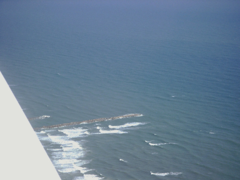
Packery 10/31/05
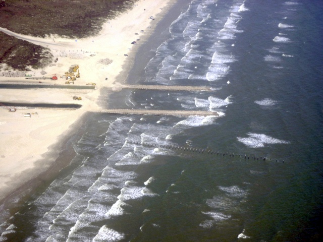
Notice that the third bar is just barely breaking and is sweeping toward the end of the south jetty.Packery 10/31/05
Notice the third bar is breaking at the same distance offshore as the end of the south jetty. The south jetty is at its finished length.Packery 10/31/05
Third bar beaking near the end of the south jetty.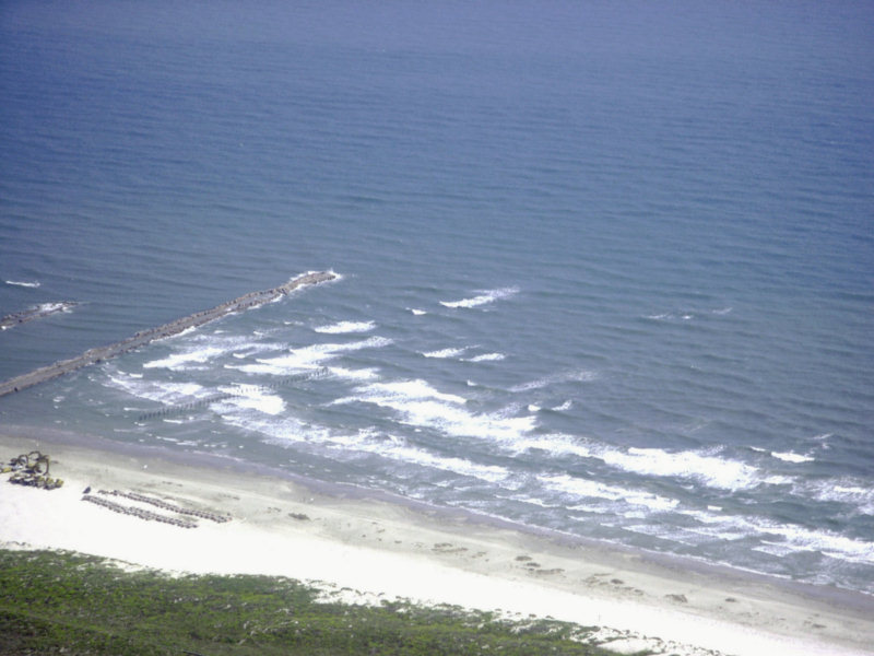
Packery 10/31/05
Note how close the third bar is breaking to the end of the south jetty. This bar will soon be pouring sand into the entrance whenever the SE winds are blowing hard.Packery 10/9/05
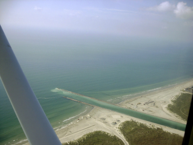
The second bar is at the end of the north jetty. You can faintly see a third bar sweeping almost to the end of the south jetty.
Packery 10/9/5
Note that it looks like there is an outer bar on the right side of the red lines that is sweeping nearly to the end of the south jetty.
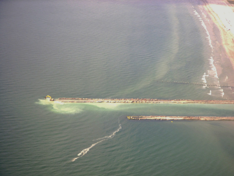
Packery 10/9/05
Note the sand waves filling the channel. it appears that they have their slipfaces to the right indicating that they were deposited by inflowing currents.
Packery 10/9/05
Sand waves filling channel. Note the slope failure of the revetment just to the right of the north (near) jetty.
Packery 8/31/05
Packery 8/31/05
The next three photos were taken on 8/2/2005
Note that the south jetty is being extended.
Extensive shoaling was noted inside of the jetties alongside of the north jetty and the shoals looked like they were covered with sand waves. The light was not sufficient to get a photo of those shoals. A bit further south we could barely see an outer bar beyond the prominent bar which impinges on the outer south jetty, but it was too dim in the existing light and water clarity to photograph.
8/2/2005
8/2/2005
8/2/2005
Packery 7/22/05
Hurricane Emily Opened Packery 7/22/05
Be careful, there is a breaking bar inside of the entrance.
Hurricane Emily opened Packery
Channel in July, 2005
Hurricane Emily Landfall
Packery Jetties 7-22-05
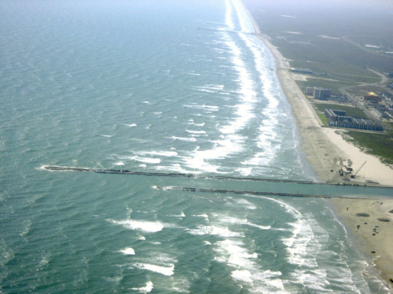
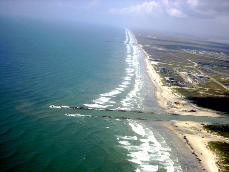
Packery Channel 6/16/05 from 6500 ft.
Note that the outer bar
which is about 800 ft offshore at Bob Hall Pier has already moved
offshore and is sweeping around the south jetty of Packery Channel.
This bar breaks heavily when the surf is up. There
will be
a huge amount of sand transported along this bar and dumped into the
mouth of Packery Channel. It will likely produce a shallow
breaking bar in or just offshore of the mouth of Packery a short time
after the pass is completed.
Packery 6/14/05
Packery Channel 6/14/05
Packery Channel 2/22/2005
Packery 2/22/2005
Packery Channel 2/22/2005
Packery Channel 1/11/2005
Packery Channel 3/30/04
Back to Packery Channel Index