


TEXAS
COAST AERIAL
PHOTOGRAPHY
Colorado
River
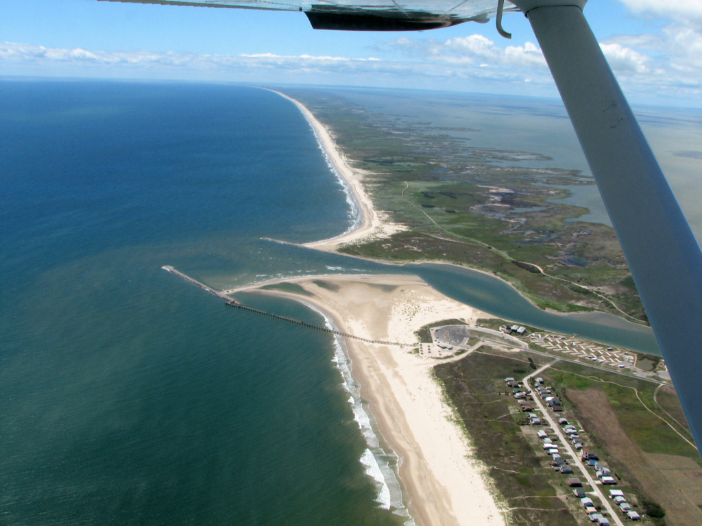
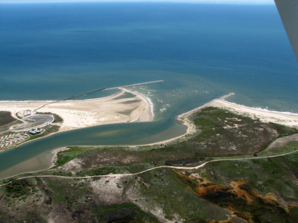
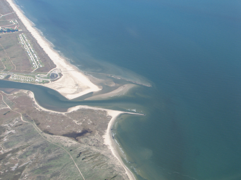
Entrance 10/28/2008
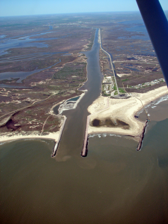
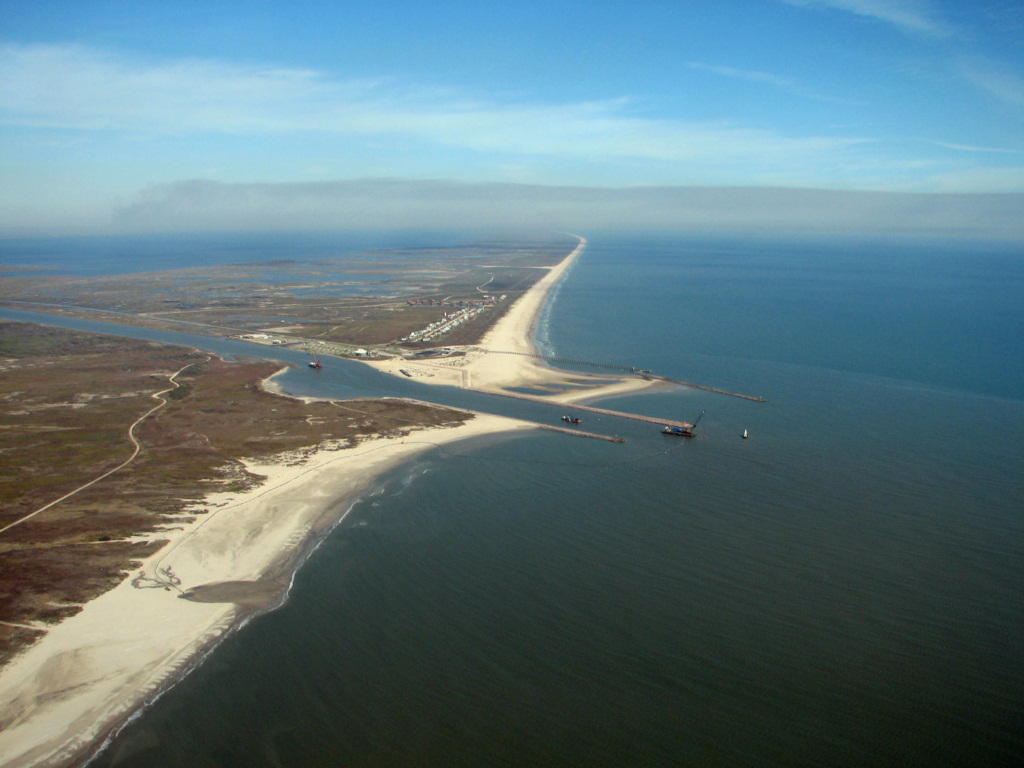
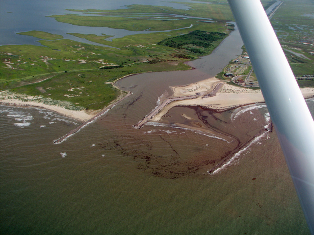
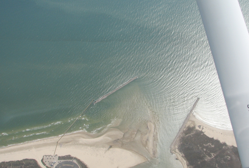
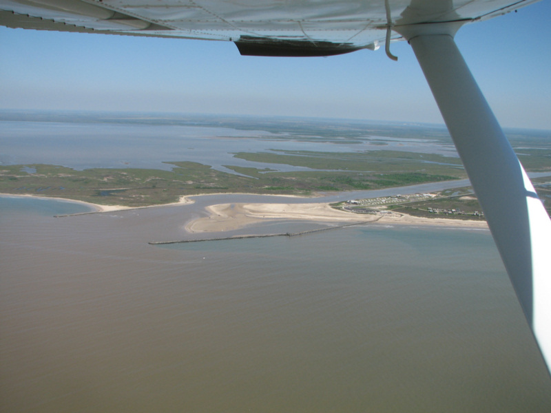
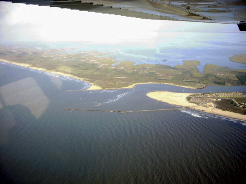
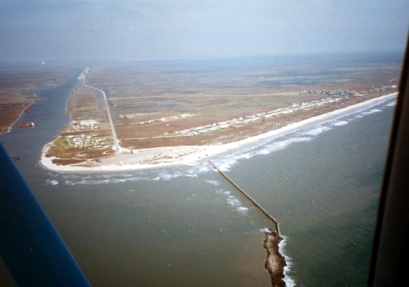
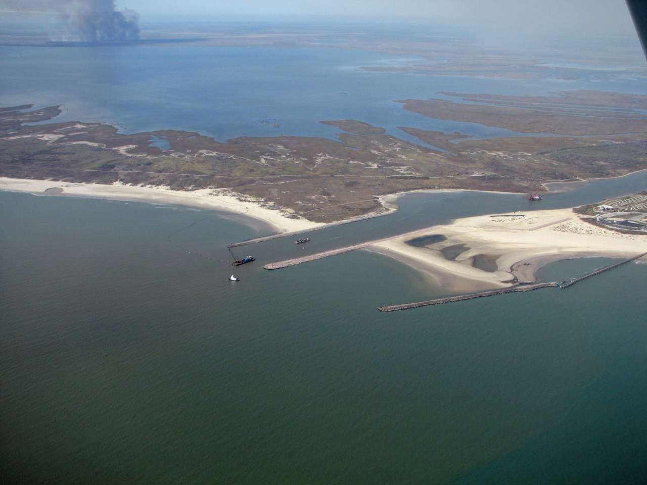
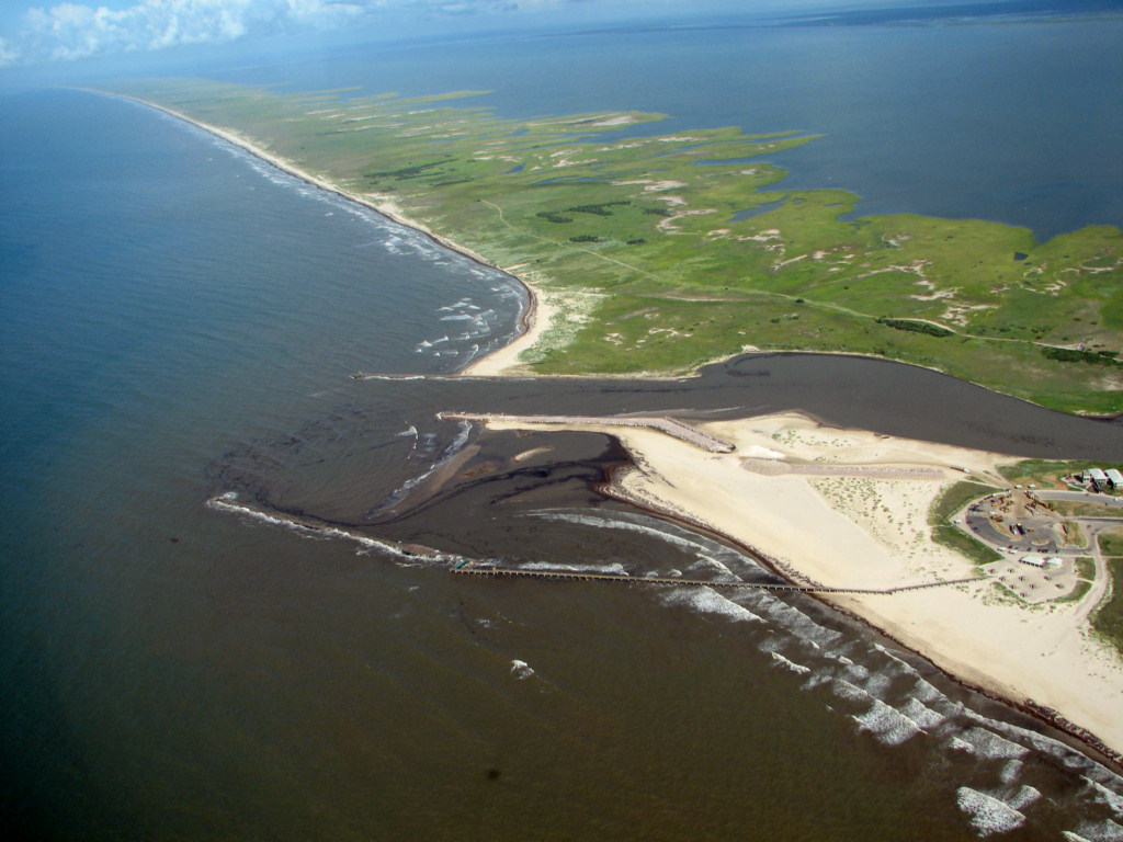
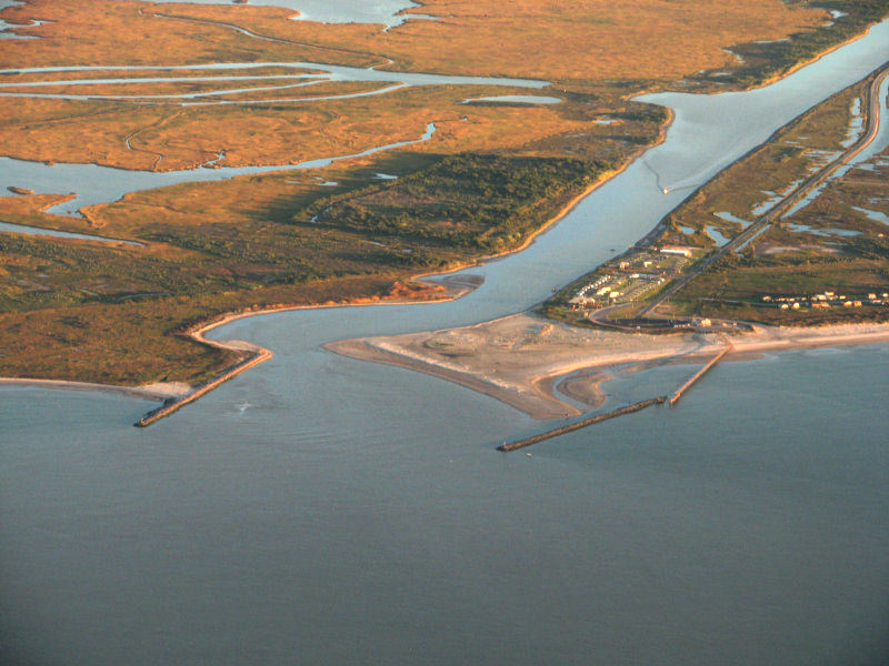
Colorado River Entrance
10/28/2008
Notice the wave refraction
and
difraction.
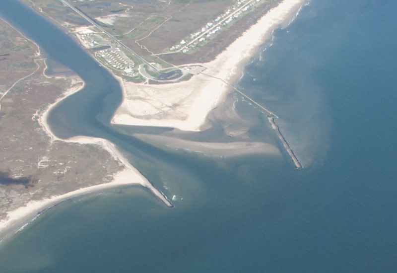
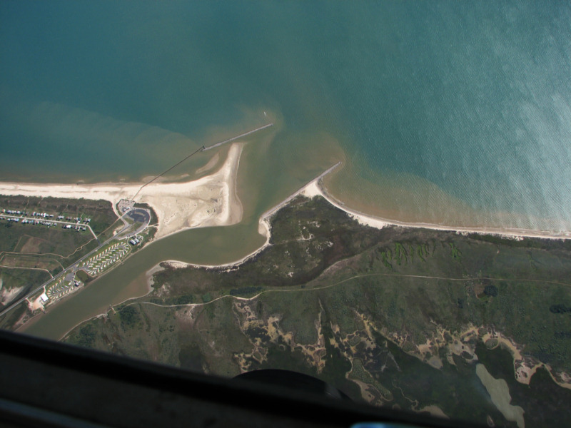
Colorado River Entrance
10/24/2007
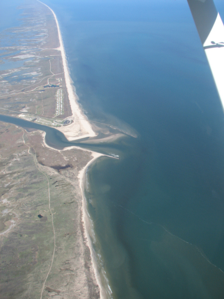
Colorado River Entrance
4/26/2007
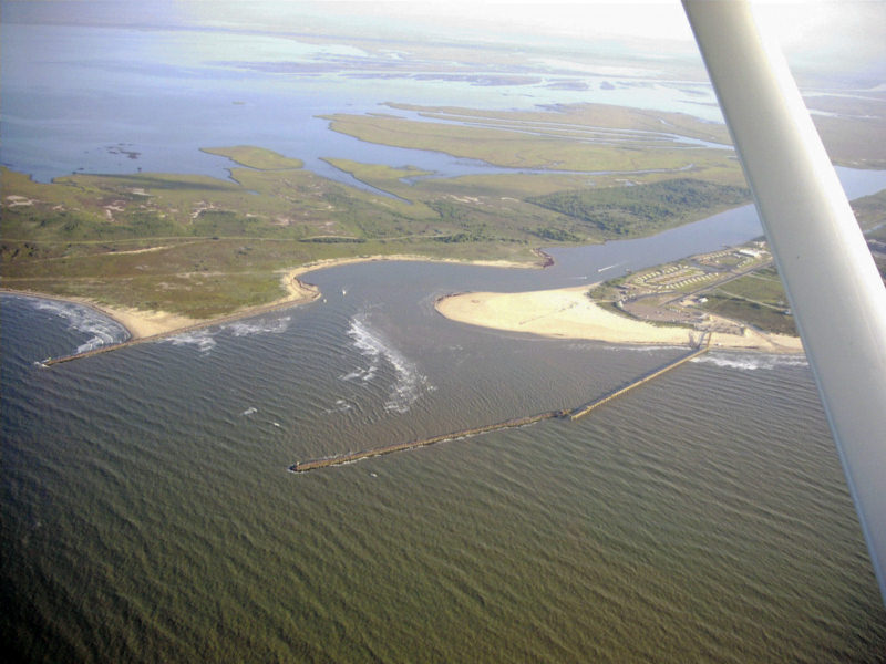
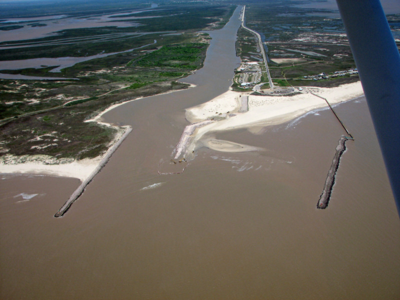
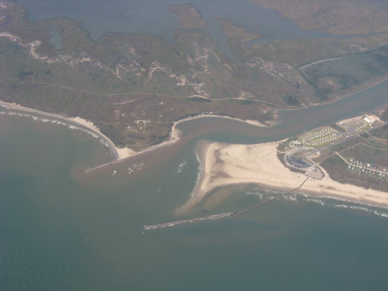
Colorado River Entrance 1/11/2007
Colorado River Entrance 1/11/2007
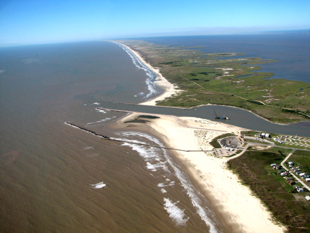
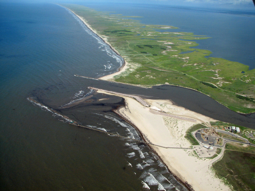
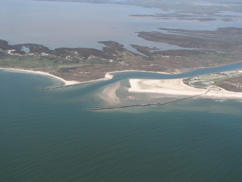
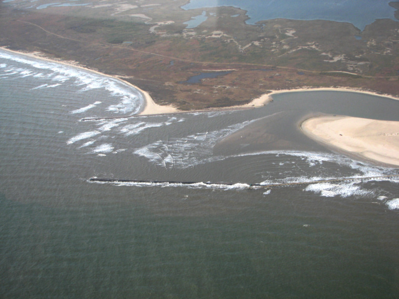
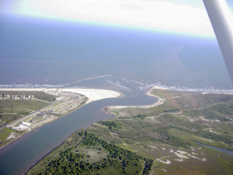
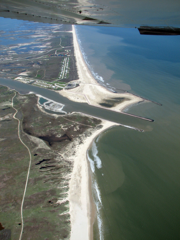
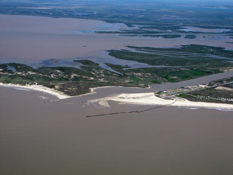
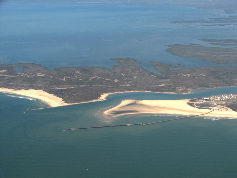
Colorado River Entrance, 5/18/2006
Colorado River Entrance, 5/18/2006
Colorado River Entrance, 5/18/2006
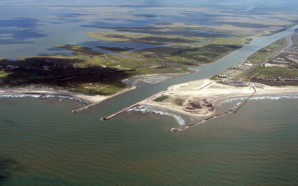
Colorado River Entrance, January 2003
Colorado River Entrance submerged east jetty, 2003
Colorado River Entrance, submerged east jetty
Colorado River Entrance Submerged east jetty, 1996

Colorado River Entrance, $2 million dredging every year

High resolution digital copies of many of these photographs are available for sale. You may purchase a digital photo in the highest resolution that I have for $25.00 for personal use or for use in your presentations. The charge will be $150 for use in publications or for commercial reproduction. Contact me to purchase photos. These photographs are copyrighted and are the property of Richard L. Watson. They may not be copied or used without permission. You may however link to this website from your website or by email.
These photographs are copyrighted and are the property of Richard L. Watson. They may not be copied or used without permission. You may however link to this website from your website or by email.
If you would like to make a donation to help support the expense of providing these photos of the Texas Coast, please click on the Paypal button below.
Colorado River Entrance 3/4/2012
Colorado River Entrance 3/4/2012
Colorado River Entrance 3/4/2012
Colorado River Entrance 3/4/2012
Colorado River Entrance 7/13/2011
Colorado River Entrance 7/13/2011
Colorado River Entrance 7/13/2011
Colorado River Entrance 3/11/2011
Dredge material is being used to fill in
the eroded embayment on the south side of the channel. It looks
like it is being retained by a sand dike. It will be interesting
to see if this area remains stable.
Colorado River Entrance 3/11/2011
Note how large the new Colorado River Delta
is growing into Matagorda Bay. This is sand which would have
continued to nourish Matagorda Peninsula if the river had not been
diverted into the bay in 1992.
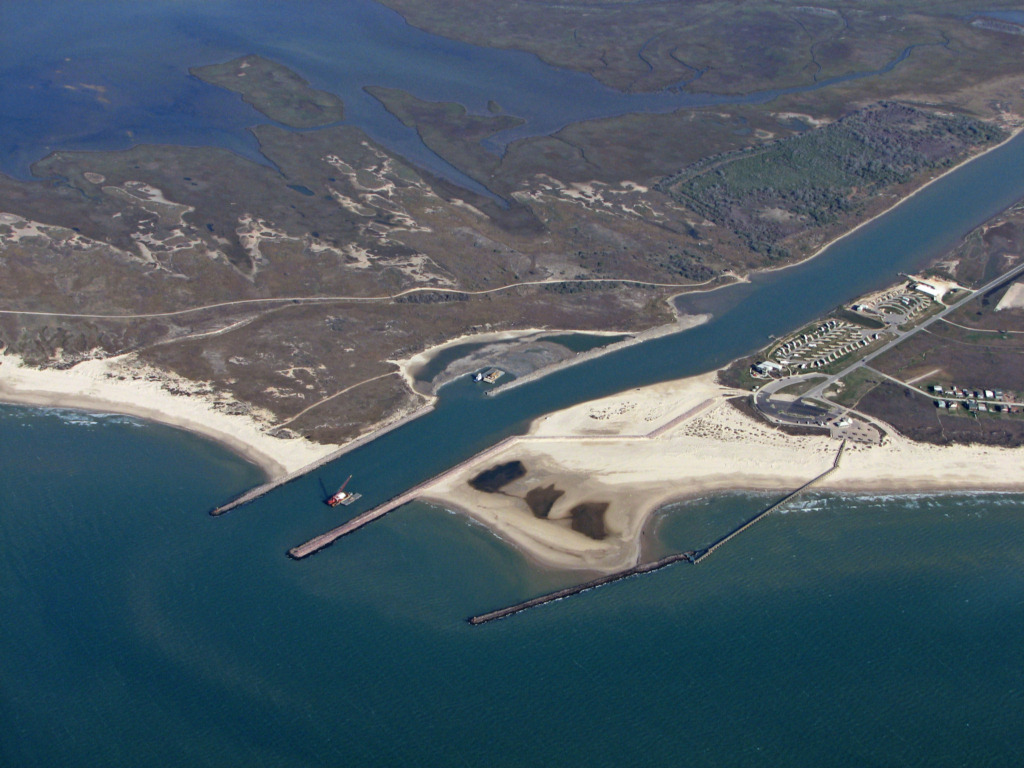
Colorado River Entrance 1/6/2011
The dredge is at the end of the jetties and placing dredge material to the south at the bottom of the photo.
Colorado River Entrance 1/6/2011
It looks like the area between the jetties
adjacent to the sea level portion of the NE jetty is rapidly filling.
This is an indicator of how much sand was flowing into the
channel prior to construction of the new center jetty and how well that
new jetty is keeping sand out of the navigation channel.
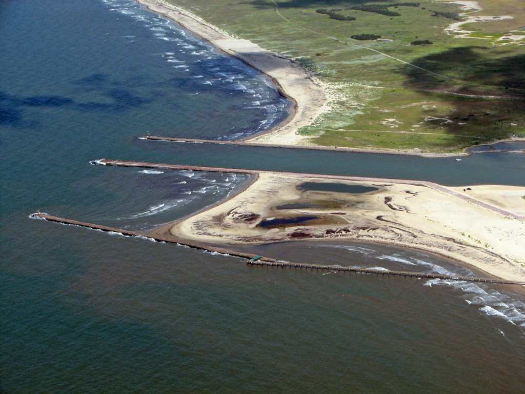
Colorado River Entrance 10/29/2010
The new jetty (in the middle) has been
completed and the channel is being dredged. The new jetty was
placed to narrow the channel so that flow can help keep the channel
swept clear of sand and to trap sand from the updrift direction (right
in this photo) which was able to pass over the submerged 1000 feet of
the old East jetty.
Colorado River Entrance 10/29/2010
Here you can see the large amount of sand that has already been accumulated on the new East jetty (the middle one).Colorado River Entrance 10/29/2010
You can plainly see the submerged portion
of the old East jetty which has a pier above it. The waves show
that it allowed all of the sand carried from East to West to flow over
the jetty and into the channel.
Colorado River Entrance 10/29/2010
You can see the dredge in the channel. It is dumping the dredged material on to the beach on the West side of the jetty.Colorado River Entrance 6/28/2010
Work continues on the new east jetty.
The crud in the water is probably decomposing Sargassum and not
oil. It looks like the bar between the new jetty and the old
jetty is growing.
Colorado River Entrance 6/28/2010
Colorado River Entrance 6/28/2010
Colorado River Entrance 6/28/2010
Colorado River Entrance 4/8/2010
Note the new jetty being built between the
existing jetties. This is necessary because the original E. jetty
was built with the shoreward end at about MLW. That allowed sand
to bypass the jetty and clog the channel. In addition, the
channel was too narrow to generate strong enough ebb currents to keep
the channel swept clear of sand. This was not a big problem until
1992 when the river was diverted to flow into Matagorda Bay, instead of
directly into the Gulf. With the natural flushing action of the
river flow removed, the pass entrance shoaled rapidly requiring twice
as much dredging as before the river was diverted. By the late
1990s, it was taking about $2 million per year to keep the entrance
open. It is hoped that the narrower channel which is now
constrained between the old W jetty and the new, closer, E jetty will
maintain flow sufficient to keep the entrance open. In addition,
the new jetty will not pass sand along the beach into the old channel
as did the old E jetty.
Colorado River Entrance 4/8/2010
Colorado River Entrance 4/8/2010
Colorado River Entrance 4/8/2010
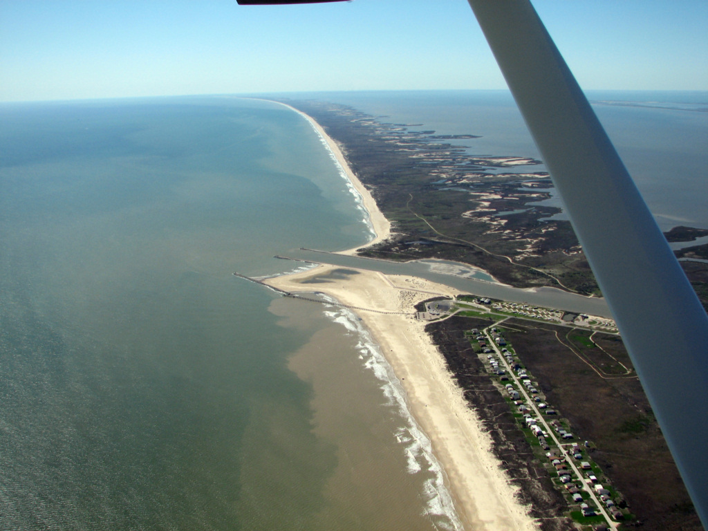
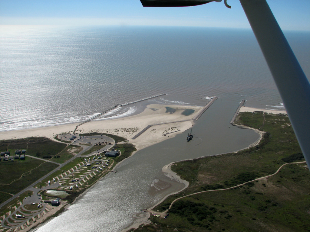
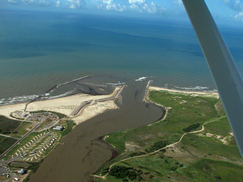
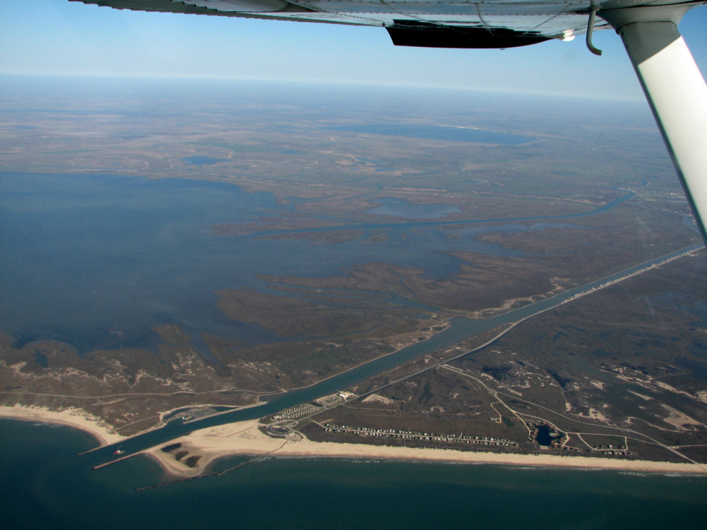
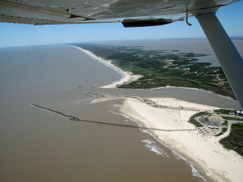
Colorado River Entrance 9/14/2009
Colorado River Entrance 9/14/2009
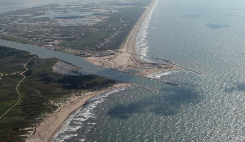
Colorado River Entrance 3/16/2009
Colorado
River
Entrance 10/28/2008
Colorado River Entrance
10/28/2008
Notice the wave refraction
and
difraction.Colorado River Entrance 2/27/2008
Colorado River Entrance 2/27/2008
Colorado River Entrance 2/27/2008
Colorado River Entrance 2/27/2008
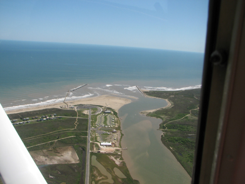
Colorado River Entrance 11/5/2007
Colorado River Entrance
10/24/2007
Colorado River Entrance 10/24/2007
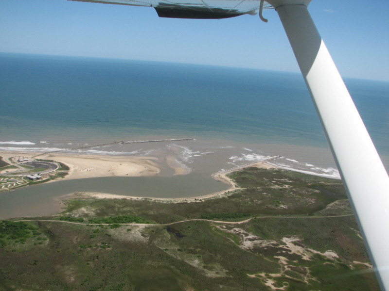
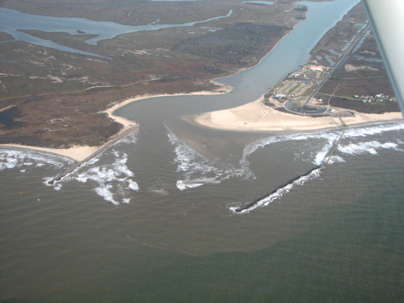
Colorado River Entrance 4/26/2007
Colorado River Entrance
4/26/2007
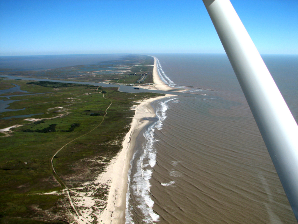
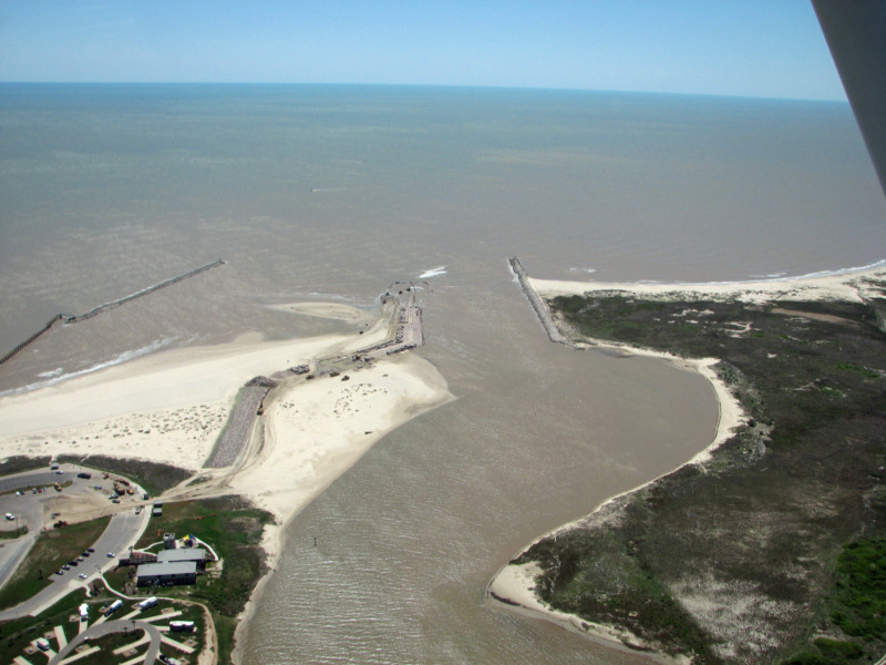
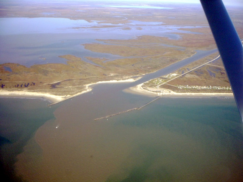
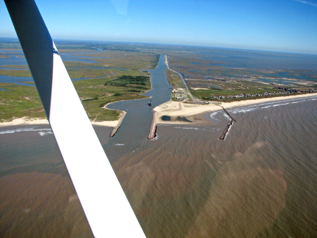
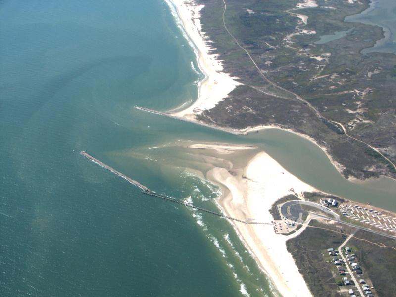
Colorado River Entrance 4/15/2007
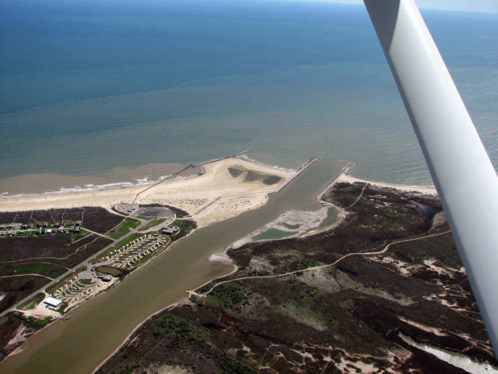
Note the huge bar.Colorado River Entrance 1/11/2007
Note that
there is a breaking bar across the entry channel. Also a huge
spit has built out from east to west along the shoreline and is
pinching the base of the channel closed. It looks like the
channel is probably only navigable by shallow draft boats.
Colorado River Entrance 1/11/2007
Note that the spit
crossing the channel
from east to west has forced tidal currents agains the west side of the
channel and is eroding the channel in an arc to the west just inland of
the base of the west jetty.
Colorado River Entrance, 5/18/2006
Colorado River Entrance, 5/18/2006
Colorado River Entrance, 5/18/2006
Colorado River Entrance, January 2003
Colorado River Entrance submerged east jetty, 2003
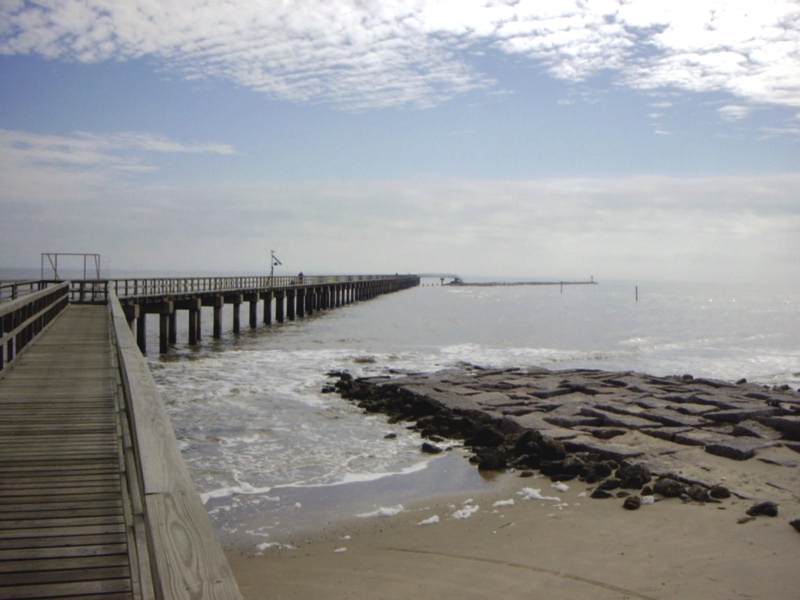
Colorado River Entrance, submerged east jetty
Colorado River Entrance Submerged east jetty, 1996
Colorado River Entrance, $2 million dredging every year