


High resolution digital copies of many of these photographs are available for sale. You may purchase a digital photo in the highest resolution that I have for $25.00 for personal use or for use in your presentations. The charge will be $150 for use in publications or for commercial reproduction. Contact me to purchase photos. These photographs are copyrighted and are the property of Richard L. Watson. They may not be copied or used without permission. You may however link to this website from your website or by email.
These photographs are copyrighted and are the property of Richard L. Watson. They may not be copied or used without permission. You may however link to this website from your website or by email.
If you would like to make a donation to help support the expense of providing these photos of the Texas Coast, please click on the Paypal button below.
Click
here to download an 1884 chart of Aransas Pass, Aransas Bay and Cedar
Bayou (2MB).
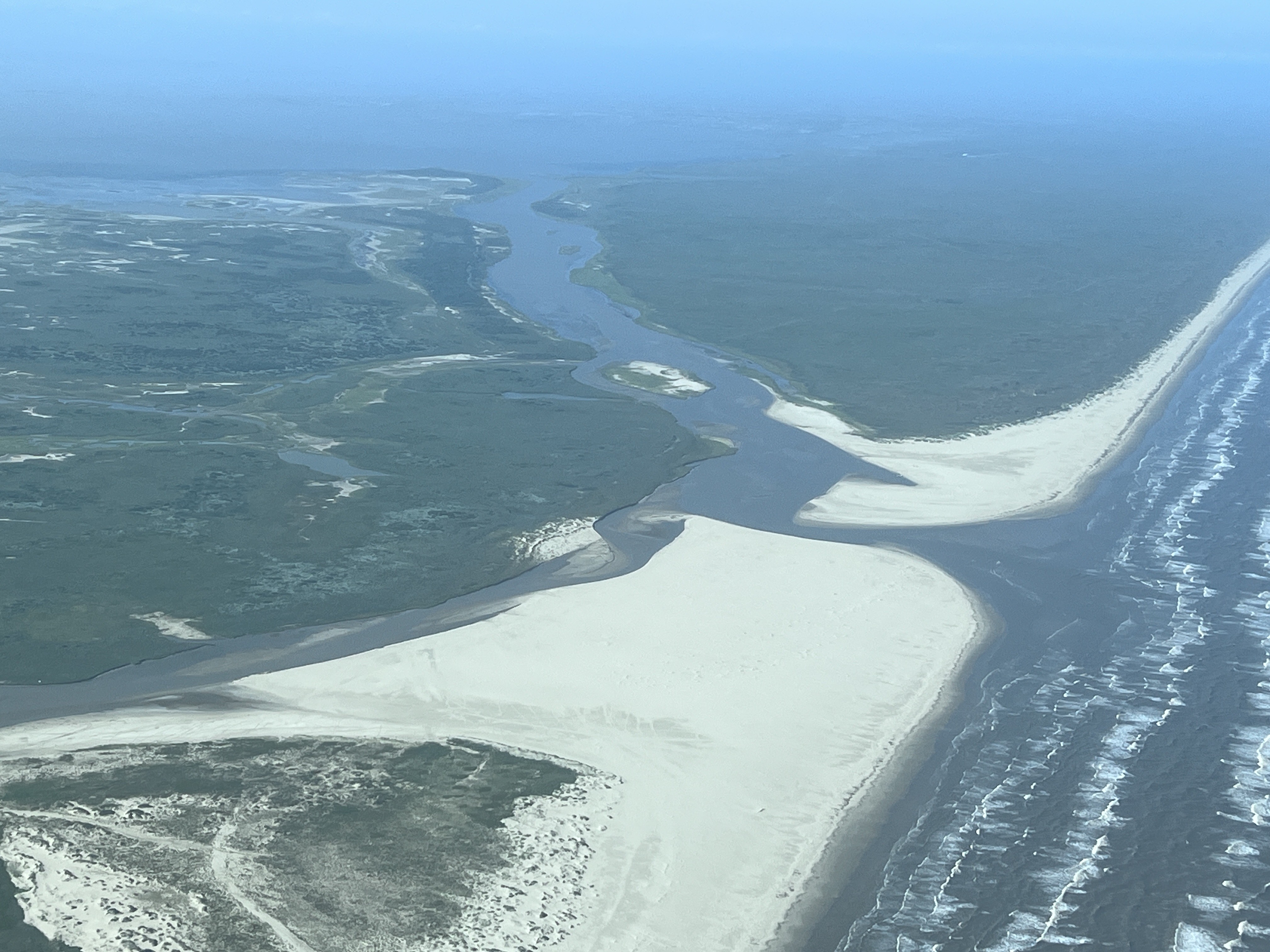
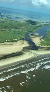
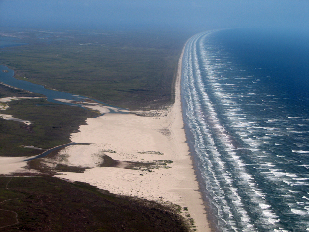
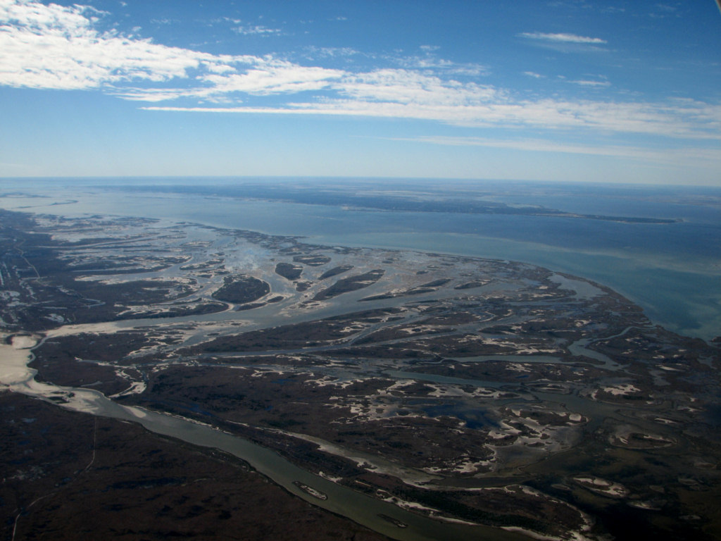
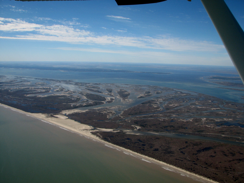
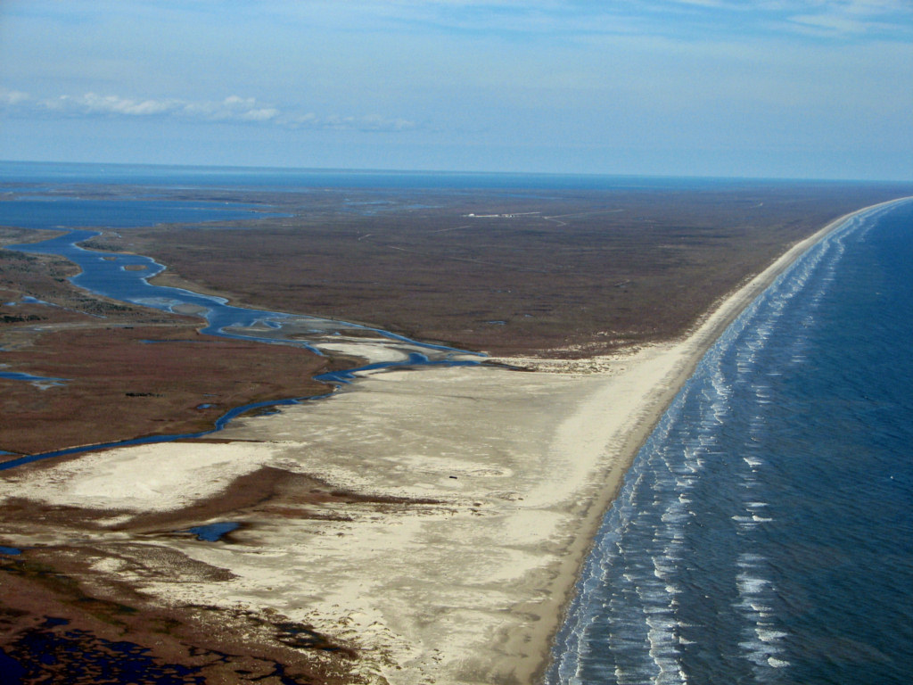
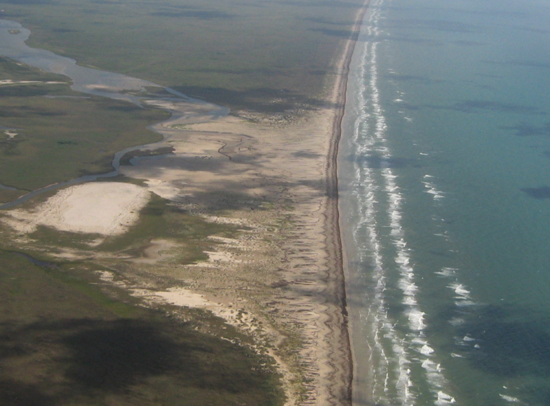
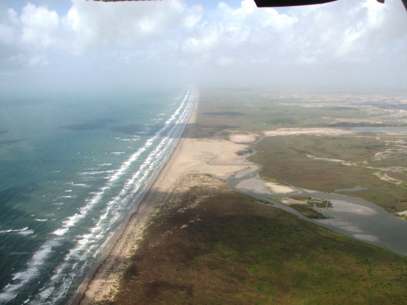
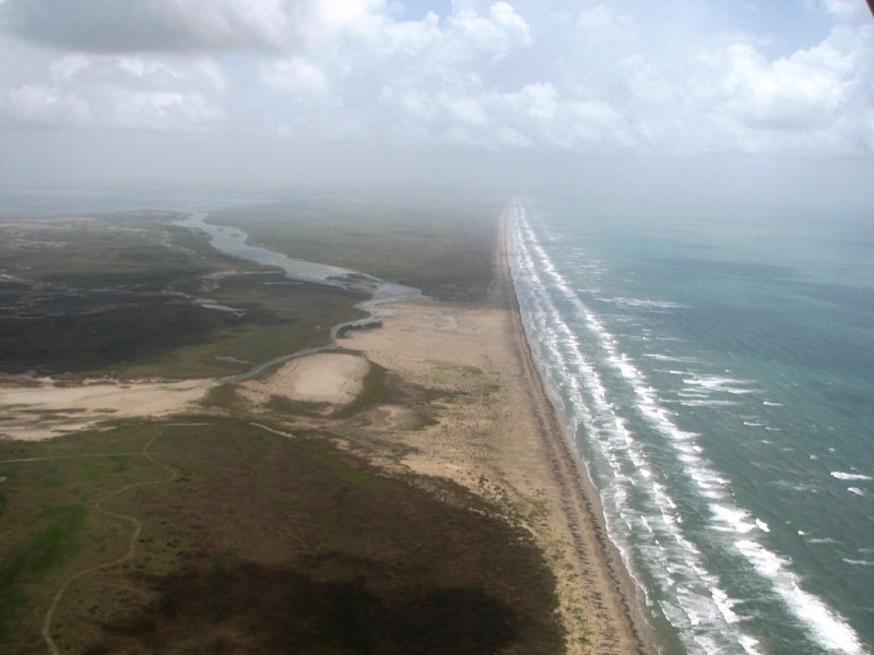
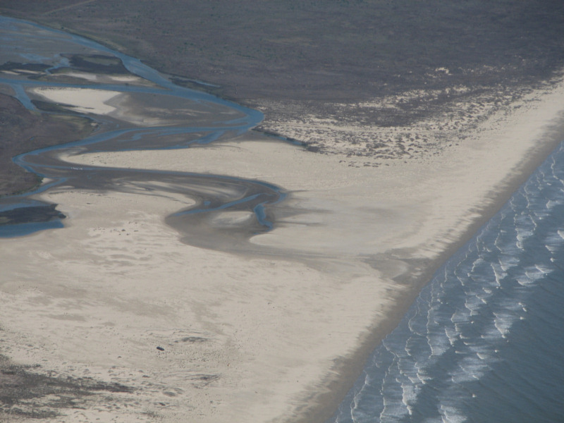
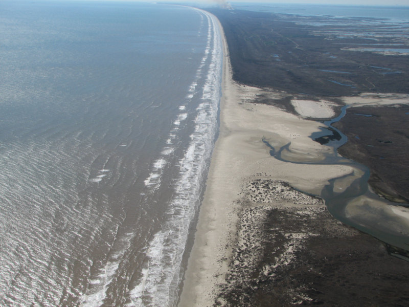
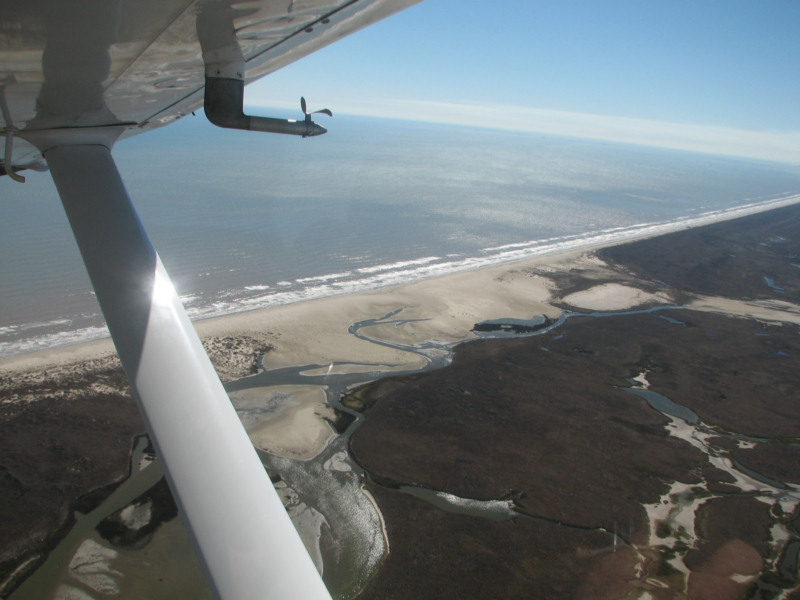
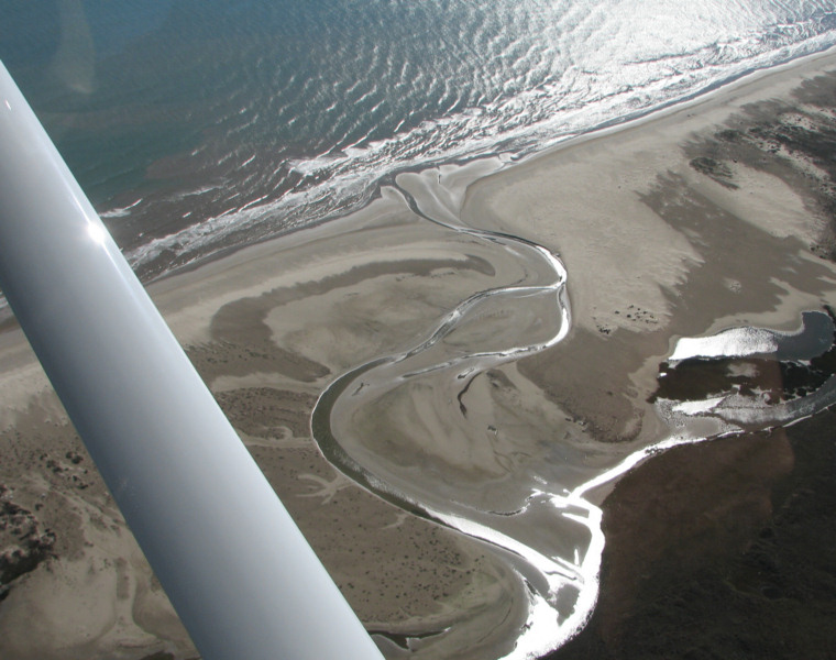
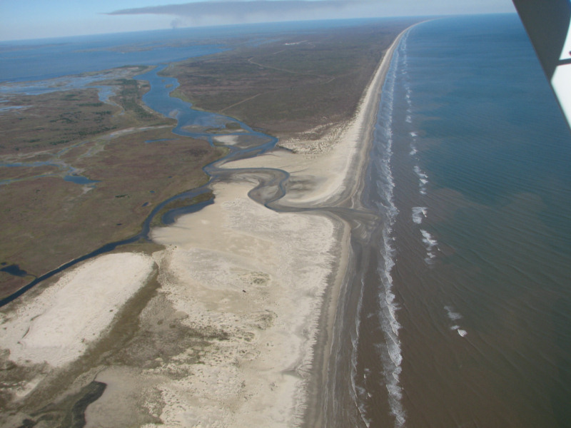
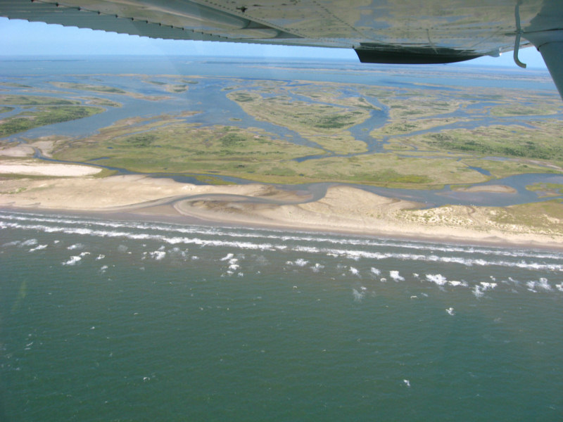
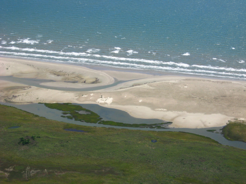
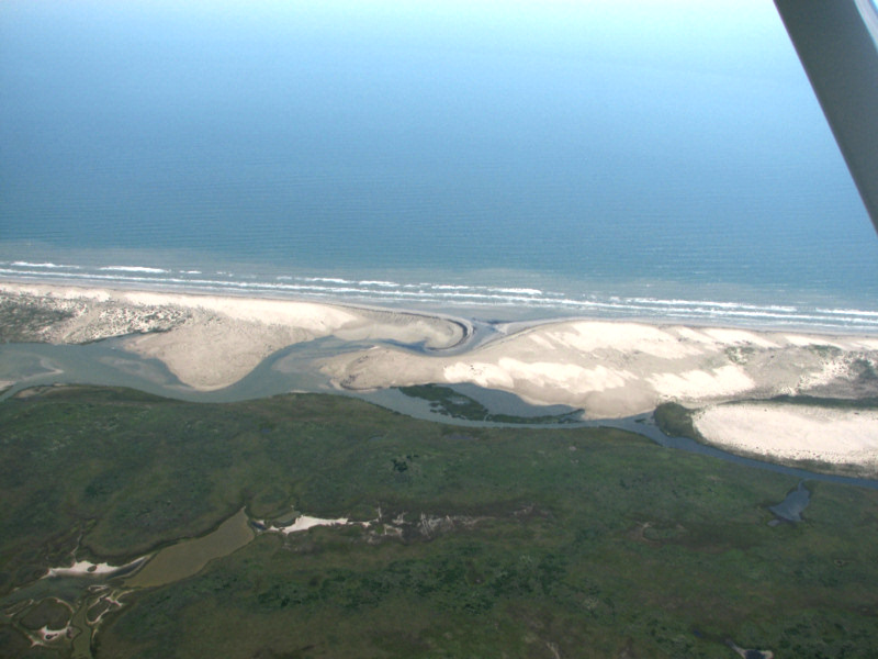
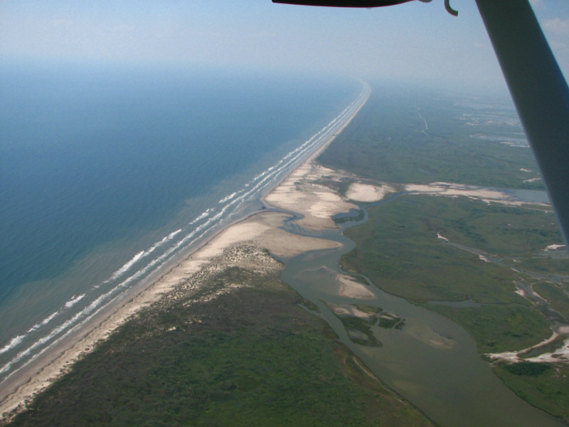
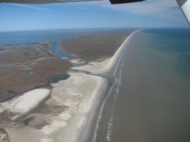
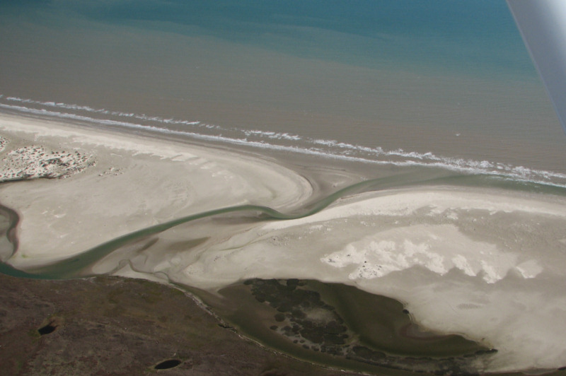
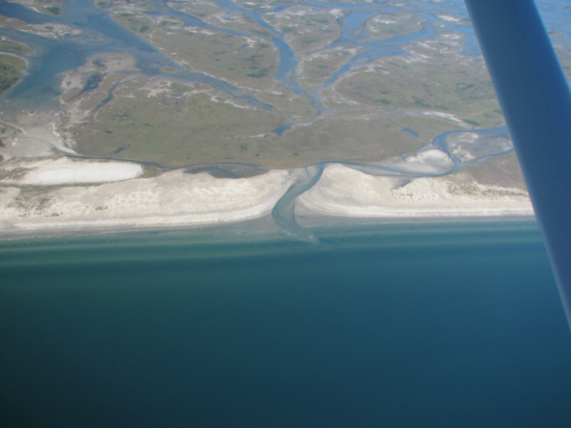
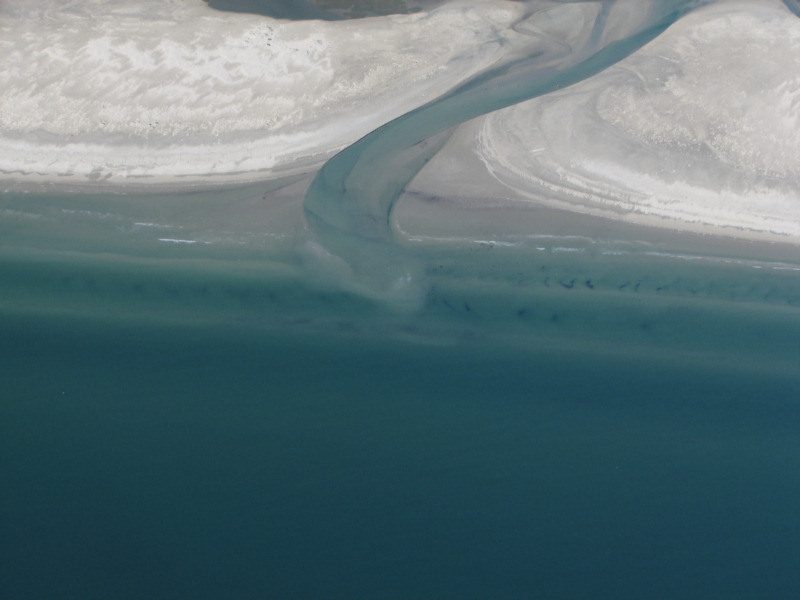
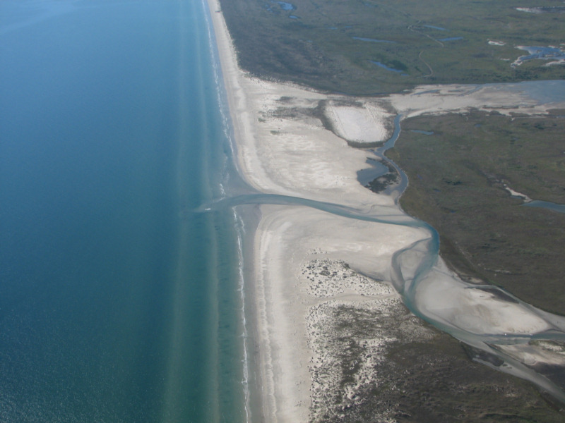
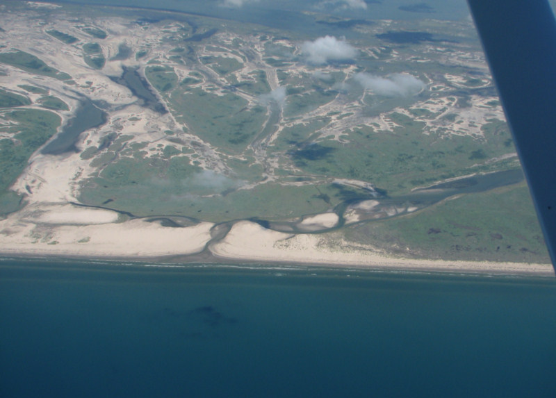
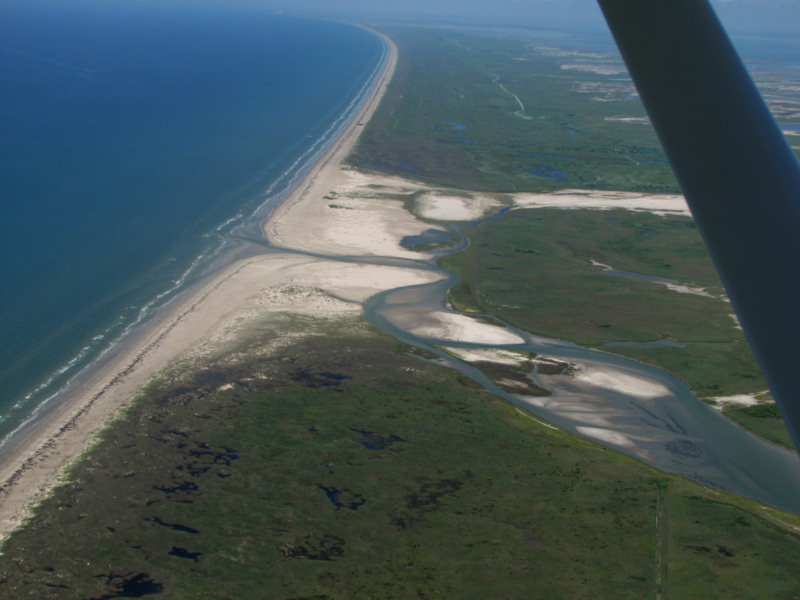
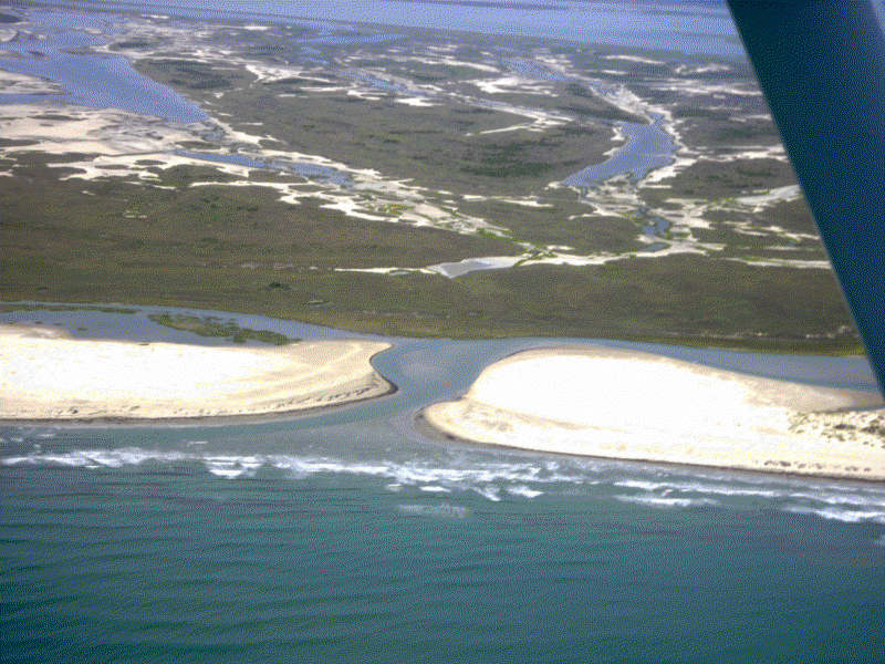
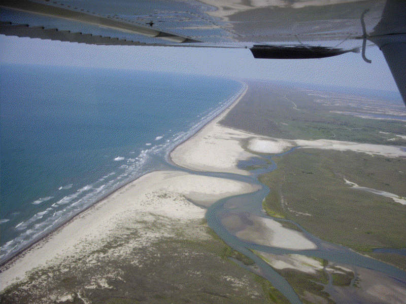
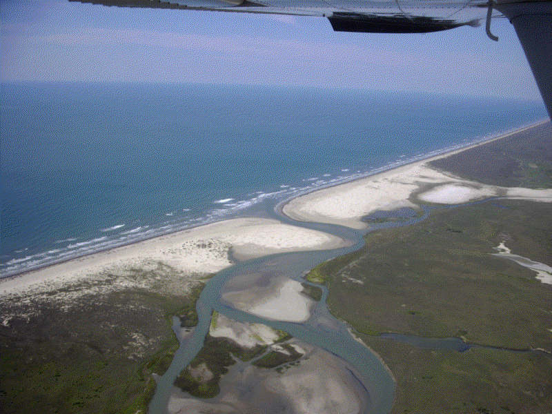
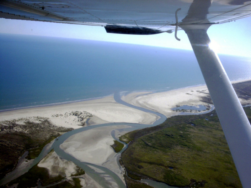
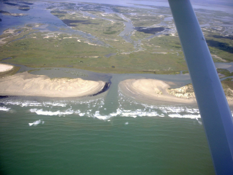
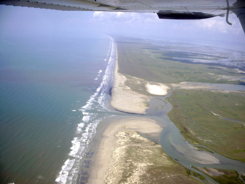
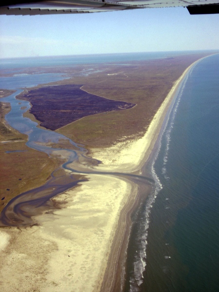
Cedar Bayou 6/18/2023 (Photo by Ray Hoese)
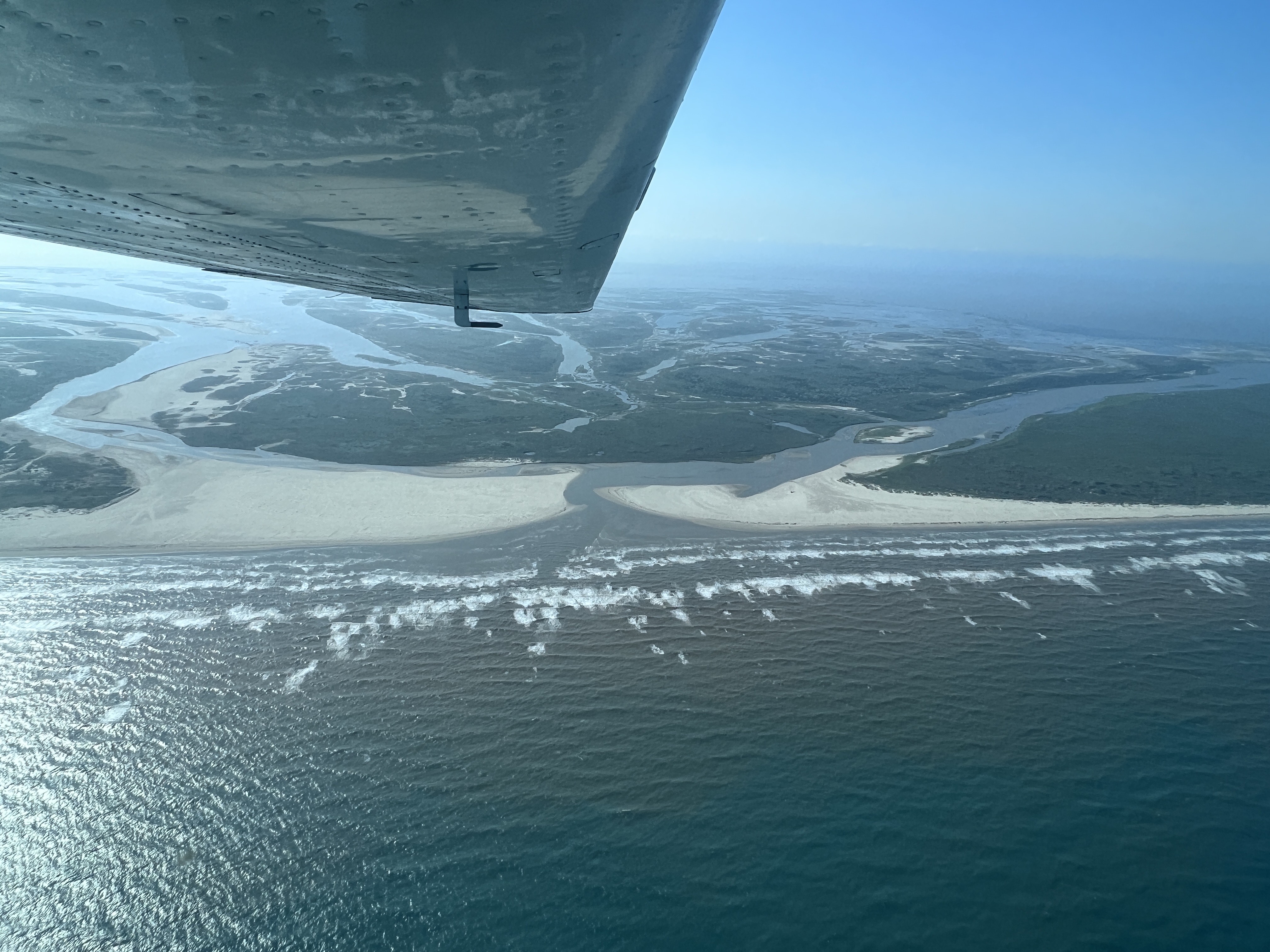
Cedar Bayou 6/18/2023 (Photo by Ray Hoese)
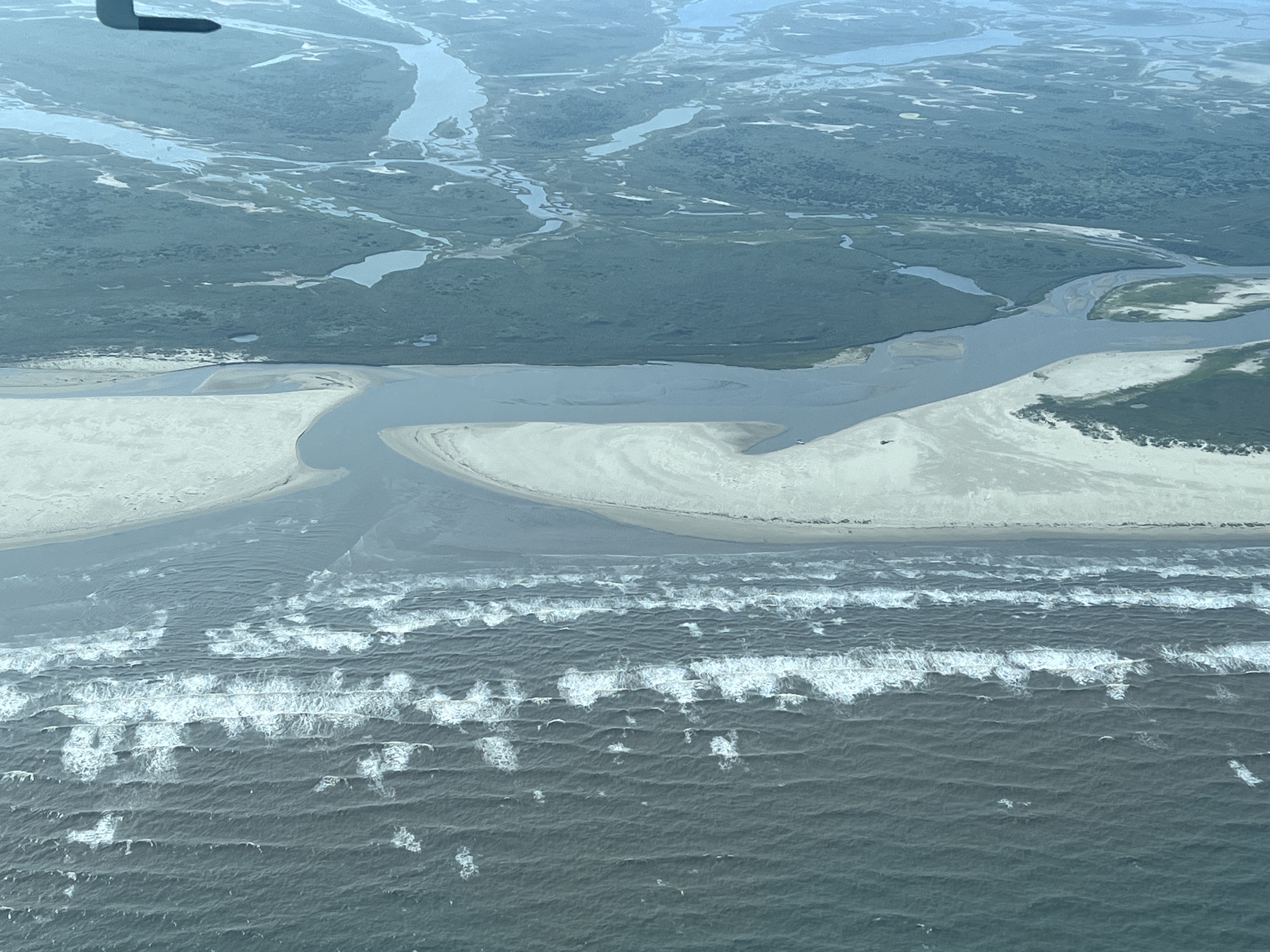
Cedar Bayou 6/18/2023 (Photo by Ray Hoese)
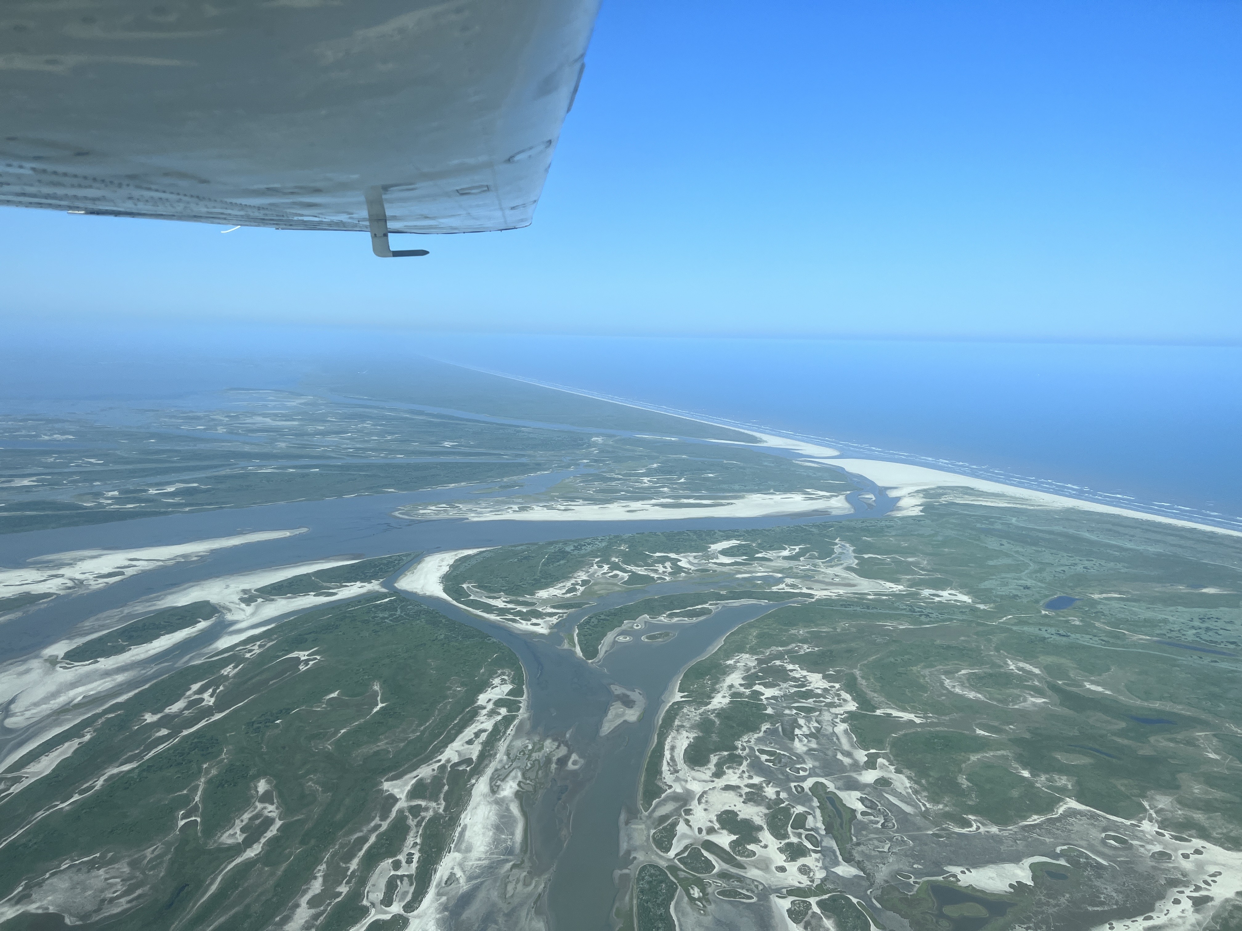
Cedar Bayou 6/18/2023 (Photo by Ray Hoese)
Cedar Bayou completely closed 10/2/2018 (Photo from Mark Creighton Video)
Click here to donload a Video of Cedar Bayou completely closed 10/2/2018 (Video courtesy of Mark Creighton)
Cedar Bayou 3/27/2015 (Photo courtesy of Mark Creighton)
Cedar Bayou 3/27/2015 (Photo courtesy of Mark Creighton)
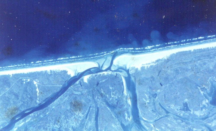
It appears that the new dredged opening
to Vinson Slough is nearly closed. It is unlikely to remain open
long since Vinson Slough connects with Aransas Bay only at very high
tides.
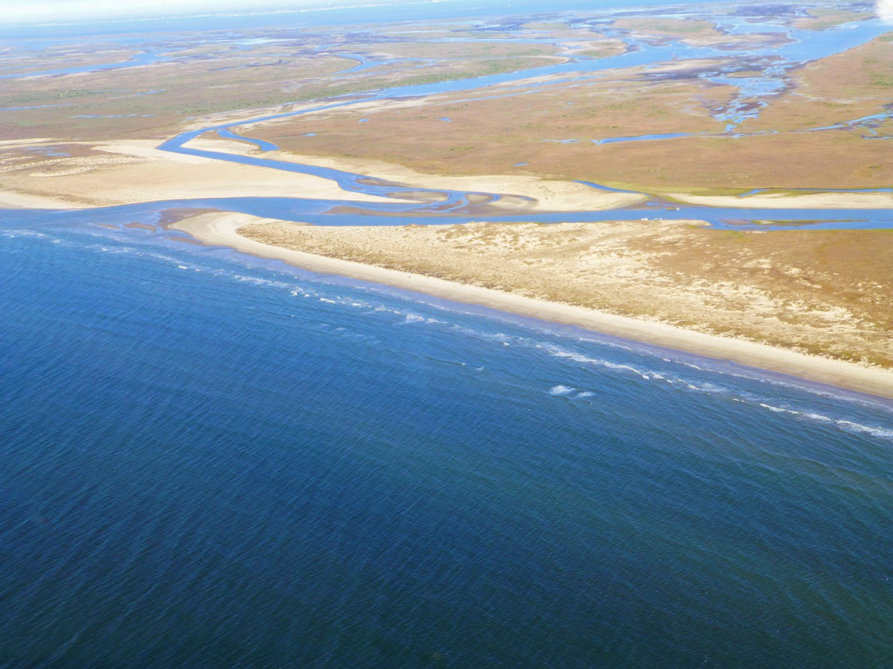
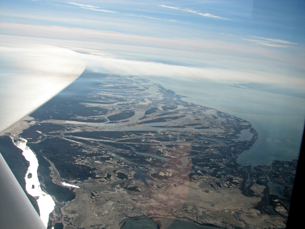
Cedar Bayou 5/17/2012

Cedar Bayou 2/26/2012
Cedar Bayou 10/7/2011
Cedar Bayou 1/6/2011
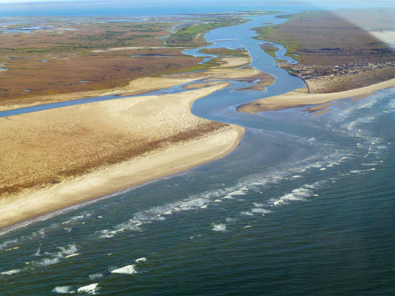
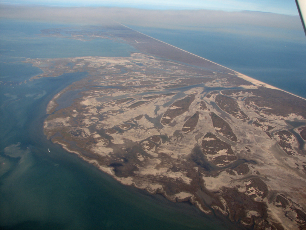
Note in the next three photos that Vinson
Bayou, channel to the left has little or no connection with Aransas
Bay. The proponents of opening Cedar Bayou and removing the
blockage at the Gulf end of Vinson Bayou expect increased flow through
Vinson Bayou in addition to flow through Cedar Bayou to keep the
channels open. Except at high tides there is no connection
between Vinson Bayou and Aransas Bay and even then it is through very
shallow channels. It is unlikely that Vinson Bayou will help much
in keeping Cedar Bayou open against the hundreds of thousands of cubic
yards of sand moving along the beach. Packery Channel already
needs to have over 200,000 cubic yards of sand dredged from the
entrance even though it has jetties to keep the channel open and sand
out of the entrance. Without jetties the prospect of Cedar Bayou
remaining open for long is low.

Cedar Bayou 1/6/2011
Cedar Bayou 1/6/2011
Cedar Bayou 4/8/2010
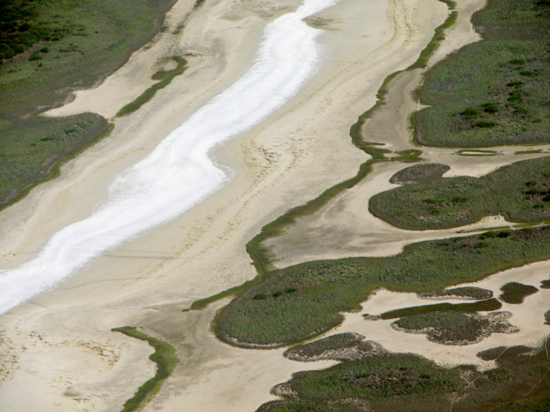
The very white areas in the washover fan appear to be new salt deposits.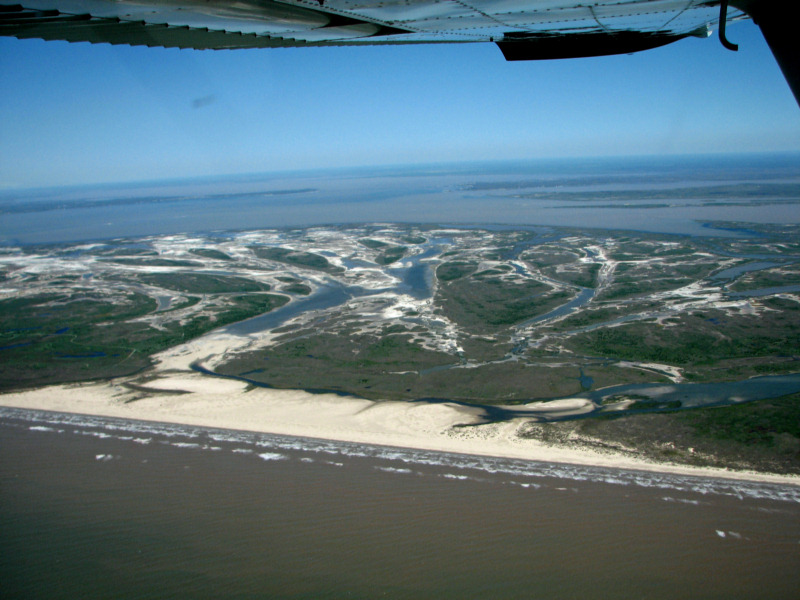
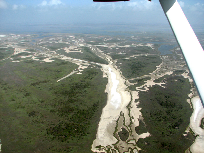
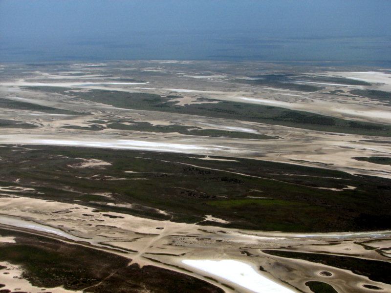
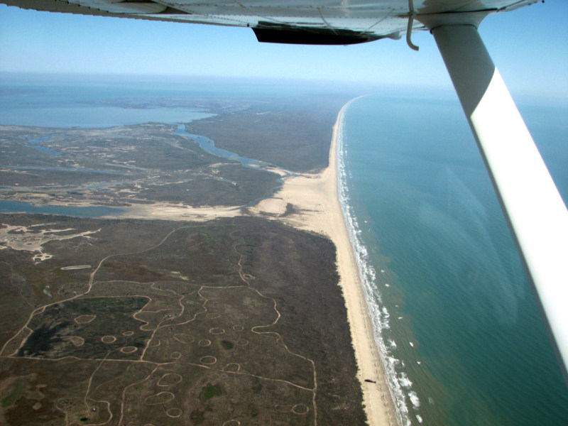
Washover fan on north end of San Jose Island. Cedar Bayou is in foreground. 1/25/2010
Cedar Bayou and the washover fan 1/25/2010
Cedar Bayou 1/25/2010
This is a photo of Cedar Bayou from the bay side and the huge washover fan on the north end of San Jose island.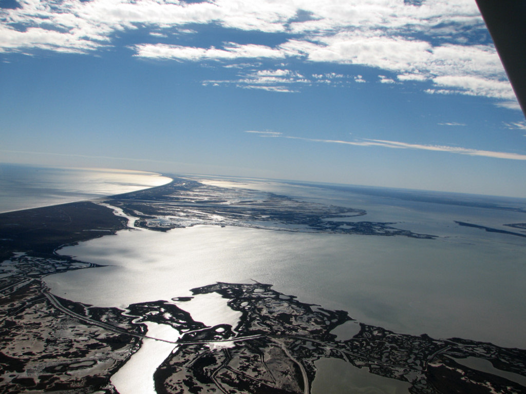
Cedar Bayou 1/10/2010
Cedar Bayou 1/11/2010
9/14/2009
Several days of light rain and high water levels in Aransas Bay have dissolved the salt deposits shown on 8/8/2009. In addition, the marshes are flooded and the ponds on Matagorda Island are full of water. This first photo shows the huge washover fan on the north end of San Jose Island.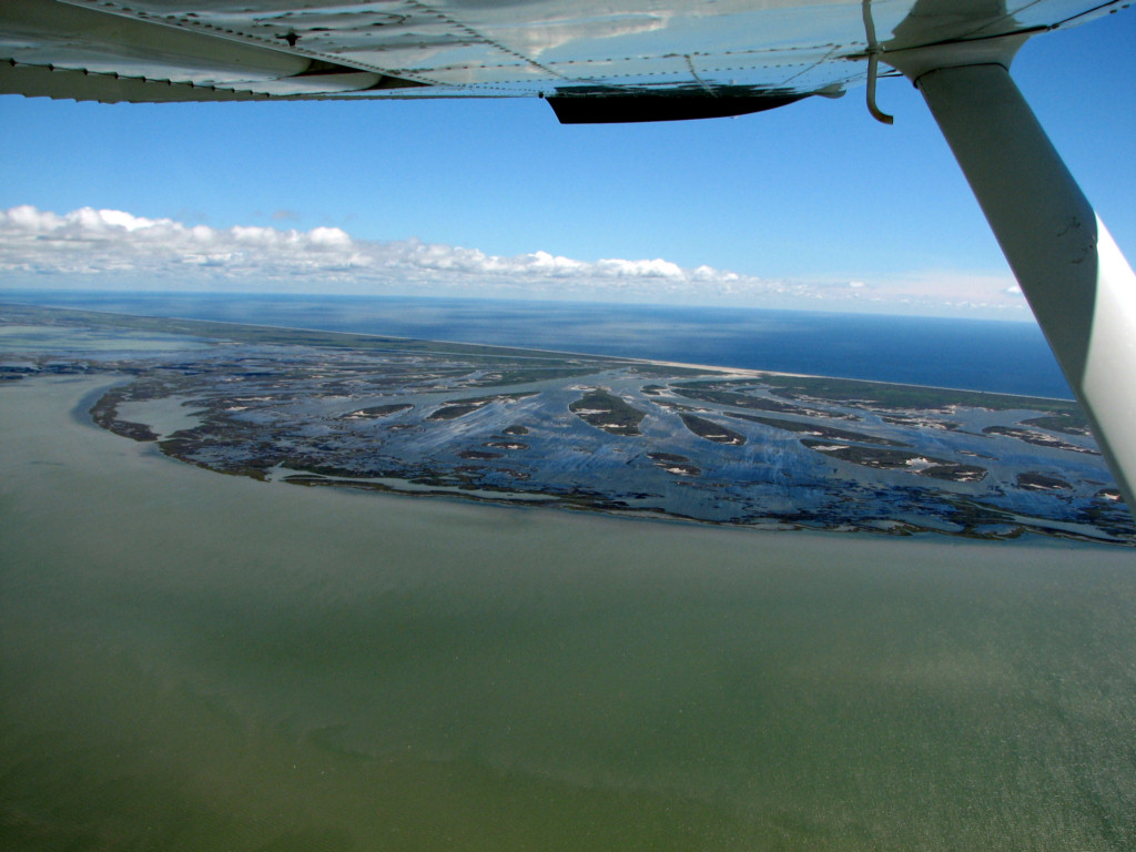
9/14/2009
8/8/2009
Here are some more photos
of
the salt near Cedar Bayou. I saw no salt further south on San
Jose Island or on Mustang Island. There is a pretty large
salt
pond just inland of Mission Bay in the Mission River delta.
Tony
Amos just informed me that he measured the salinity in one of the few
remaining ponds in Vinson Slough near the Gulf. It was 76ppt.
The following commentary is by Dick Hoese, a marine biologist
who
has been studying this area just about forever.
Not sure about San
Jose. In summer, 1955, what is now Harbor Oaks Harbor in Rockport was a
salt pan. There were small ones on Harbor Island the summer of 1964. Do
not remember any in 1970, but there were some around
Baffin, and Celia stopped things. My neighbor on the
Johnson
Ranch in Lamar found the old salt works on St. Charles Bay and there
has been some archeological work there. Since the flats stop somewhere
around here I have wondered what the northern limit was because the
LaSalle expedition in 1685 reported them. A corrpespondent
sent
me a historical record of settlers drying salt somewhere
around
Matagorda Bay, but have not checked it out. We have only had this
property for a little over a decade, but what seems unusual is the hot
weather from the high pressure during the time of maximum sun azimuth
with little clouds. It feels like Mexico.
Evaporation rates
seem unusual, but have not seen any data.
I started my thesis on Cedar
Bayou in 1956 and do not remember any. There were also some aerials
taken around then, but do not recall seeing any salt. Will
ask
the old timers.
We have had unprecented
wet weather since then, at least in modern Texas history, so while I
hope it rains it will be interesting if we return to an earlier
pattern
8/8/2009 This pond is on the south shore of Mesquite Bay.
8/8/2009 The black lines across the pond are cattle tracks.
8/1/2009
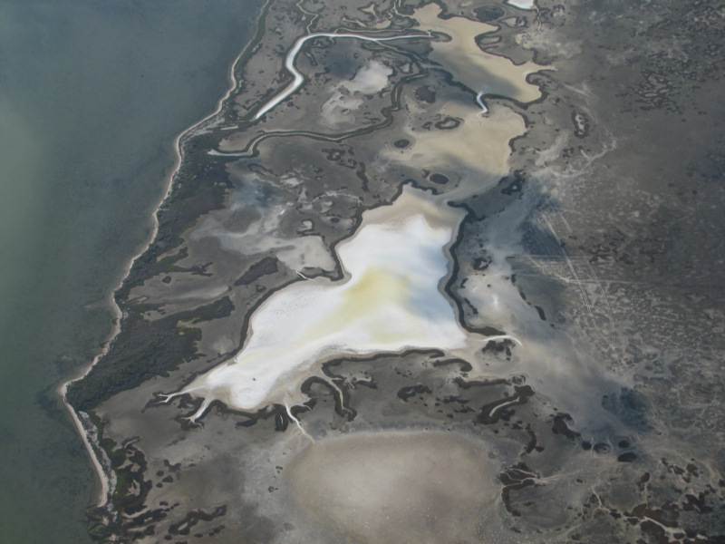
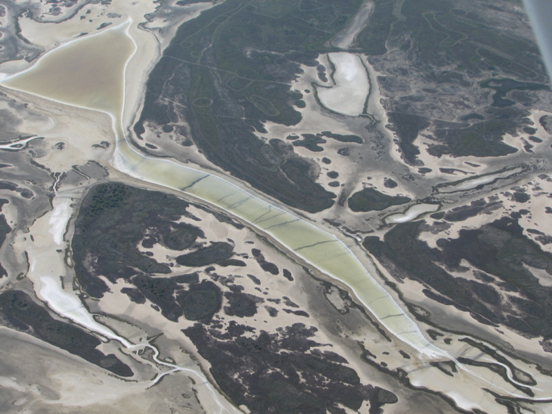
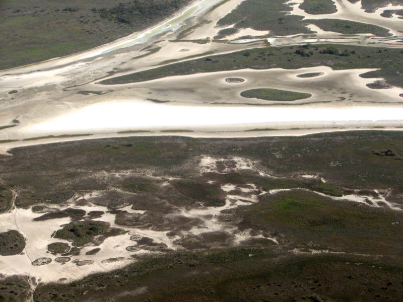
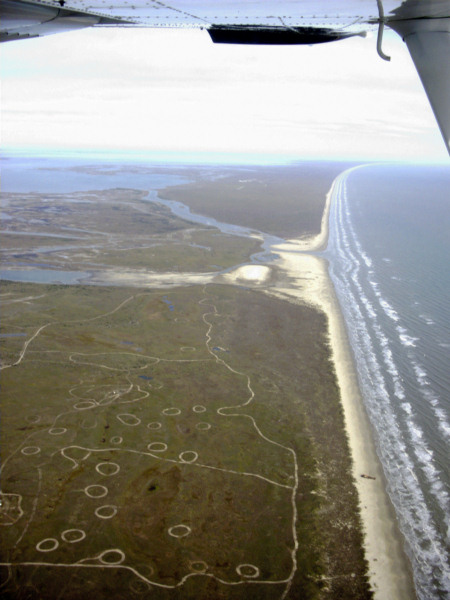
The drought and the low lake levels have caused many of the sloughs in the washover fan at the north end of San Jose Island to dry out and become salt pans. I don't recall ever seeing salt pans like this on San Jose Island, or at any location north of Laguna Madre. In the 1800s, this would have been a bonanza for an entrepeneur.8/1/2009 Washover fan salt pans
8/1/2009 Washover fan salt pans
Washover fan salt pans 8/1/2009
Washover fan salt pans 8/1/2009
Cedar Bayou 3/16/2009
Cedar Bayou 10/18/2008
Cedar Bayou after Hurricane Ike 9/17/2008
Cedar Bayou after Hurricane
Dolly 7/28/2008
Cedar Bayou 6/28/2008 Closed
Cedar Bayou 6/28/2008
Closed
Cedar Bayou 2/27/2008 CLOSED
Cedar Bayou 2/6/2008 CLOSED
Cedar
Bayou 2/6/2008 CLOSED
Cedar Bayou 12/16/2007
Cedar
Bayou 12/16/2007
Cedar Bayou 11/5/2007

Cedar Bayou 10/20/07 Closed at low tide
Cedar Bayou 10/20/07 Closed at low tide
Cedar Bayou 9/21/2007
Cedar Bayou 9/21/2007
Cedar Bayou 1/8/2007
Cedar
Bayou 1/8/2007 nearly closed
Cedar Bayou 11/17/2006
Cedar Bayou 11/17/2006
Cedar Bayou 11/17/2006
Cedar Bayou 10/28/2006
Cedar Bayou is nearly closed at low tide.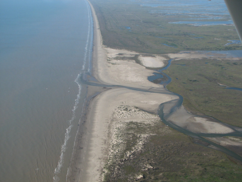
Cedar Bayou 10/28/2006
Cedar Bayou is nearly closed at low tide.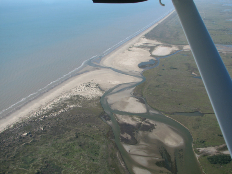
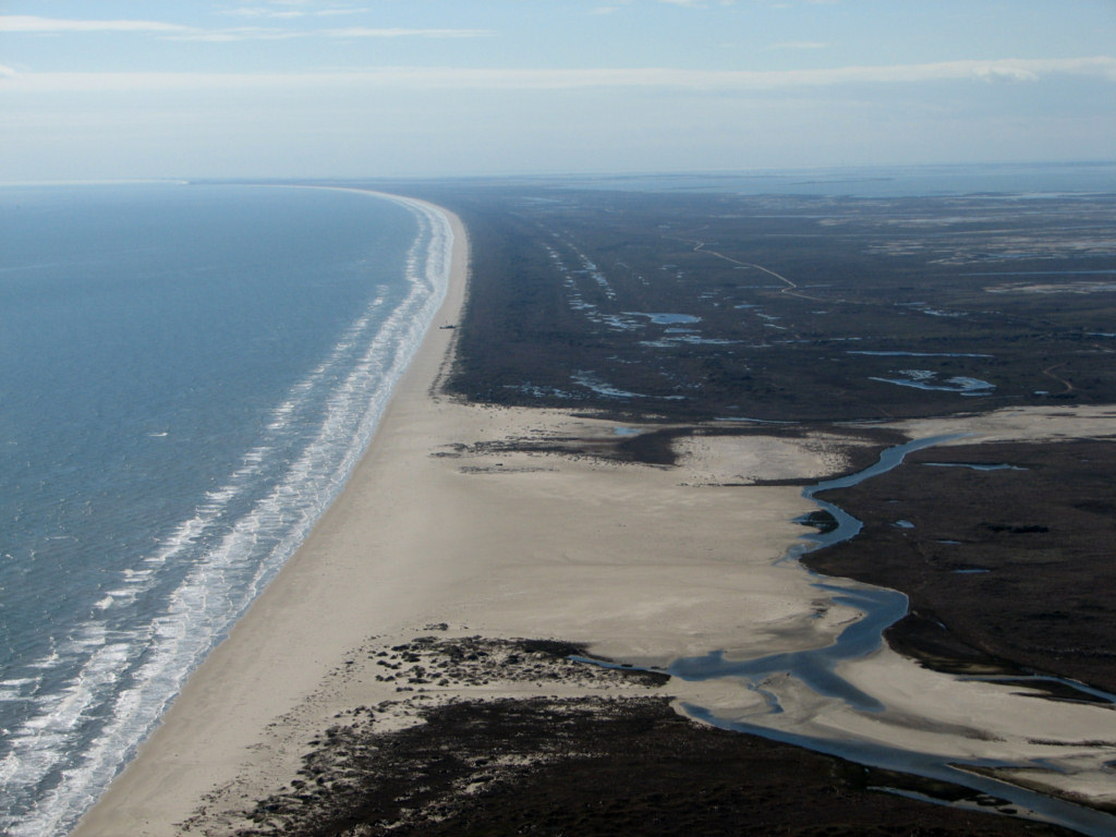
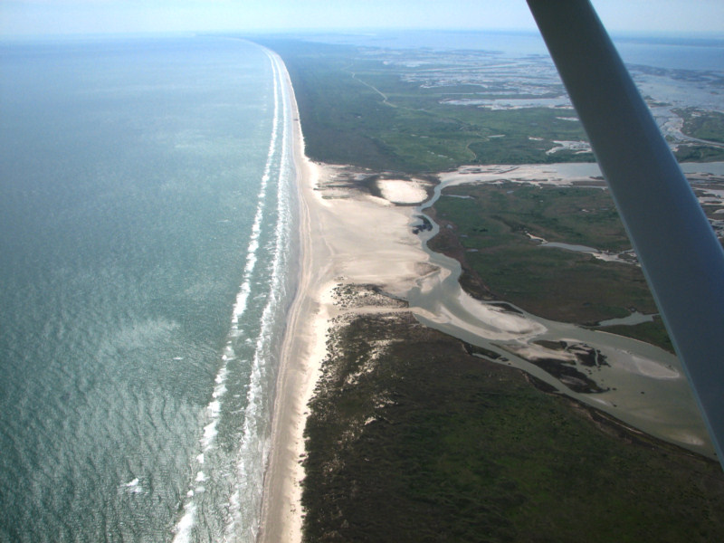
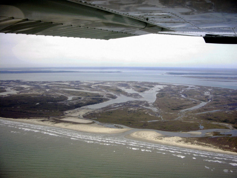
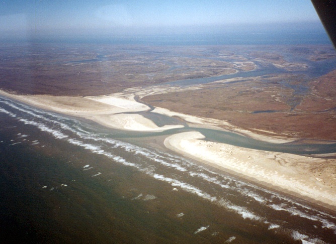
Cedar Bayou 8/31/2006 from 5500 ft.
Cedar Bayou 7-17-06
Cedar Bayou 5/16/2006
Cedar Bayou 5/16/2006
Cedar Bayou 5/16/2006
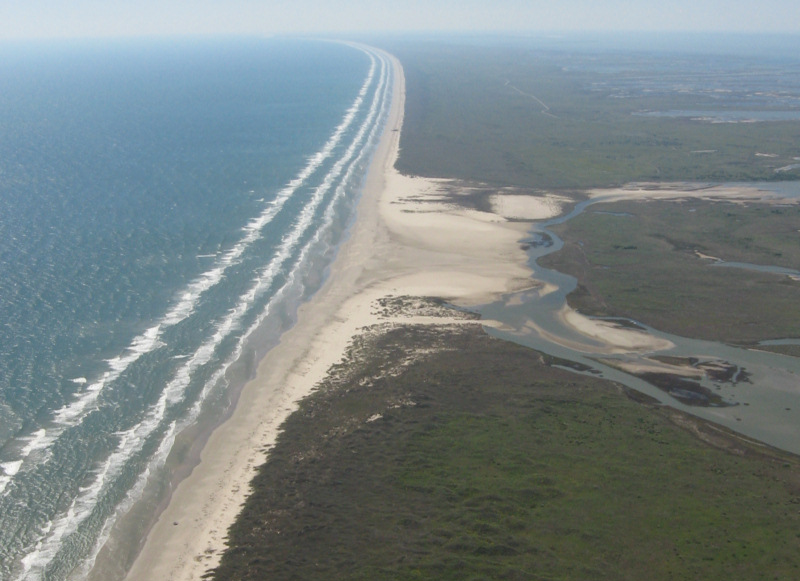
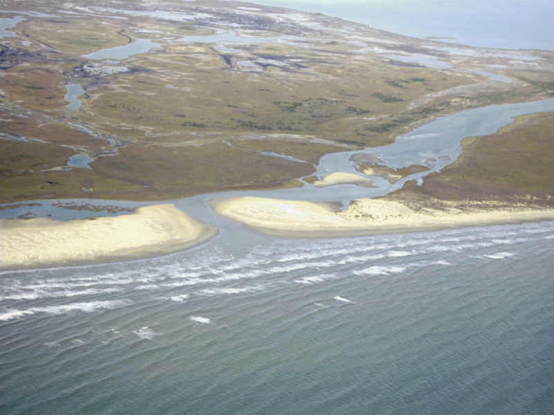
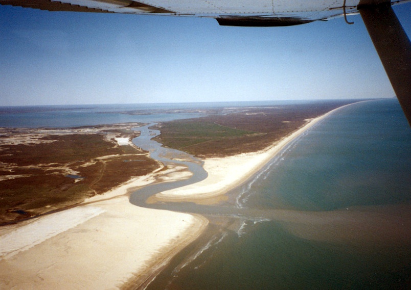
Cedar Bayou and San Jose Island Washover Fan,
12/11/2005
Cedar Bayou, 12/11/2005
Cedar Bayou, 12/11/2005
Cedar Bayou, 11/22/2005
Cedar Bayou, 11/22/2005
Cedar Bayou 7/22/05 after Hurricane Emily
Cedar Bayou 7/22/05 after Hurricane Emily
Cedar Bayou, March 2004

Cedar Bayou, November 2003
Cedar Bayou, 1997
Cedar Bayou, 1996
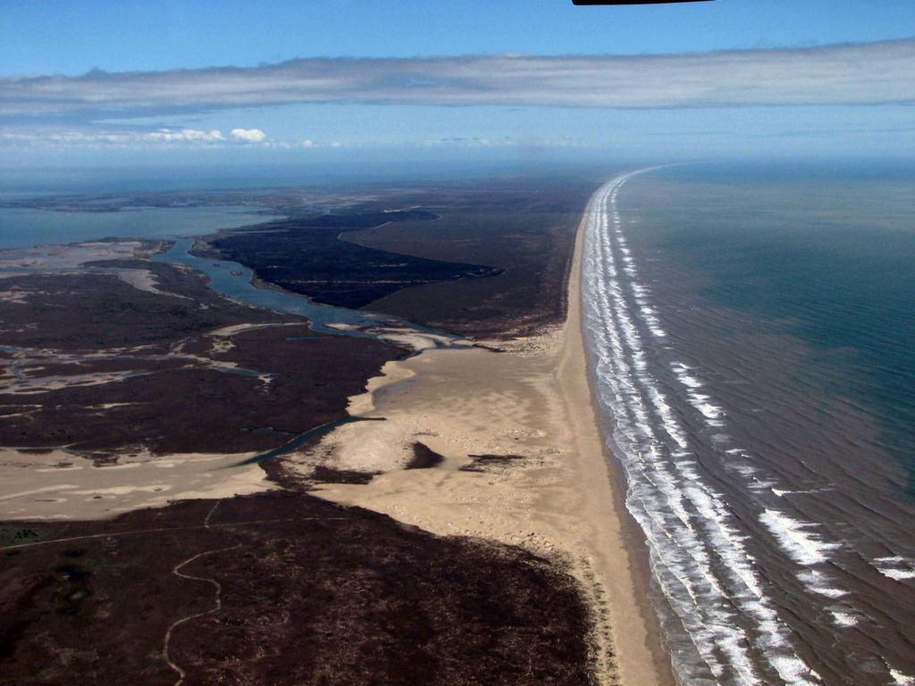
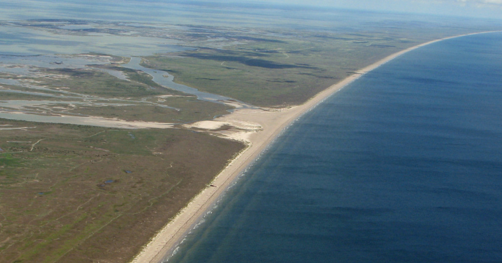
Cedar Bayou 1973 from 60,000ft
Cedar Bayou 4/3/67
Cedar Bayou 4/3/67
