


Click here to return to Betsy A. Churgai's Island Associates Real Estate
TEXAS COAST AERIAL PHOTOGRAPHYHigh resolution digital copies of many of these photographs are available for sale. You may purchase a digital photo in the highest resolution that I have for $25.00 for personal use or for use in your presentations. The charge will be $150 for use in publications or for commercial reproduction. Contact me to purchase photos. These photographs are copyrighted and are the property of Richard L. Watson. They may not be copied or used without permission. You may however link to this website from your website or by email.
These photographs are copyrighted and are the property of Richard L. Watson. They may not be copied or used without permission. You may however link to this website from your website or by email.
If you would like to make a donation to help support the expense of providing these photos of the Texas Coast, please click on the Paypal button below.
Read the following paper for much more information about the Texas coast.
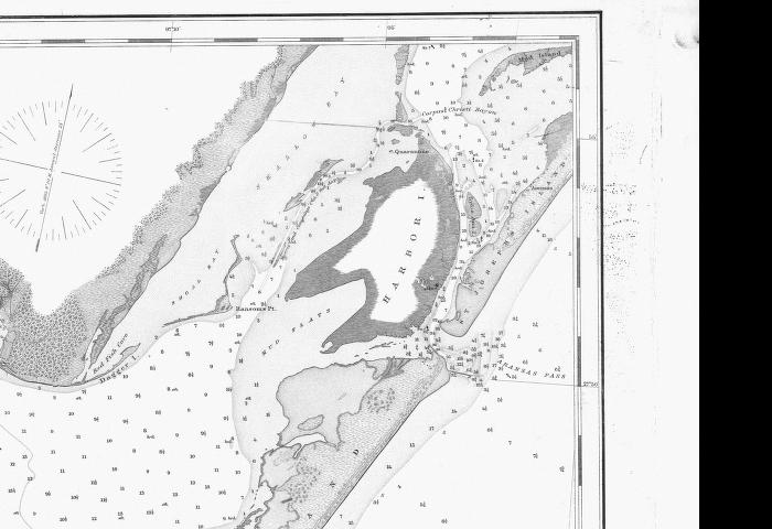
Coastal Law and the Geology of a Changing Shoreline, March 2006, updated to include section on poor beach and dune management practicesClick here to download 1884 chart of Aransas Pass, Aransas Bay and Cedar Bayou (2MB).
Wikipedia History of Port Aransas and Aransas Pass
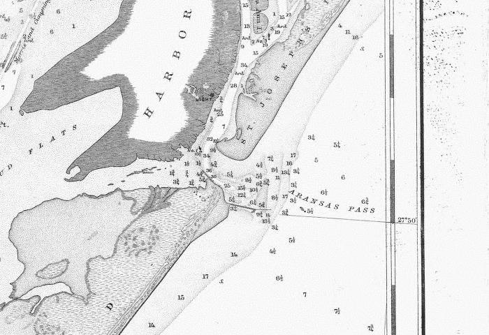
1887 Chart of Aransas Pass
Aransas Pass Entrance 1887
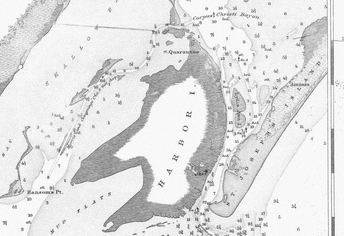
Aransas Pass, Lydia Ann Channel, Corpus Christi Bayou and Morris and Cummings Cut 1887
There
was no direct shipping channel from Port Aransas to Corpus
Christi. Ships would enter the relatively deep Aransas Pass,
located
across from the light house and proceed north to an anchorage NE of
Harbor Island at Quarantine Shore. There they offloaded to
small
shallow draft "lighters" which proceeded through Corpus Christi Bayou,
a natural channel, and then Morris and Cummings Cut, a dredged channel,
to enter Corpus Christi Bay. Creation of the deep and direct
channel
from Aransas Pass at Port Aransas to Corpus Christi captured virtually
all of the tidal flow in and out of Corpus Christi Bay and the natural
process of longshore drift carrying hundreds of thousands of cubic
yards of sand across the entrance of Corpus Christi Pass closed it.
Lake Padre is a remnant of the original Corpus Christi Pass.
See the Packery Channel photo sections for 1887 maps of
Corpus
Christi Pass.
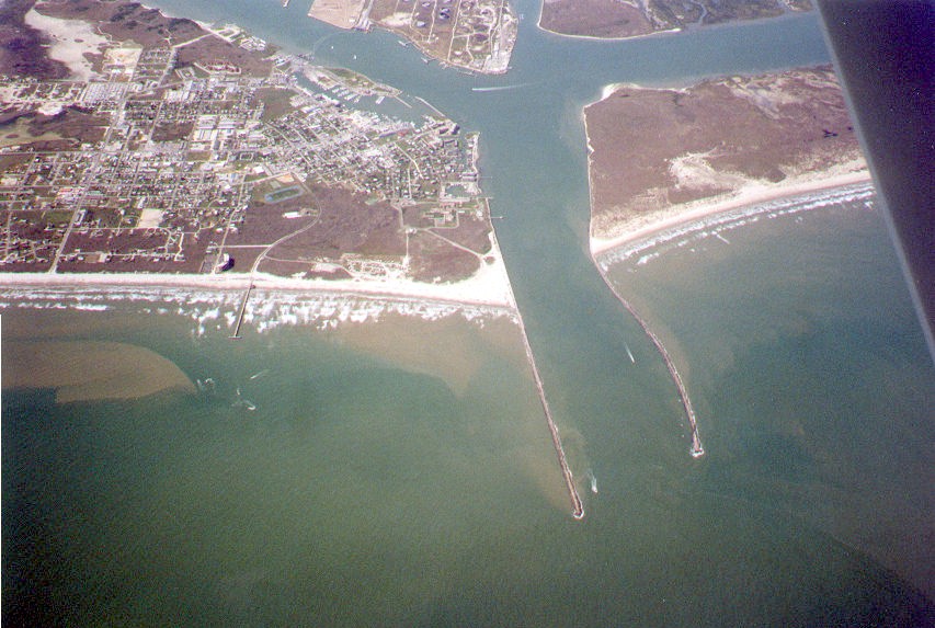
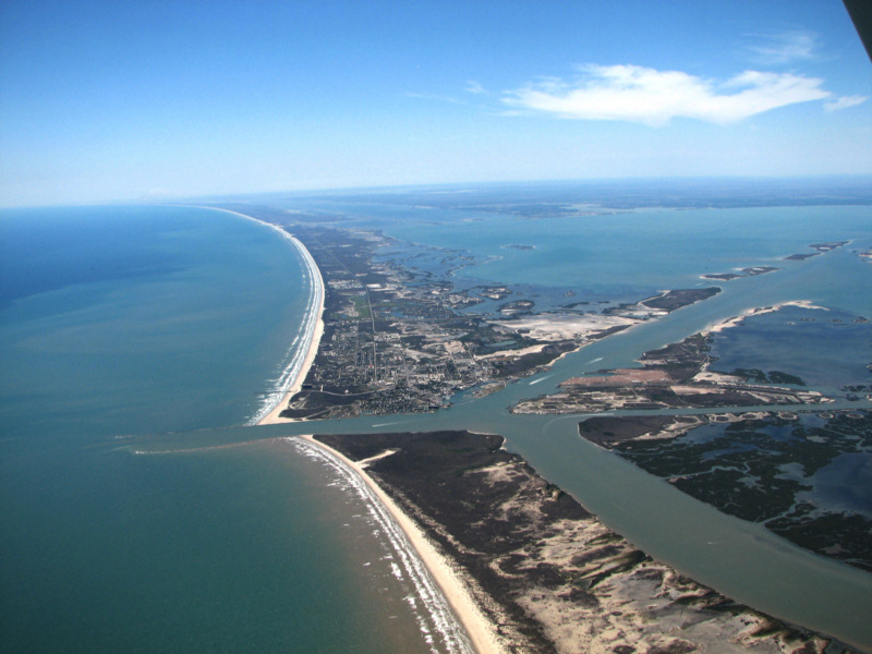
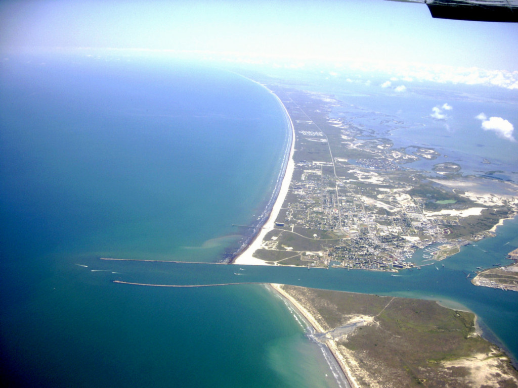
Aransas Pass and Port Aransas 8/8/2009
Aransas Pass 8/8/2009
Aransas Pass 8/8/2009
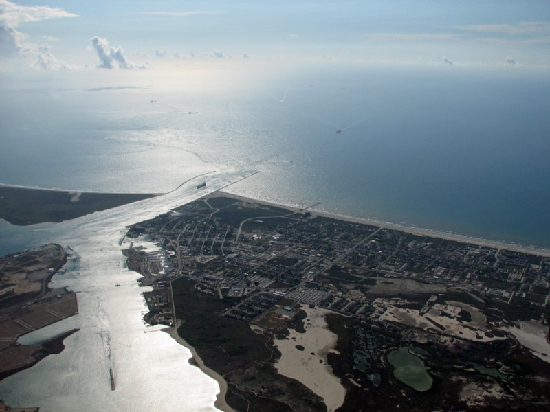
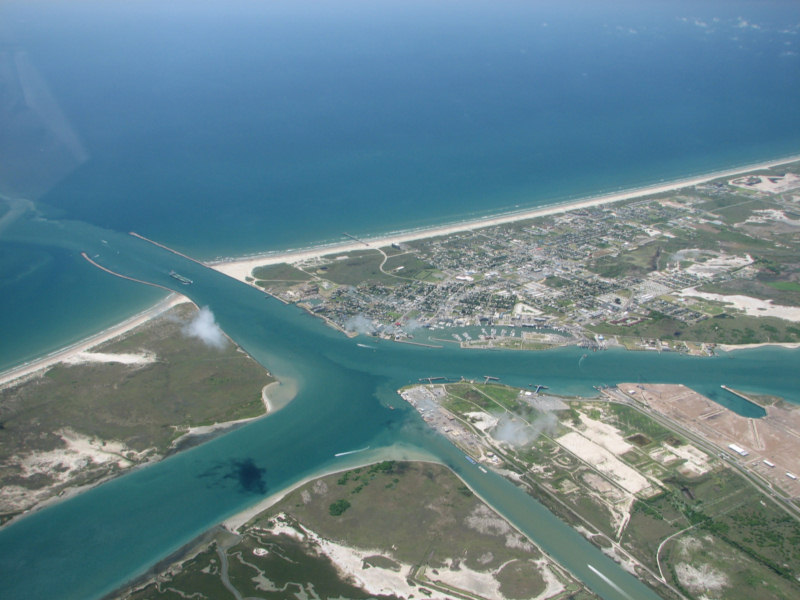
Aransas Pass and Port Aransas 4/14/2009

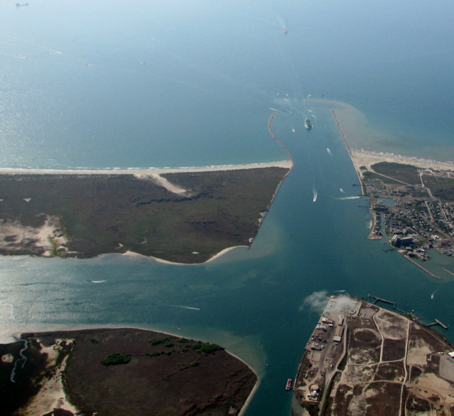
Aransas Pass and Port Aransas 4/14/2009
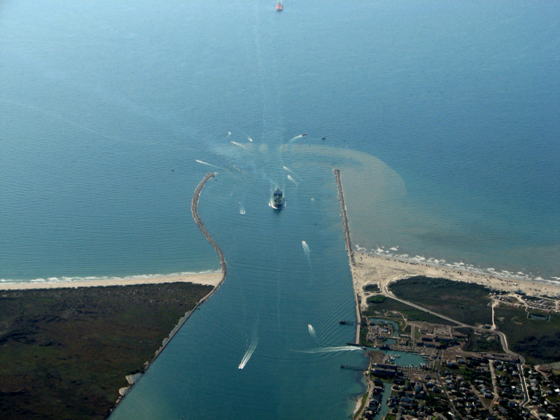
Aransas Pass and Port Aransas 4/14/2009

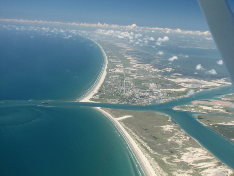
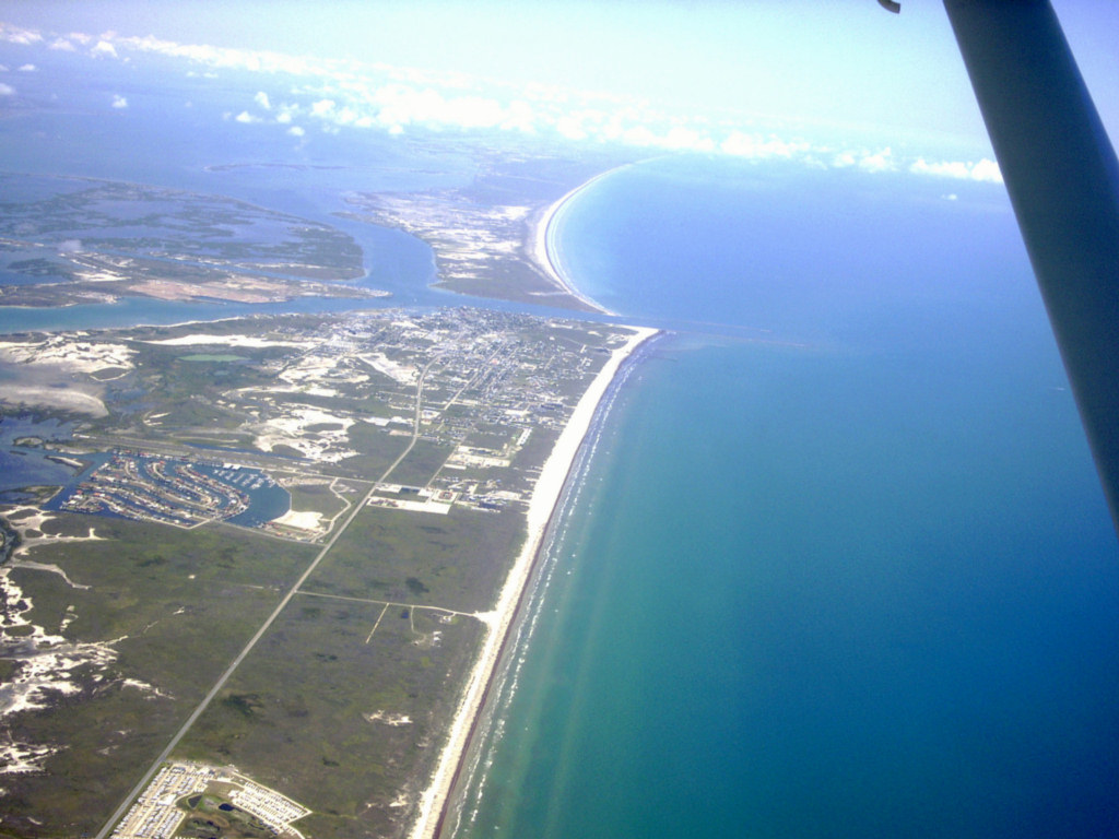
Aransas Pass and Port Aransas 8/16/2006
Aransas Pass and Port Aransas 8/16/2006
Aransas Pass 8/16/2006
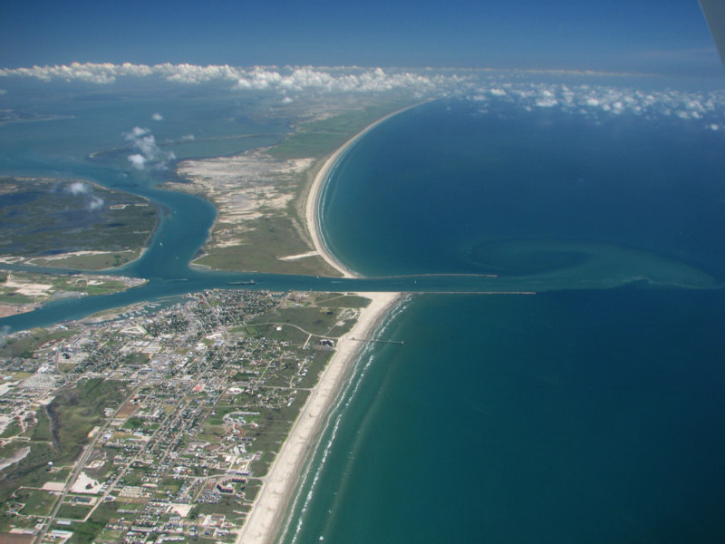
Aransas Pass and Port Aransas June 16, 2005
Aransas Pass and Port Aransas June 16, 2005
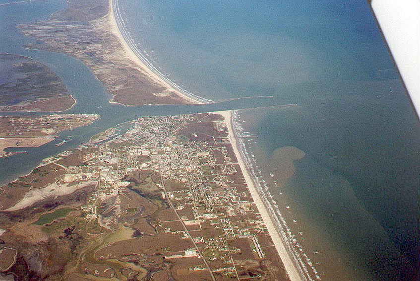
Aransas Pass at Port Aransas, 1998

Aransas Pass and Port Aransas
Aransas Pass Jetties