


TEXAS COAST AERIAL PHOTOGRAPHY
Miscellaneous Aerial and Ground Photos
High resolution digital copies of many of these photographs are available for sale. You may purchase a digital photo in the highest resolution that I have for $25.00 for personal use or for use in your presentations. The charge will be $150 for use in publications or for commercial reproduction. Contact me to purchase photos. These photographs are copyrighted and are the property of Richard L. Watson. They may not be copied or used without permission. You may however link to this website from your website or by email.
These photographs are copyrighted and are the property of Richard L. Watson. They may not be copied or used without permission. You may however link to this website from your website or by email.
If you would like to make a donation to help support the expense of providing these photos of the Texas Coast, please click on the Paypal button below.
Click here for a new page of aerial photos of inlets on Florida's west coast!
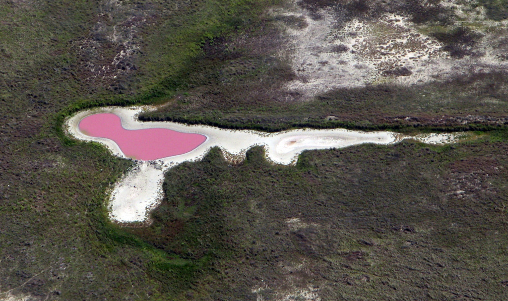
Pond on San Jose Island 10/7/2011
No it isn't the world's
source for Pepto Bismol. It is probably a huge concentration of
bacteria. I have requested input from experts and the following are
some of their suggestions as to the source of this stuff. Dunaliella salina pink (if
you search on that name in google images, you can see a pond with the
identical appearance. It has been seen in commercial salt ponds
on the Mexican coast. Another suggested "If it is anoxic it is a
bacteria. If it is an oxic system, it is either a charophyte, a
euglenoid, or haematococcus." Here is more information http://waynesword.palomar.edu/plsept98.htm Some more information.
It's common in tidal pool salt production. I did a tour of the Bonaire salt mines once http://g.co/maps/4pff4 . You found a natural one.
"The brine then passes on through the
various ponds, with the sodium chloride content rising
from 2% to 25%. This increasing
salinity gives the ponds a distinctive pink colour, as algae
in strongly saline solutions produce a
red pigment called haematochrome. The Red Sea is red
for the same reason."
http://nzic.org.nz/ChemProcesses/production/1H.pdf
http://www.ehow.com/how-does_5182970_process-making-salt-sea-water.html
Aircraft carrier Lexington at Corpus Christi 2/5/2011
This is a great naval air museum. Take your kids for a visit.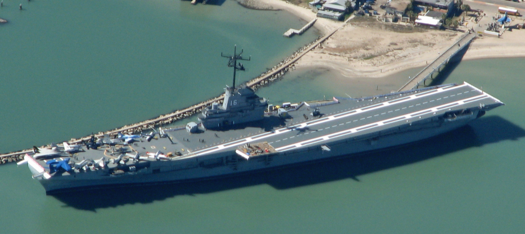
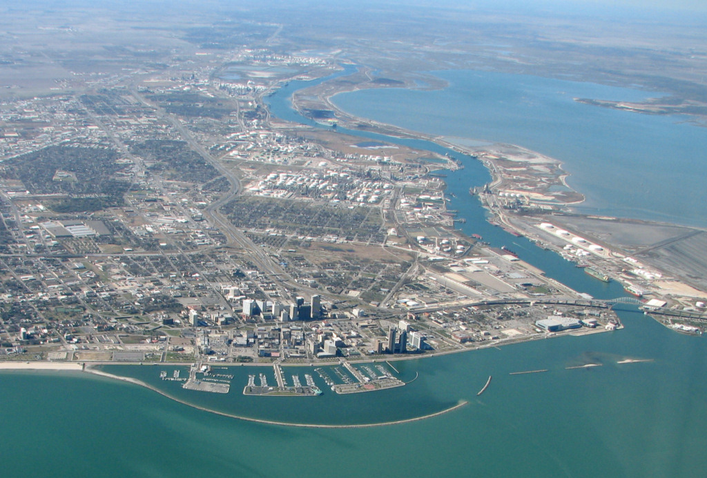
Beautiful Bayfront Corpus Christi 2/5/2011
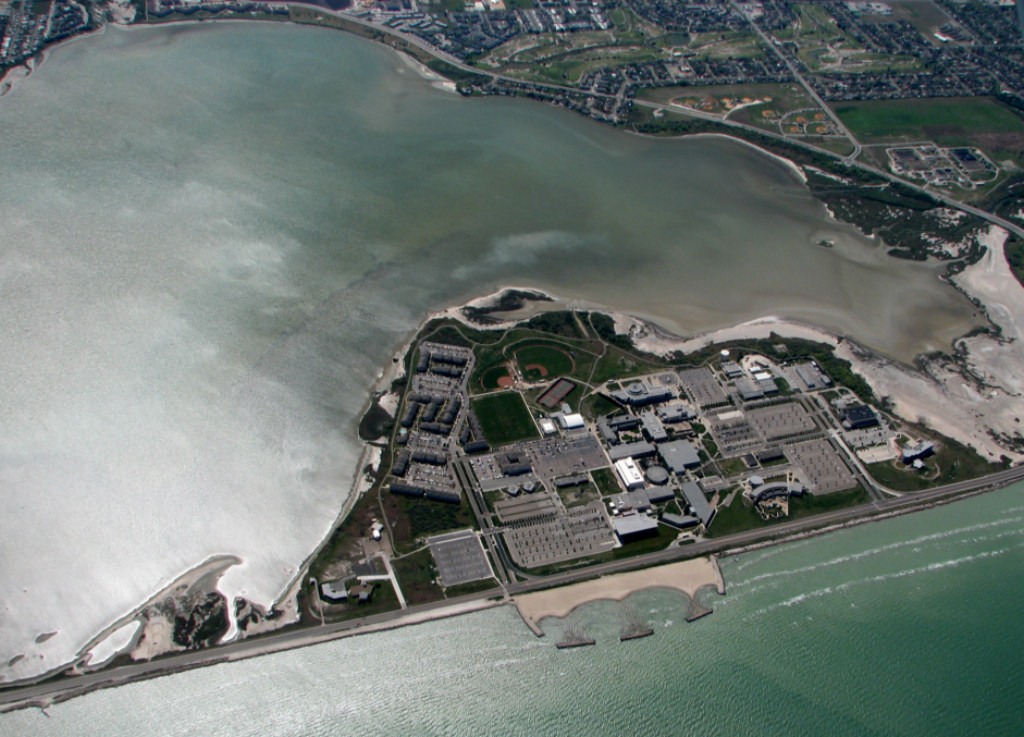
Texas A&M University Corpus Christi 2/5/2011
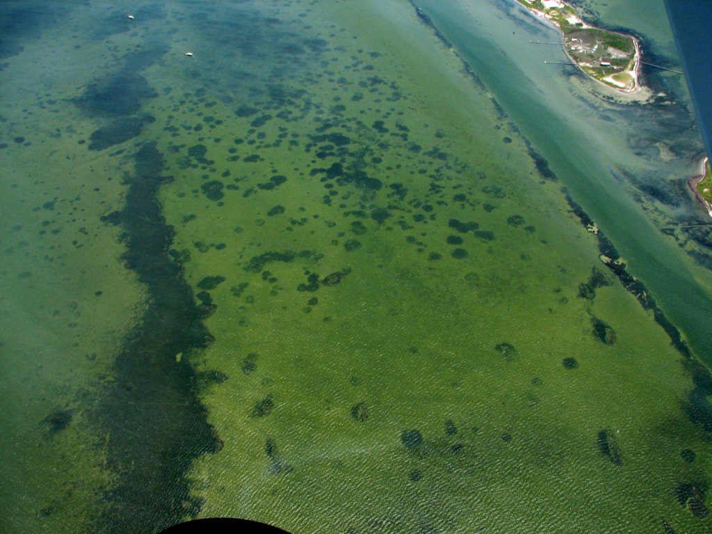
Note the huge algal bloom on the east side of the campus in Oso Bay.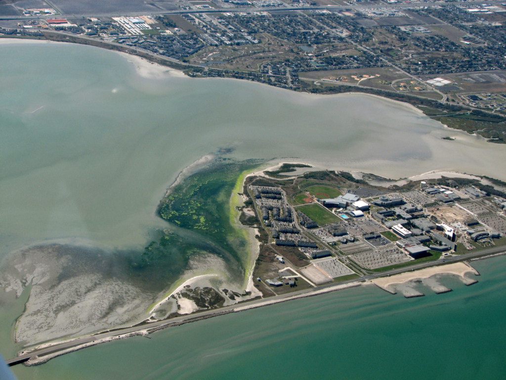
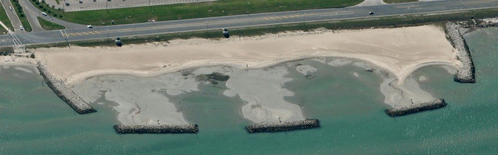
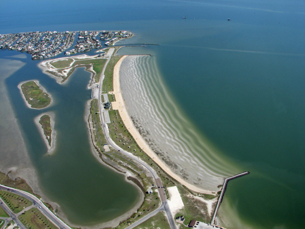
TAMUCC BEACH AND TOMBOLOS 2/5/2011
New marsh islands along the Portland to Corpus causeway 2/5/2011
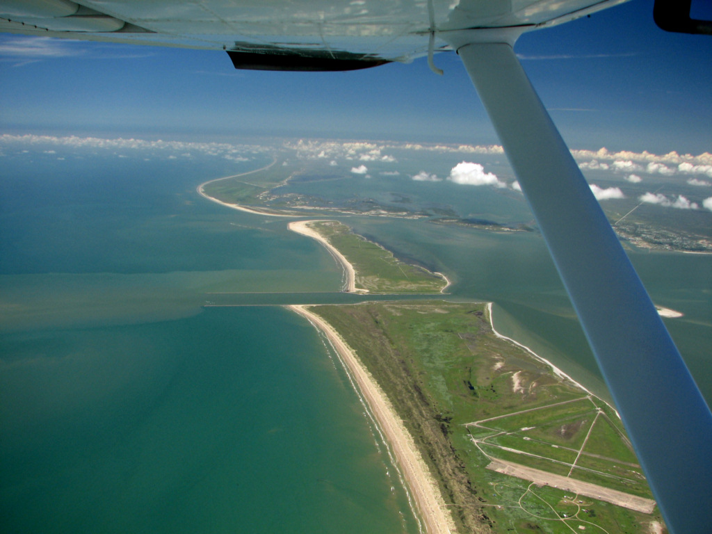
World War airfield near Laguna Salada, Laguna Madre, TX. 2/5/2011
This was an outlying landing field for training at the Navy base at Corpus Christi.
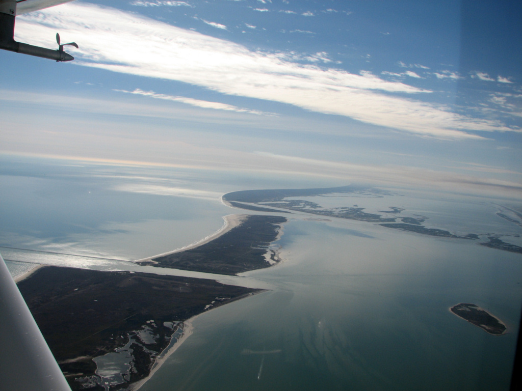
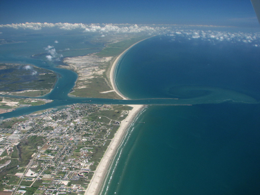
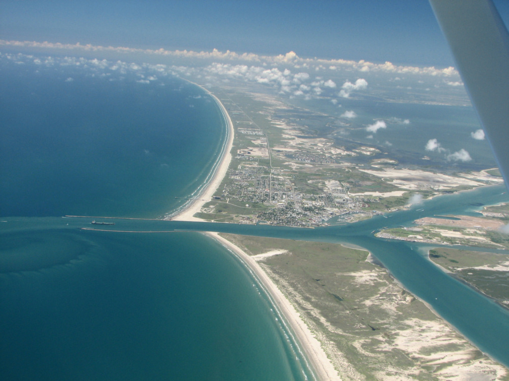
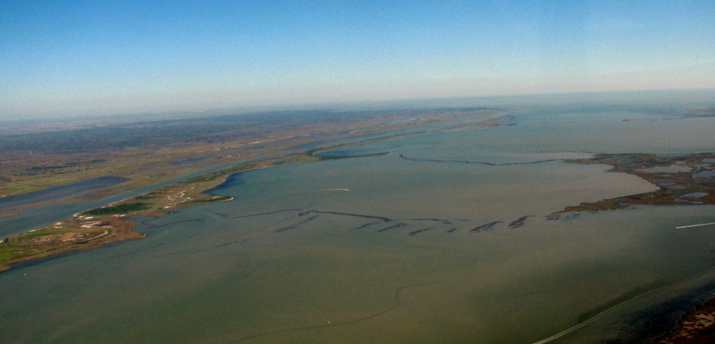
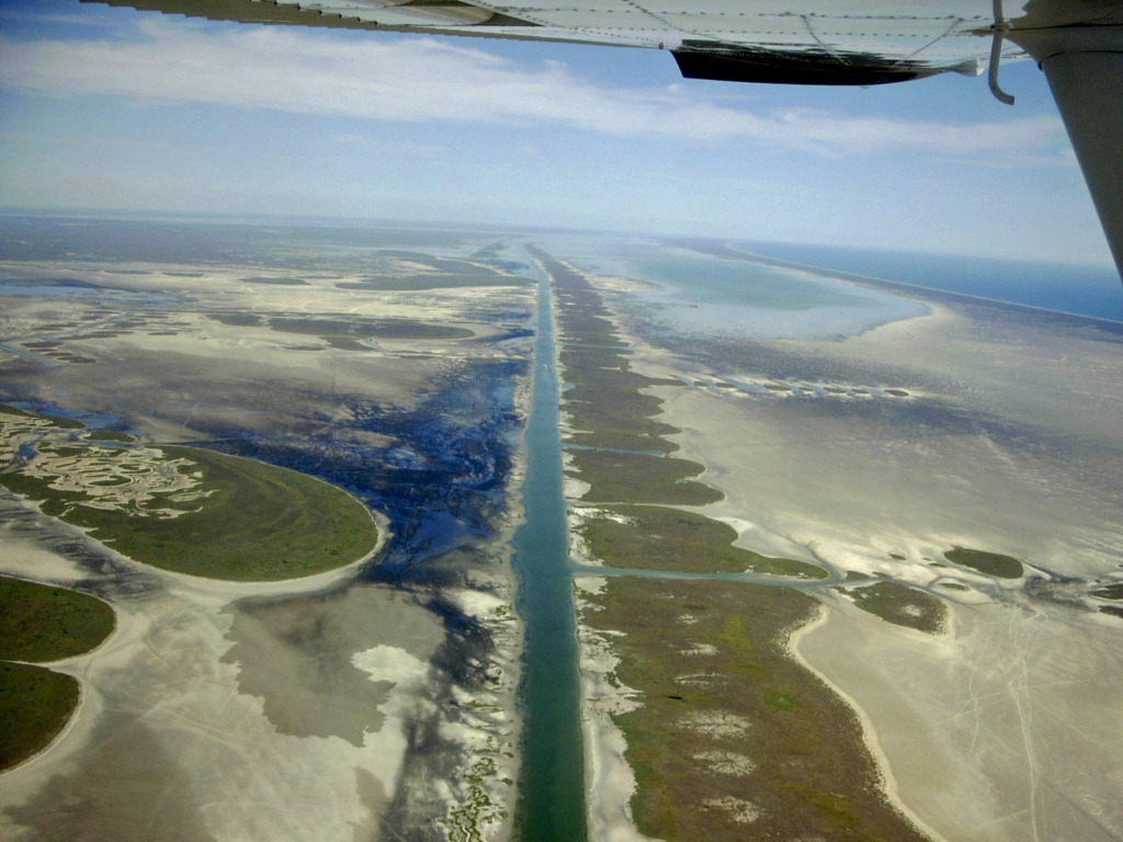
Matagorda Ship Channel 1/6/2011
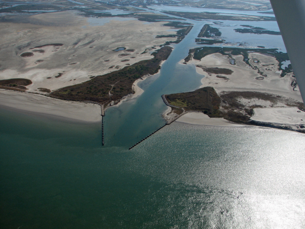
Island Moorings Marine Entrance Channel December 9, 2010
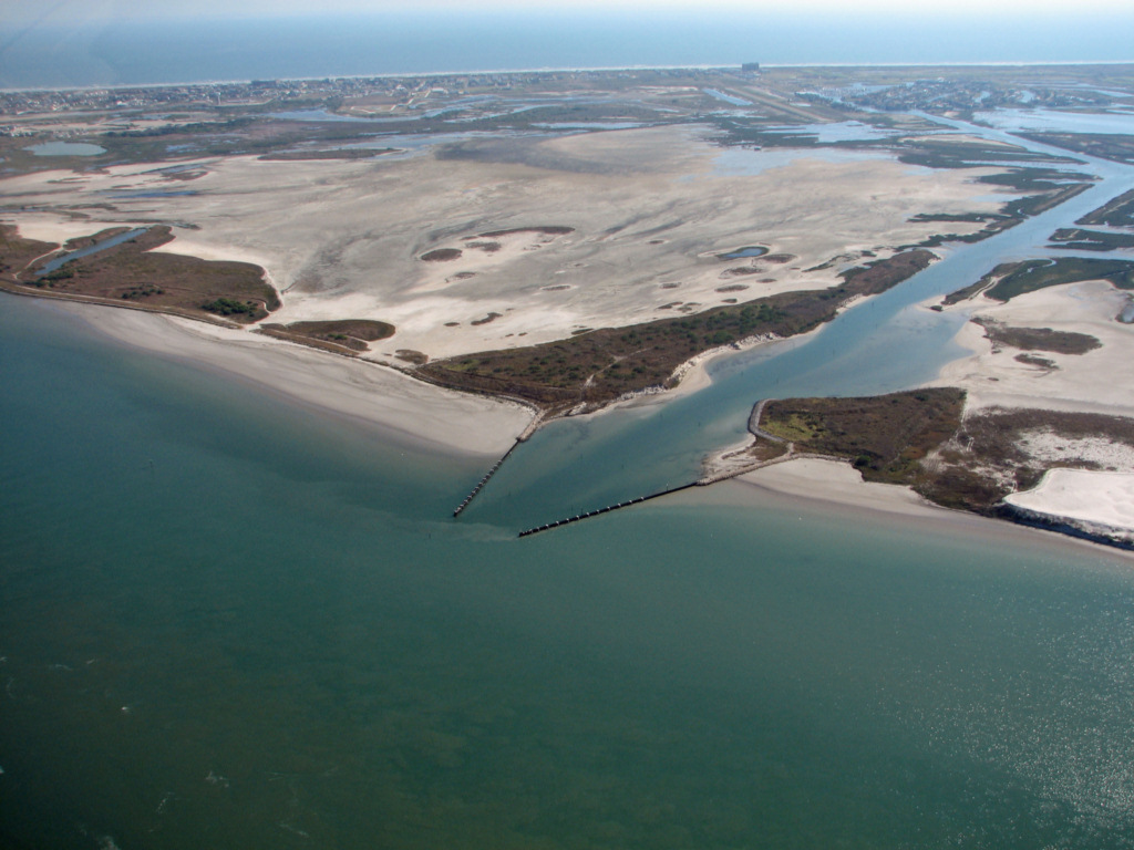
Island Moorings Marine Entrance Channel December 9, 2010
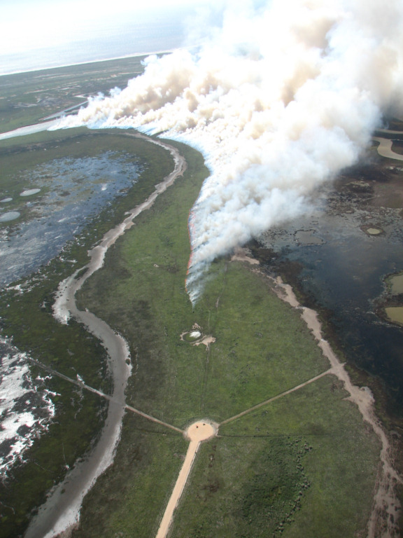
Controlled burn 10/29/2010
We saw this controlled burn being started.
At the bottom of the photo there is a truck that is barely
visible at this resolution trailing a very thin line of fire as it
drives along starting the fire behind it. Would be a bad day to
get stuck!
Matagorda Island has many drainage channels that drain the interior of the island through the dunes and across the beach. Note also the many bomb craters. From WWII till about 1970 Matagorda Island was a bombing range. 1/25/2010
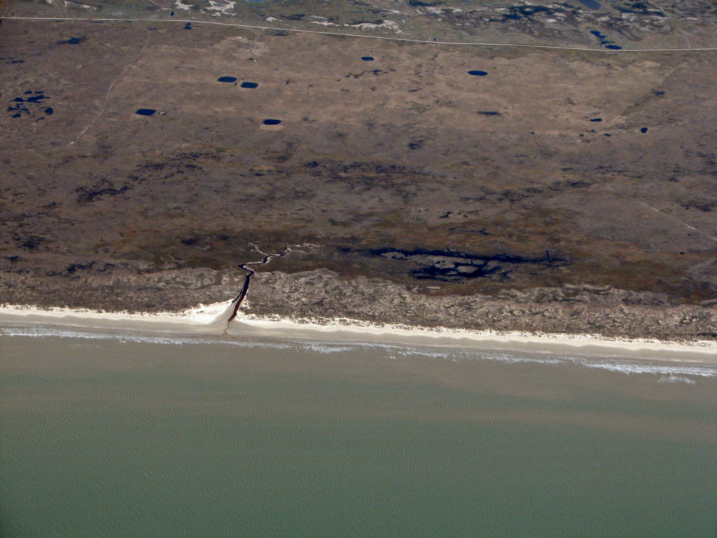
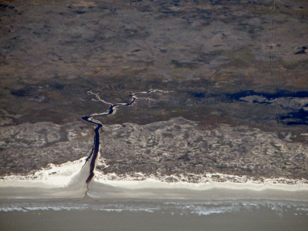
Close up of the above drainage
channel. 1/25/2010.
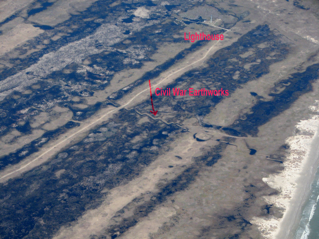
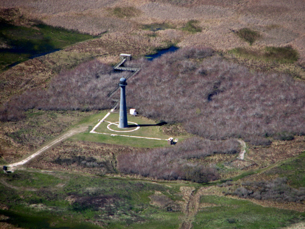
Lighthouse and Civil War Earthworks on N. end of Matagorda Island 1/25/2010
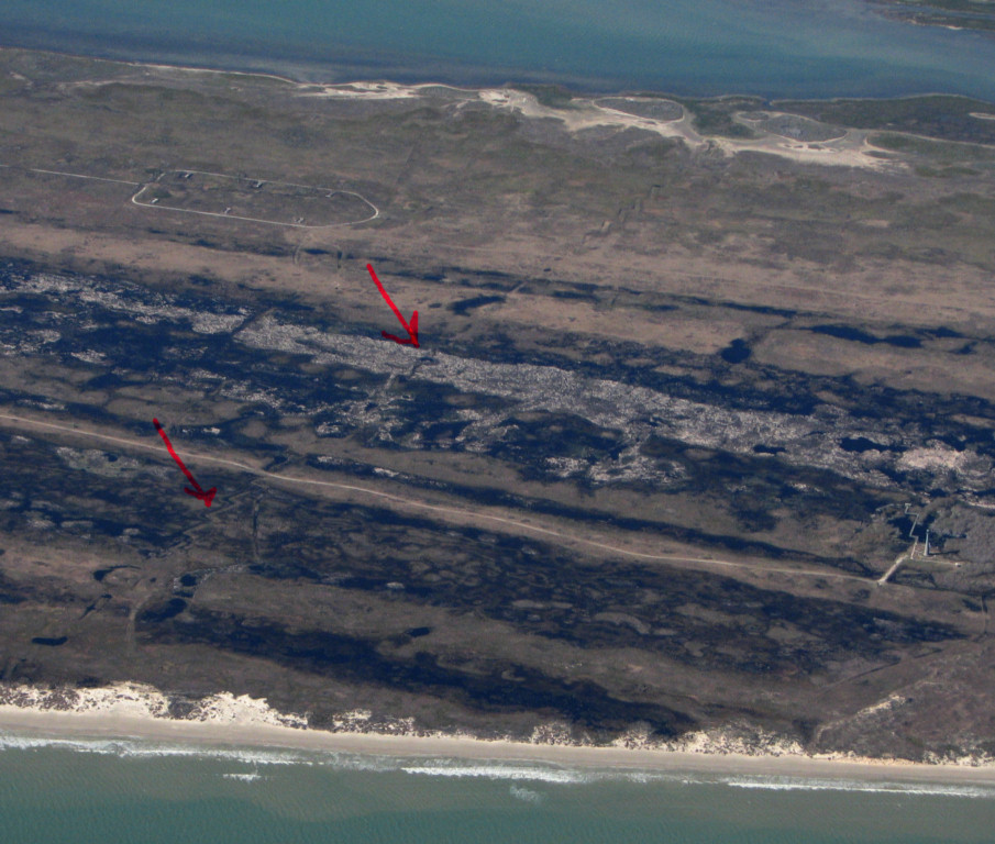
Lighthouse and Civil War Earthworks on N. end of Matagorda Island 1/25/2010
Mesquite Bay oyster reefs 1/25/2010
Mesquite Bay oyster reefs 1/25/2010
St. Charles Bay Entrance and reefs 1/11/2010
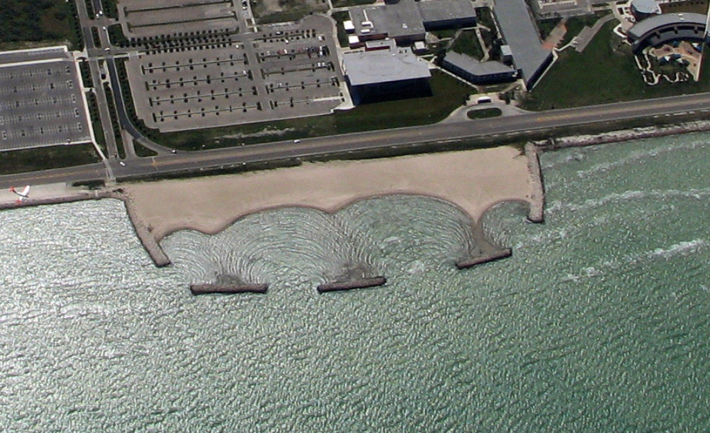
Public Beach and new
jetties at Rockport, Texas. 11/17/2006
Ebb plume at Aransas Pass, 8/16/2007
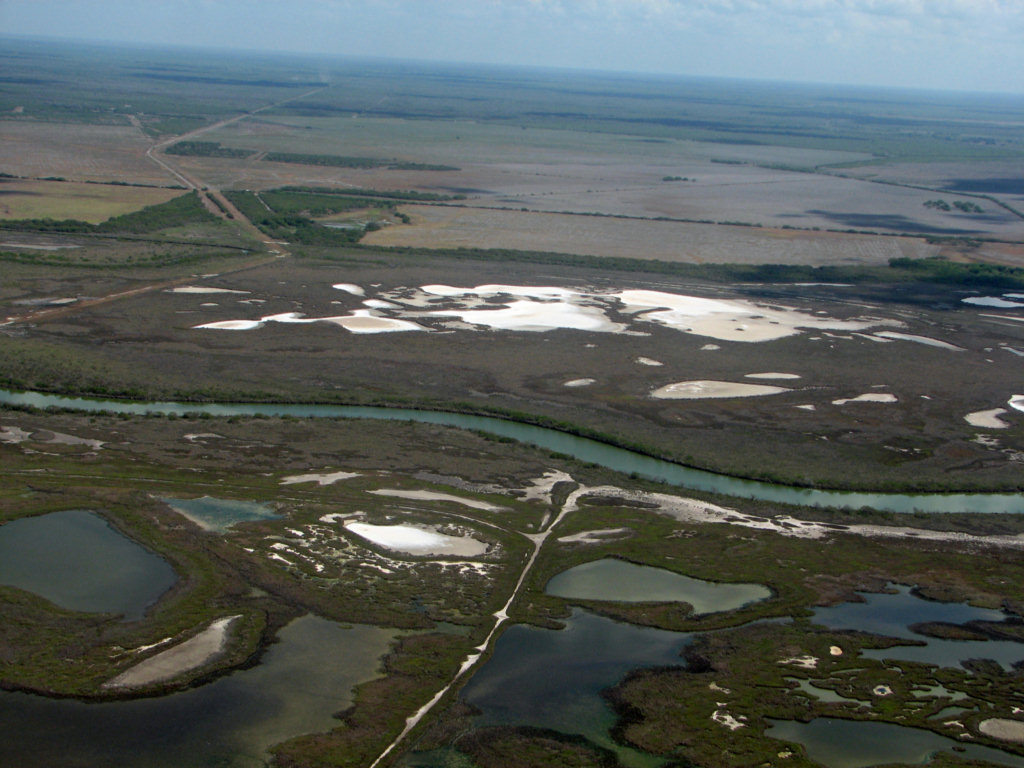
Mission River Delta salt deposits 8/12/2009
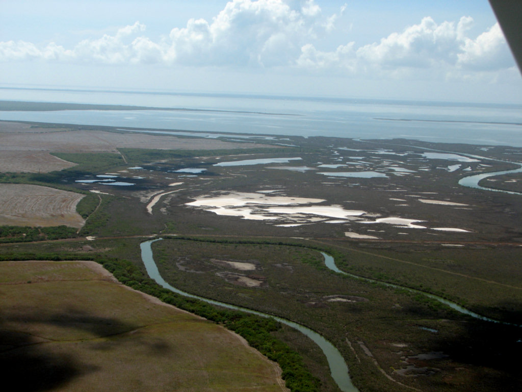
Mission River Delta salt deposits 8/12/2009
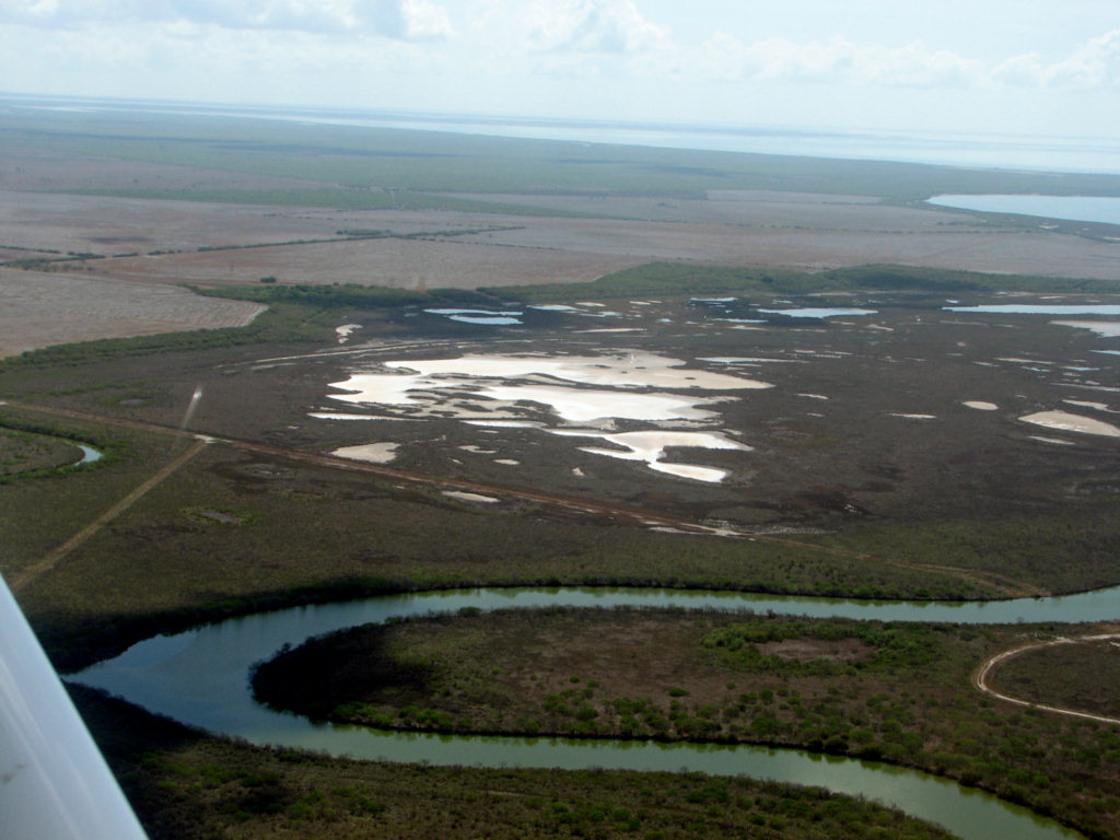
Mission River Delta salt deposits 8/12/2009
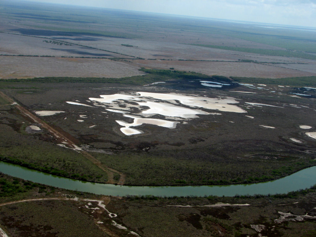
Mission River Delta salt deposits 8/12/2009
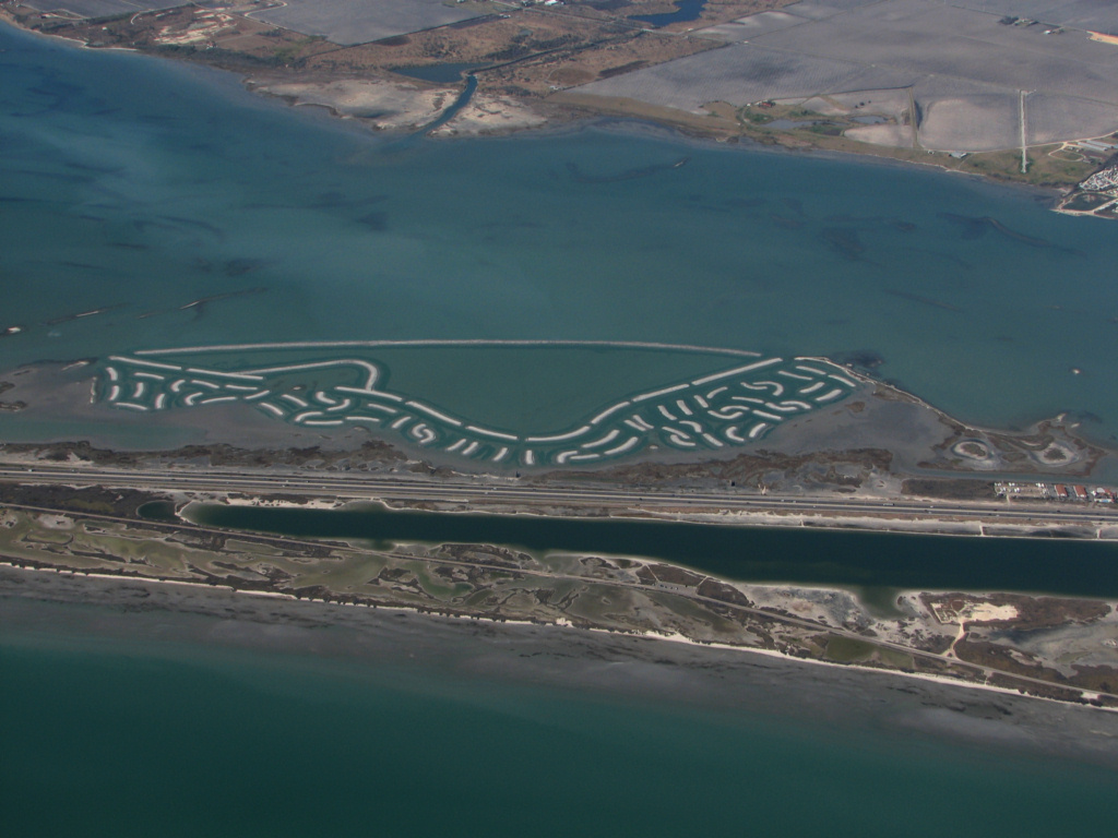
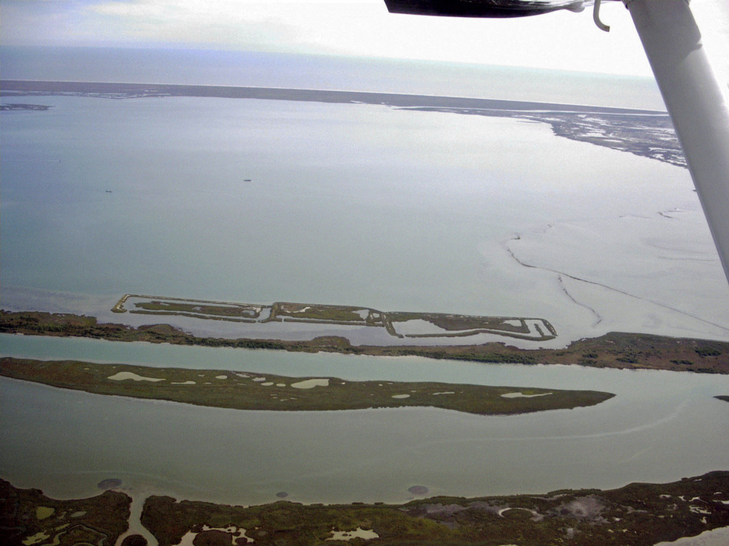
Seagrass remediation 1/19/2000 work by TAMUCC
The
created marshes in Mesquite
Bay were part of a demonstration project
funded by Mitchell Energy Corp. back in the 90s. Charles Bellaire
assisted in the design and planting of the cells. TAMUCC had a contract to
evaluate the early development.
funded by Mitchell Energy Corp. back in the 90s. Charles Bellaire
assisted in the design and planting of the cells. TAMUCC had a contract to
evaluate the early development.
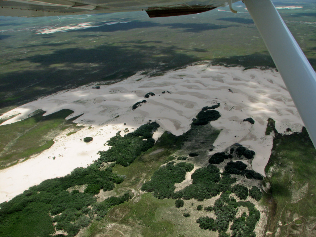
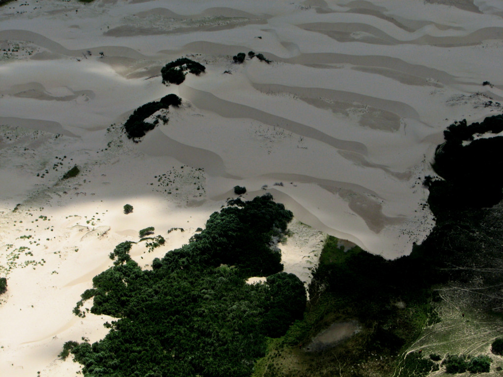
Active Sand Dunes on Central Padre Island 8/7/1967, Most people don't remember the huge areas of active dunes on Mustang and Padre islands in the 1950s and 1960s due to long droughts and over grazing. Mildew on slide from years on boats.
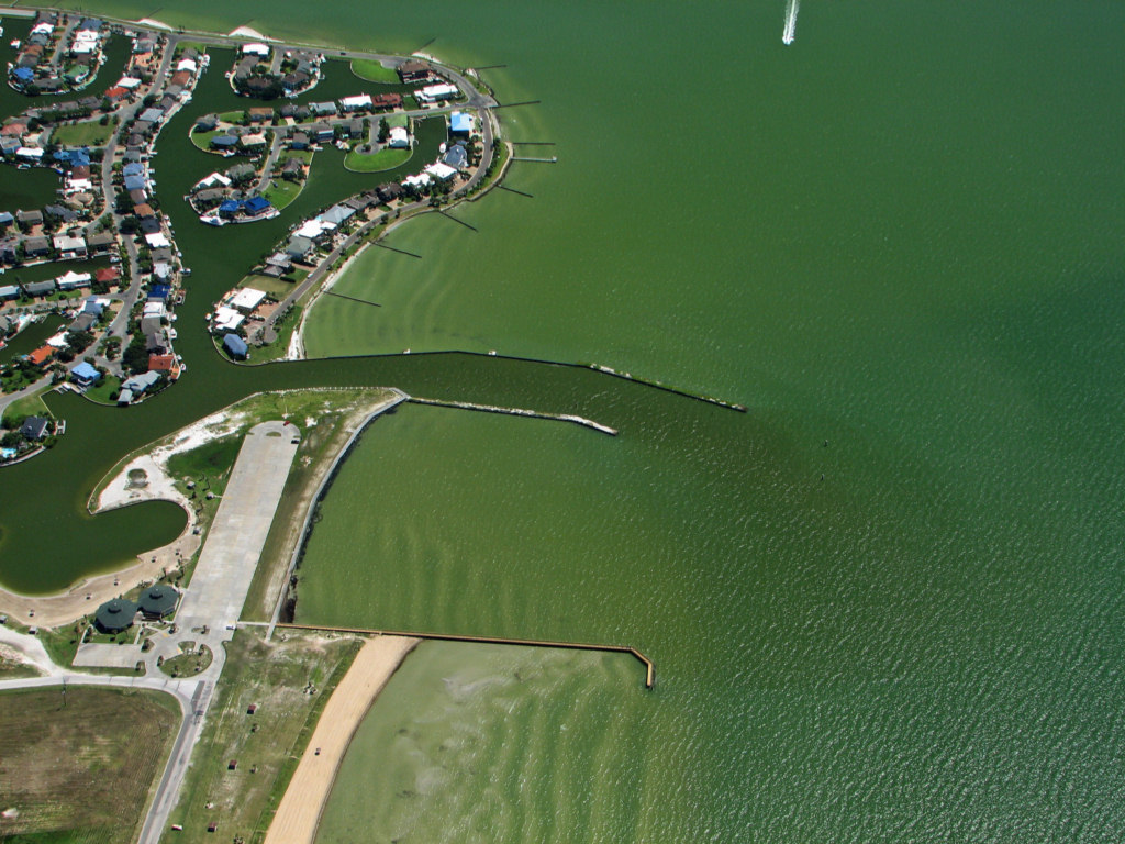
Key Allegro, Rockport, TX 8/16/2006
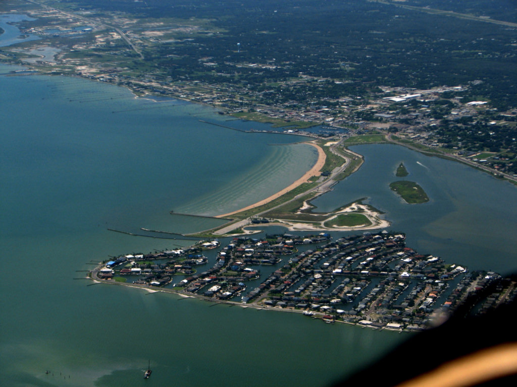
Leggett Light Channel, Key Allegro, Rockport, Texas 8/16/2006
Click here for information about the design of this channel entrance.
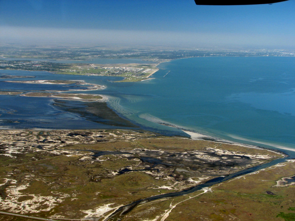
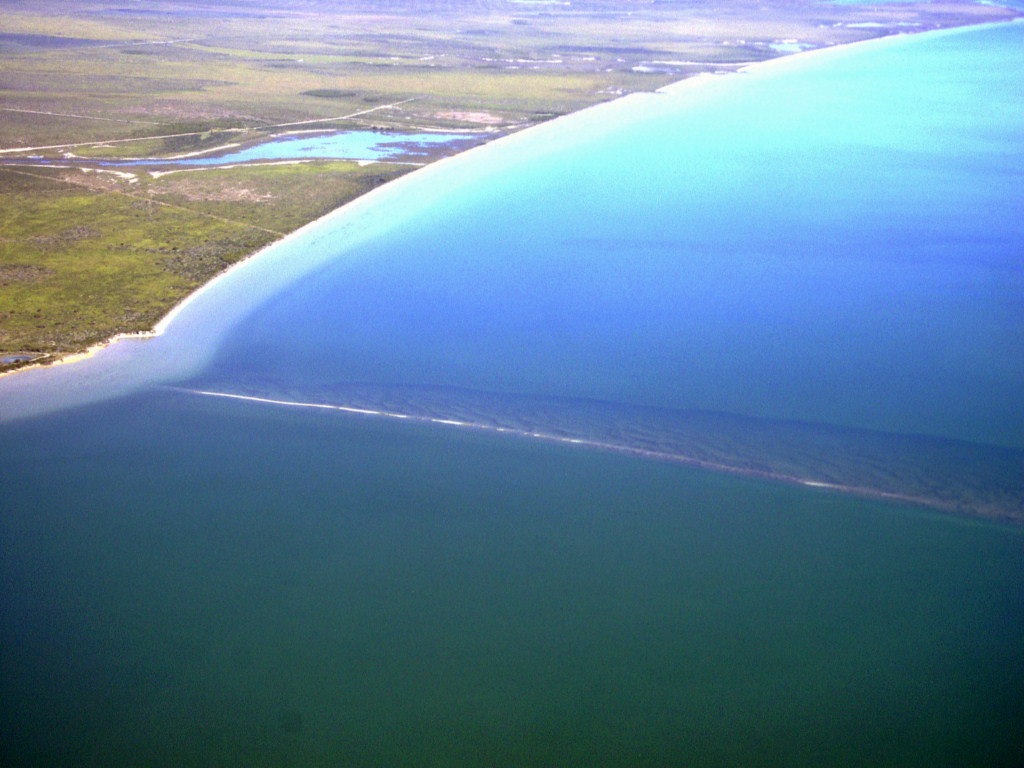
Bars across the mouth of Laguna Madre at Corpus Christi Bay 11/17/2006
Axis of deep channel in northern Laguna Madre on a rare clear water day. 2/6/2006. There are no seagrasses in the channel as it is too deep for adequate light in normal conditions.
Cedar Bayou, 11/22/2005
Colorado River Entrance and Matagorda Peninsula, 2/27/2008
Chenier Plain (beach ridges) just north of Sabine Pass in Louisiana, 4/26/2007
Note that in French, Chenier means oak tree. Oak trees grew on the beach ridges.
Texas A&M University, Corpus Christi, 3/4/2007
Note: The University of Texas wisely advised the Aggies to build this university on an island where it can be easily washed away by a hurricane.
Tombolos forming behind the breakwater at the TAMUCC artificial beach, 3/4/2007. Note the interesting wave refraction and diffraction behind the breakwaters.
Mesquite Bay oyster reefs at low tide 10/26/2006
Long oyster reef at the site of the historic port of El Copano at the mouth of Mission Bay in Copano Bay, 11/22/2005. The port had a long wharf out on the reef. The reef served as a natural breakwater to protect the ships and boats.
The near end of the red line points to the site of the old truck railroad from the town of Aransas Pass to the mouth of Corpus Christi Bayou in Aransas Bay, 12/1/2006. Ships unloaded in Aransas Bay and the truck railroad transported the goods to shore in Aransas Pass.

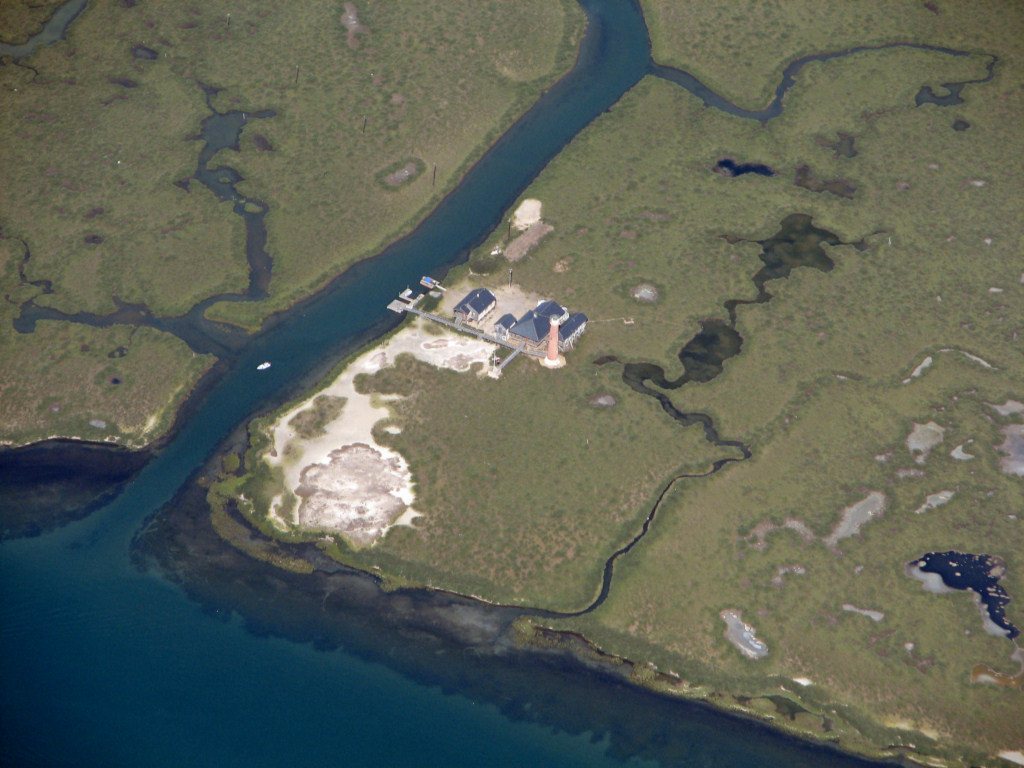
Lighthouse on Harbor Island, Port Aransas 8/8/2009.
Matagorda Island, 10/24/2001
North end of Matagorda Island and Pass Cavallo, 8/16/2006
Lighthouse at N. end of Matagorda Island, 2/27/2008
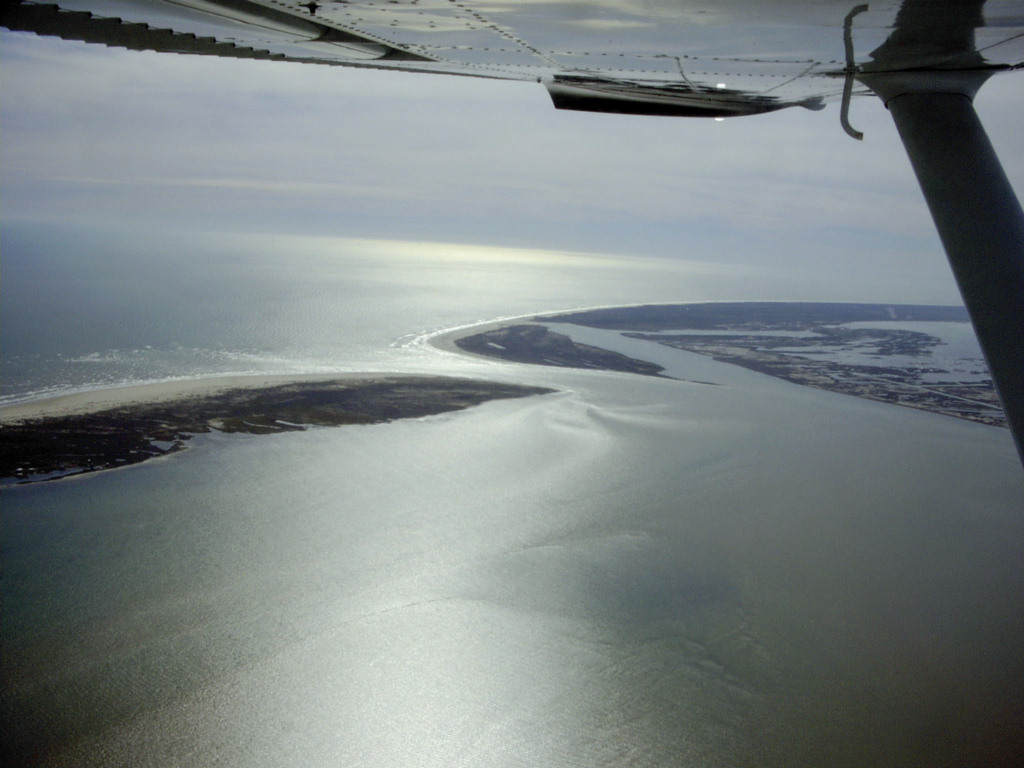
Pass Cavallo, 12/11/2005
Matagorda Ship Channel & Pass Cavallo, 8/16/2006
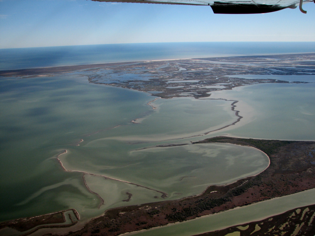
Laguna Madre looking north
from Mesquite
Rincon, 3/4/2001. Mesquite Rincon is the large vegetated area
in
the lower left. The large water body in the upper right
between
the Gulf Intracoastal Waterway and Padre Island is The Hole.
Before construction of the GIWW, it frequently blew dry and
was
known as the Fish Graveyard Basin.
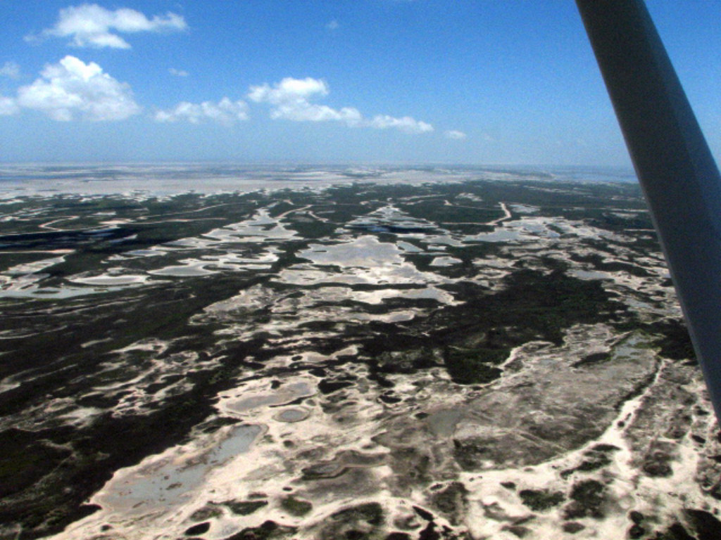
Serpulid worm reefs in the mouth of Baffin Bay, TX. 7/13/2008.
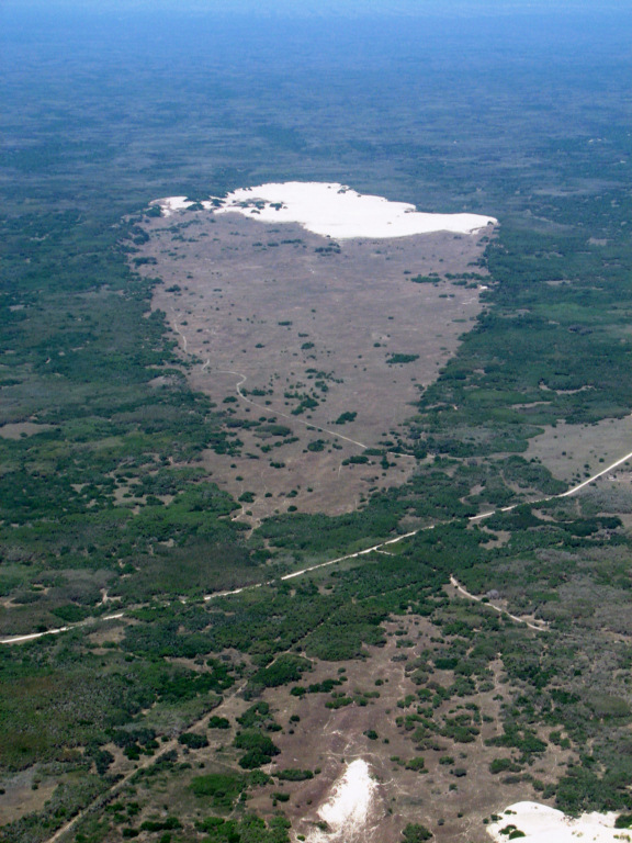
Banner dune on King Ranch
north of Port
Mansfield, 4/5/2008.
Banner dunes were named by
Texas pioneering oceanographer/geologist Armstrong Price for their
shape like a ragged banner, or flag.They form when there is a blowout at the apex (bottom of the photo). As the dune migrates downwind on the prevailing SE winds, it expands sideways and ultimately forms the characteristic triangular shape. The deflation flat behind the migrating active dune is eroded down to the level of damp sand and is re-vegetated by a salt tolerant grass. The old name for these is Sacahuiste flats after the Spanish name for the grass, which is Spartina spartinae (Gulf cordgrass). The advancing dune can reach heights up to 40 feet and kills everything in its path, including mature oak motts.
Banner dunes over running an oak mott, Kenedy County, TX, 7/13/2008
Close up of the above banner dune showing the height of the slip faces, 7/13/2008.
Here you can see that the entire face of the topography is defined by scars left by passing banner dunes, 1/13/2008.
At this location the dunes were migrating straight toward the viewer who is looking to the SE.
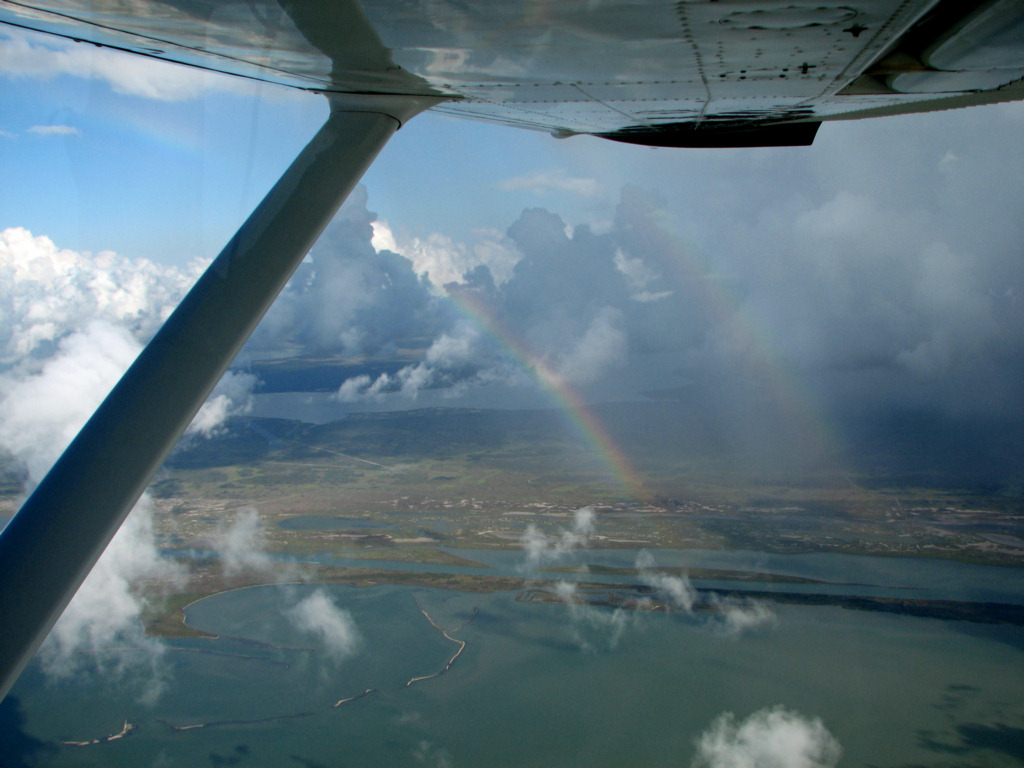
Double rainbow over Blackjack Peninsula from Mesquite Bay, 8/8/2009.